


- News
- E-mail list
- Signup for our newsletter
- Stentec news
- News
- Developers Blog
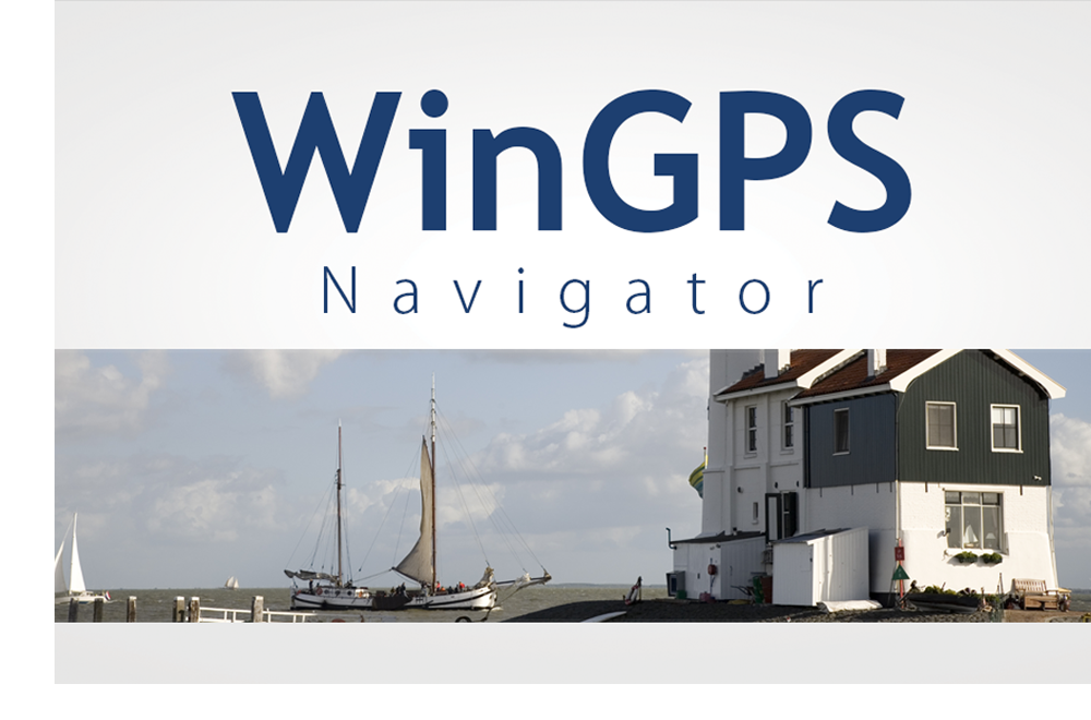
- WinGPS
- WinGPS series
- WinGPS versions
- WinGPS specifications
- For Windows
- WinGPS Lite
- WinGPS Navigator
- WinGPS Pro
- WinGPS Voyager
- For Android
- WinGPS Marine
- WinGPS Marine Plus
- WinGPS Smartwear
- For iOS
- Apps for iOS
- WinGPS Marine
- WinGPS Marine Plus
- DKW 1800 series
- Vaarkaart Friese Meren
- Service and upgrades
- Service Subscriptions
- WinGPS Yacht Navigator
- WinGPS trackpilot
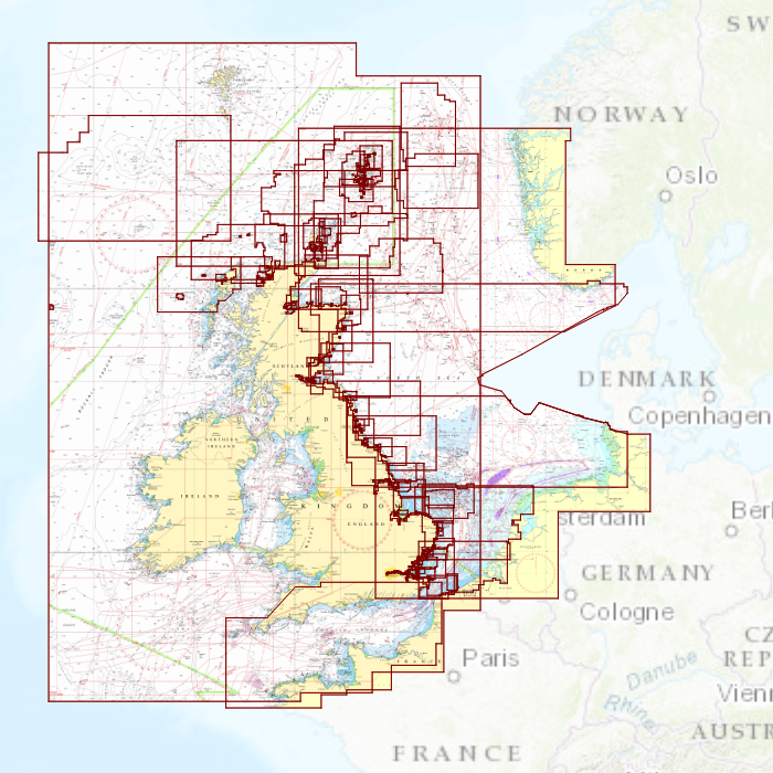
- Charts
- Chart overview
- DKW Inland waters
- DKW The Netherlands
- DKW Friese meren
- DKW Amsterdam
- DKW Biesbosch
- DKW Belgium
- DKW Northern France
- DKW Southern France
- DKW Northeast Germany
- DKW Northwest Germany
- DKW Southwest Germany
- DKW Rhine and Moselle
- DKW Danube 1-West
- DKW Danube 2-Central
- DKW Danube 3-East
- DKW Coastal waters
- DKW 1800 series
- DKW 1600+
- DKW UK1 English & Scottish Eastcoast
- DKW German Bight
- DKW German Baltic coast
- DKW Imray series
- DKW Delius Klasing series
- NV-Verlag series
- Exclusive for Android
- Subscription - DKW the Netherlands
- Chart apps
- Other
- Hardware
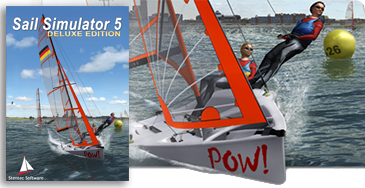
- Simulators
- Shop
- Downloads
- Support
- Downloads
- Help pages
- Documentation
- System Requirements
- Availability GRIB files
- Frequently asked questions - FAQ
- WinGPS 5
- WinGPS Marine (Android)
- WinGPS Marine (iOS)
- Installation help
- WinGPS 5 (Windows)
- WinGPS Marine (Android)
- Tips
- Offline installation DKW charts (Windows)
- Installation ENC charts (Windows)
- Connecting SD card (Android)
- NV Verlag charts
- Offline NOAA Charts
- Download TeamViewer
- Contact
- Contactform - Helpdesk
- Callback Service
- Commercial Shipping
|
|
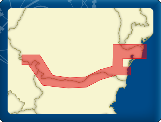
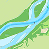
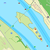
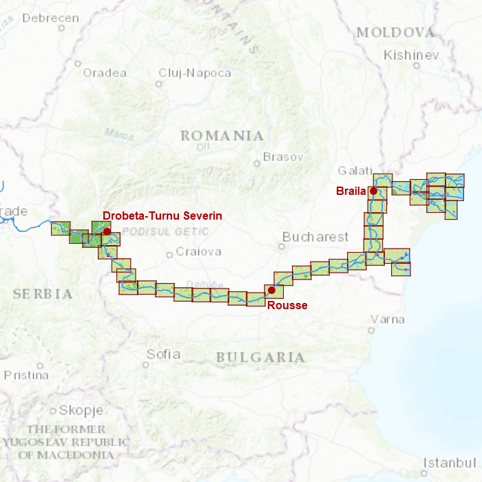
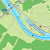
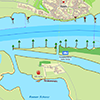
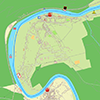
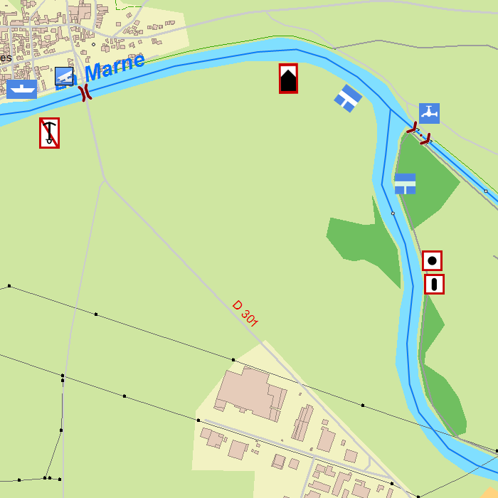
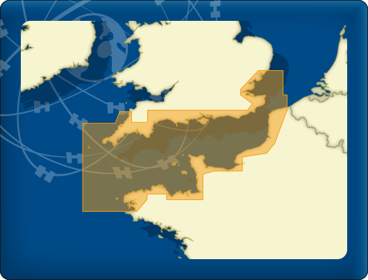
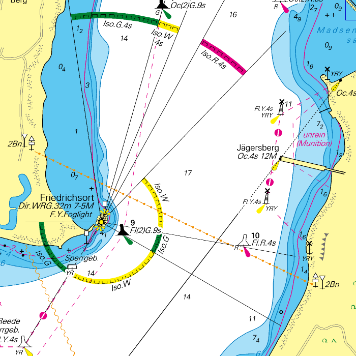
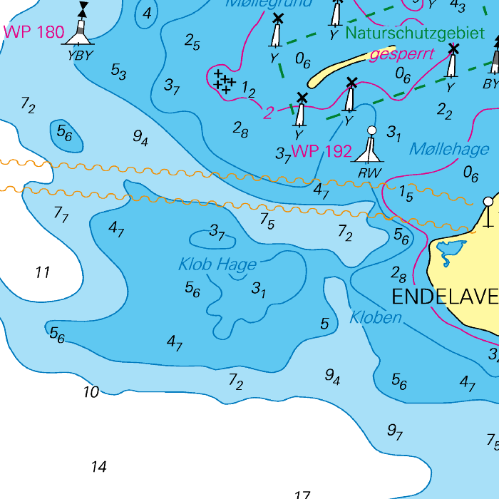
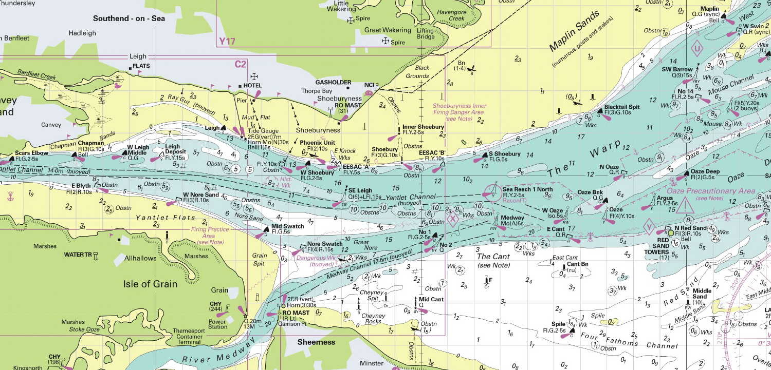
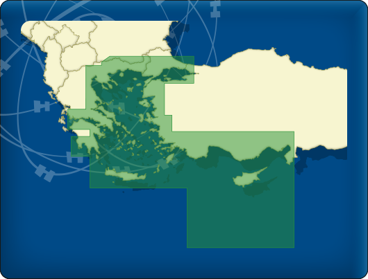
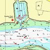
DKW Danube 3-East
The DKW Danube 3-East is developed for sailors, motorboaters and commercial shipping. The chart gives a clear view of all the eastern Danube and is ideal in combination with the paid versions of WinGPS. Using the route network you can easily and quickly plan routes on the eastern Danube.
Covering area
In this chart set the eastern Danube is covered from Belgrade up until the Black Sea, including a.o.
- Danube, from Požarevac up until the Romanian east coast (km 1085-44)
- The Bracul Borcea
- The Canalul Dunare-Marea Neagra
- The Brat Macin
- The Bracul Sulina, including branches
- The Kiliske Hyrlo, including branches
- The Bratul Sfântu Gheorghe, including branches

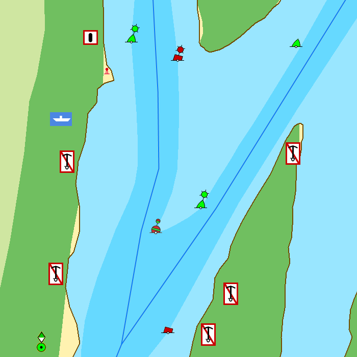
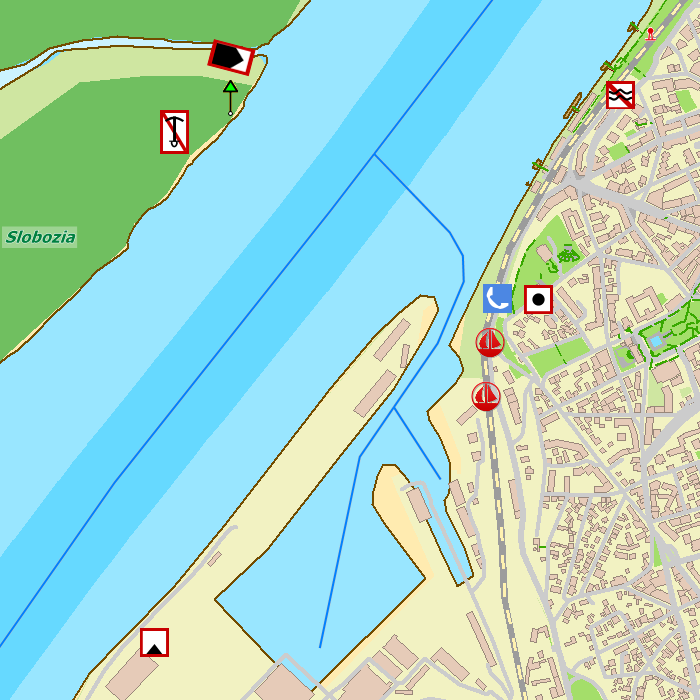


Depth image
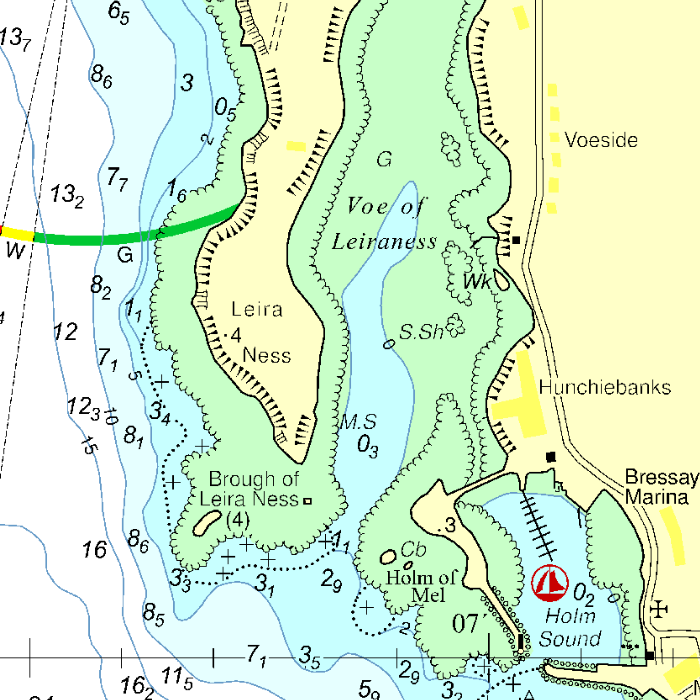
This chart set has a unique and clear depth image. The chart is published annually by Stentec, based on OpenStreetMap, IENC charts and user remarks. The chart has a high level of detail with 2 meter per pixel, making it possible to zoom in up until the jetties at your home port.
Chart image
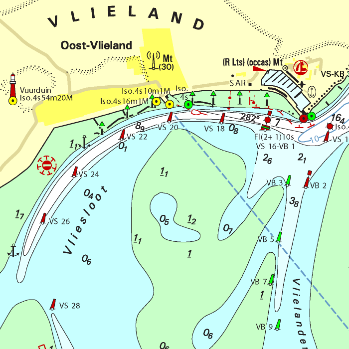
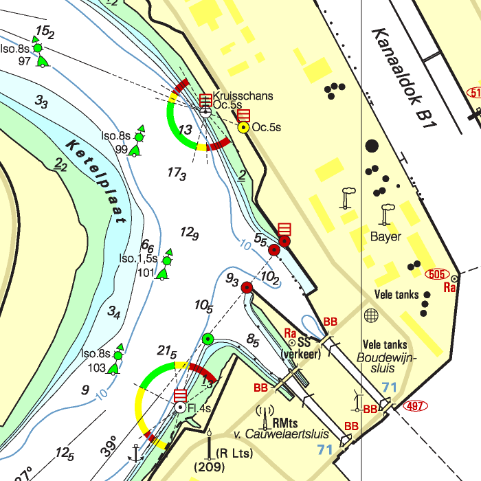
Stentecs inland water charts are so-called hybrid charts. The bottom surface is a raster format. This is where a.o. the quays, depths and buildings are shown. All other navigational information is projected on top of this through waypoints. These waypoints remain the same size when zooming in or out. The chart can be fully personalized by adding or removing certain waypoint groups and showing you only the information you select.
The DKW Danube 3-East has waypoints, with a.o. buoys, harbours, moorings, diesel tank stations, watersport campsites and VHF channels.
Specifically for commercial shipping waterway signs and VIN moorings are added.
|
|
|
System Requirements: This chart can be used in WinGPS for Windows and can also be installed on the WinGPS Marine apps for Android and iOS. For accurate route planning with rotating chart and AIS you will need at least WinGPS Pro or the paid version of WinGPS Marine. Click here for more information about the WinGPS series. |
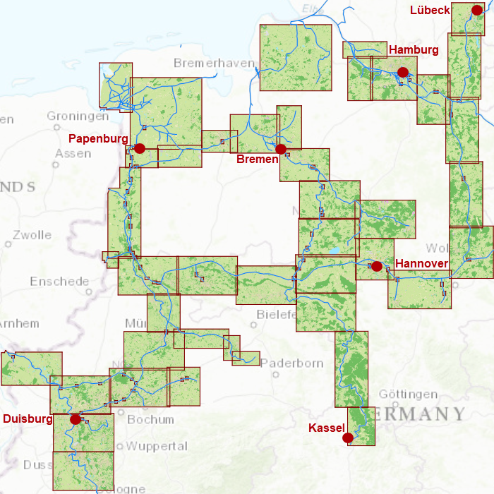
Build your own chart sets for WinGPS 4 !
The new DKW Builder 1.2.3.0 allows you to build even larger chart sets for all versions of WinGPS 4, including the WinGPS 4 Mobile. Digital scans of your paper charts can be used to create your own chart set. An other way would be to simply use Google Earth screenshots and stitch them together using the trial version of Autostitch. This way you could, for example, build a riverchart set or a set of port mouth charts. Thanks to the input from frequent users of DKW Builder we were able to optimize it for building and regularly updating large DKW2 chart sets.
Ideal for digitizing your sea charts. You could have these charts digitally scanned in full colour in 200 or 240 dpi by a printer or copy service. They will be delivered on CD-ROM or DVD in, for example, BMP format. Obviously you can use your own scanner to make smaller (A4) scans with some overlap as well. Because of the improved 3-point calibration technique, high accuracy can be reached, even on somewhat rotated images.
The professional DKW Builder has no restrictions regarding size or number of charts in one set. For optimal use, some basic knowledge with respect to chart projections and chart dates is recommended. More information about building chart sets can be found in the WinGPS 4 manuals (available for download in our GPS Freeware section).
With DKW Builder you create a chart set, containing multiple charts. The set can be stored as a chart-archive-file (for example mychartset.chv), which can be installed using DKW Manager. The self made DKW2-chart sets will be suitable for GPS-navigation with WinGPS 4-series programs on PC or PocketPC right away.
DKW Builder Lite
 DKW Builder Lite is a freeware application which allows your to make a digital copy of small charts using a standard size (A4) scanner. Together with other Lite versions of our software, you can get started getting to know modern navigation software developed by Stentec. DKW Builder Lite can also be used to add new or adjusted charts to the WinGPS 4 Chart Manager. When calibrated well, the charts will join seamlessly. You can try this with a couple of Google Earth screenshots. Use placemarks to get calibration points.
DKW Builder Lite has the following restrictions:
- Can use a maximum of 1250*1750 pixels per chart
- 10 charts per set max.
- A maximum of 10 points for polygon clipping of chart borders
What do you need to build DKW2 charts out of digitally copied paper charts ?
- A pc system able to fulfil the minimum system requierements of all the software to be used
- Charts to be scanned/copied with 2 or 3 calibration points
- A digital scanner with scanning software
- Photo editing software like Photoshop or the Gimp for lining out charts, copy&paste work and later on for updating chart information.
- DKW Builder from our online shop or DKW Builder Lite (2 MB) for building a chart archive file
- DKW Manager to install chart sets.
- WinGPS 4 (Lite, Mobile Lite, Mobile Navigator, Navigator, Pro or Voyager)
|
|
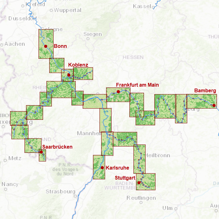
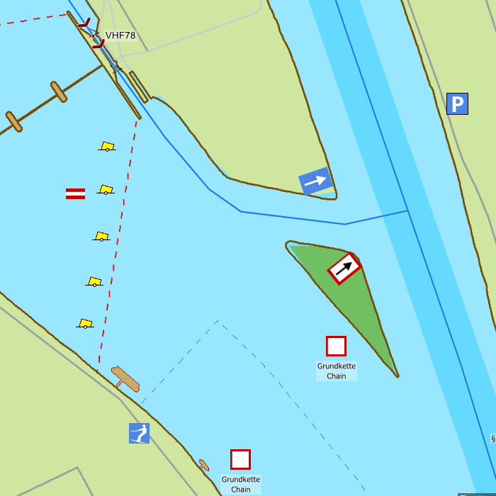
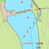
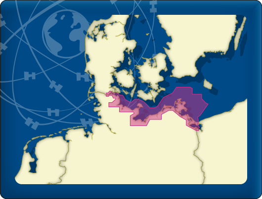
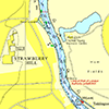
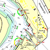
DKW Southwest Germany
The DKW Southwest Germany is developed for sailors, motorboaters and commercial shipping. The chart gives a clear view of all Southwestern German water ways and is ideal in combination with the paid versions of WinGPS. Using the route network you can easily and quickly plan routes on the inland waterways of Southwest Germany.
Covering area
In this chart set all large Southwestern German waterways are covered. The covering area is from Bonn up until the French and Belgian border and Bamberg, including a.o.
- The Rhine between Karlsruhe and Köln (km. 354 -697)
- The Mosel from Koblenz to Schengen (km 0 - 242)
- The Saar from Konz past the French border at Saarbrücken (km 0 - 104)
- The Sure up until Echternach (Luxembourg)
- The Lahn from Steeden up until Lahnstein am Rhein (km 70 – 137)
- 384 km Main from Mainz am Rhein up until the Main-Donau-Kanal at Bamberg
- The sailable Neckar from Mannheim up until Wernau (km 0 - 203)


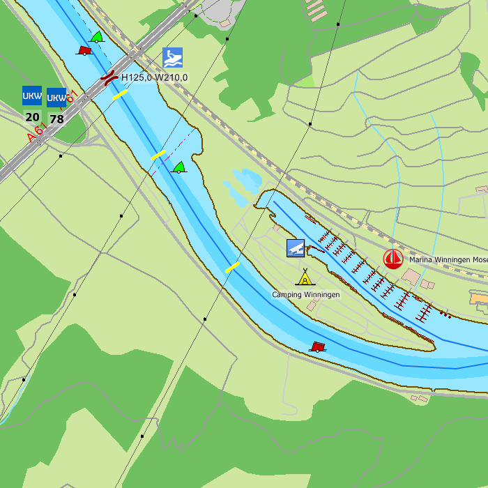
Depth image
This chart set has a unique and clear depth image. The chart is published annually by Stentec, based on OpenStreetMap, IENC charts and user remarks. The chart has a high level of detail with 2 meter per pixel, making it possible to zoom in up until the jetties at your home port.
Chart image
Stentecs inland water charts are so-called hybrid charts. The bottom surface is a raster format. This is where a.o. the quays, depths and buildings are shown. All other navigational information is projected on top of this through waypoints. These waypoints remain the same size when zooming in or out. The chart can be fully personalized by adding or removing certain waypoint groups and showing you only the information you select.
The DKW Southwest Germany has waypoints, with a.o. buoys, harbours, moorings, diesel tank stations, watersport campsites and VHF channels.
Specifically for commercial shipping waterway signs and VIN moorings are added.
|
|
|
System Requirements: This chart can be used in WinGPS for Windows and can also be installed on the WinGPS Marine apps for Android and iOS. For accurate route planning with rotating chart and AIS you will need at least WinGPS Pro or the paid version of WinGPS Marine. Click here for more information about the WinGPS series. |
|
|
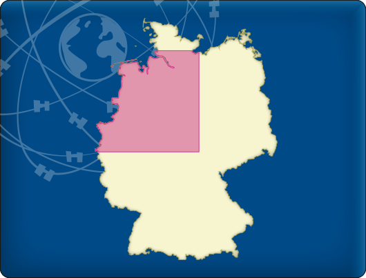
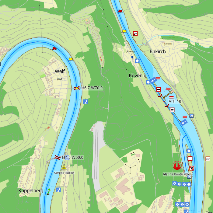
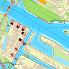
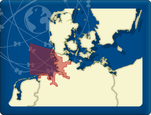
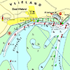
DKW Northwest Germany
The DKW Northwest Germany is developed for sailors, motorboaters and commercial shipping. The chart gives a clear view of all Northwestern German water ways and is ideal in combination with the paid versions of WinGPS. Using the route network you can easily and quickly plan routes on the inland waterways of Northwest Germany.
Covering area
In this chart set all large Northwestern German waterways are covered. The covering area is from the Dollard up until the Baltic coast at Lubeck and Duisburg, including a.o.
- The Rhine between Leverkusen to Lobith (km. 700 - 785)
- The sailable channels and rivers in the Ruhr area
- The 'Veen' channels between Emden and Oldenburg
- The Weser up until the connection at the Hünte (km 33)
- The Elbe between Bleckede and Hamburg (km. 550 – 610) with the Elbe-Lübeckkanal, the Elbe-Seitenkanal and the Schifffahrtweg Elbe-Weser
- The Aller
- The Küstenkanal
- The Ems-Jade-Kanal
- The Ems and the Dortmund-Emskanal
- The Mittellandkanal and the Stichkanalen
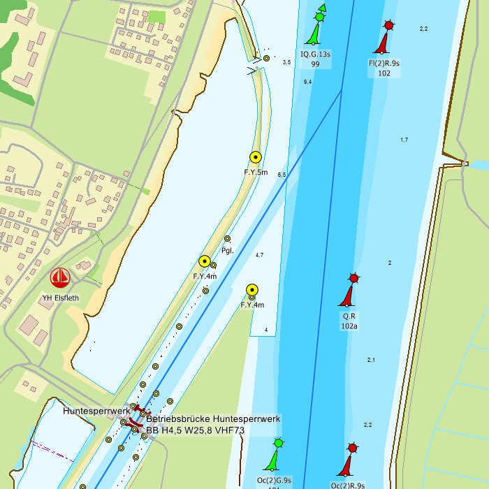

Depth image
This chart set has a unique and clear depth image. The chart is published annually by Stentec, based on OpenStreetMap, IENC charts and user remarks. The chart has a high level of detail with 2 meter per pixel, making it possible to zoom in up until the jetties at your home port.
Chart image
Stentecs inland water charts are so-called hybrid charts. The bottom surface is a raster format. This is where a.o. the quays, depths and buildings are shown. All other navigational information is projected on top of this through waypoints. These waypoints remain the same size when zooming in or out. The chart can be fully personalized by adding or removing certain waypoint groups and showing you only the information you select.
The DKW Northwest Germany has waypoints, with a.o. buoys, harbours, moorings, diesel tank stations, watersport campsites and VHF channels.
Specifically for commercial shipping waterway signs and VIN moorings are added.
|
|
|
System Requirements: This chart can be used in WinGPS for Windows and can also be installed on the WinGPS Marine apps for Android and iOS. For accurate route planning with rotating chart and AIS you will need at least WinGPS Pro or the paid version of WinGPS Marine. Click here for more information about the WinGPS series. |
|
DKW 1800 Series |
DKW German Bight |
DKW German |
|
|
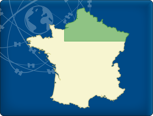
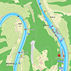
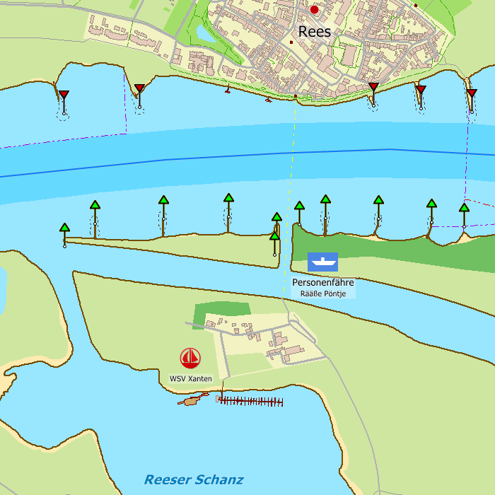
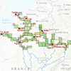
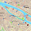
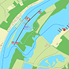
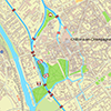
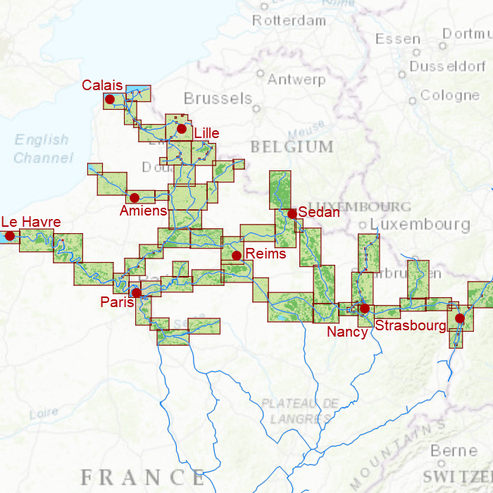
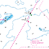
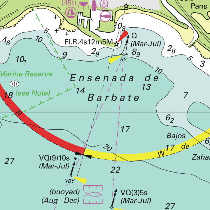
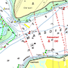
DKW Northern France
The DKW Northern France is developed for sailors, motorboaters and commercial shipping. The chart gives a clear view of all Northern French water ways and is ideal in combination with the paid versions of WinGPS. Using the route network you can easily and quickly plan routes on the inland waterways of Northern France.
Covering area
In this chart set all large Northern French waterways are covered. The covering area is from the Belgian/French border up intil Paris, Including the Somme, the Rhine, the Sambre, the Meuse and the Seine.

Depth image
This chart set has a unique and clear depth image. The chart is published annually by Stentec, based on OpenStreetMap, IENC charts and user remarks. The chart has a high level of detail with 2 meter per pixel, making it possible to zoom in up until the jetties at your home port.
Chart image
Stentecs inland water charts are so-called hybrid charts. The bottom surface is a raster format. This is where a.o. the quays, depths and buildings are shown. All other navigational information is projected on top of this through waypoints. These waypoints remain the same size when zooming in or out. The chart can be fully personalized by adding or removing certain waypoint groups and showing you only the information you select.
The DKW Northern France has waypoints, with a.o. buoys, harbours, moorings, diesel tank stations, watersport campsites and VHF channels.
Specifically for commercial shipping waterway signs and VIN moorings are added.
|
|
|
System Requirements: This chart can be used in WinGPS for Windows and can also be installed on the WinGPS Marine apps for Android and iOS. For accurate route planning with rotating chart and AIS you will need at least WinGPS Pro or the paid version of WinGPS Marine. Click here for more information about the WinGPS series. |
|
DKW UK1 |
DKWID20 |
|
|

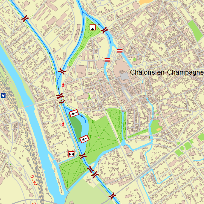
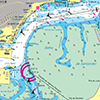
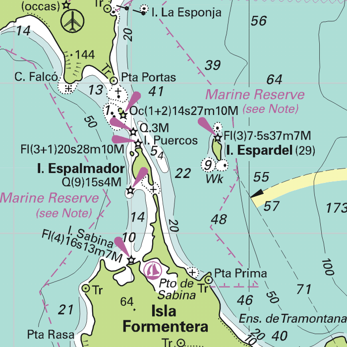
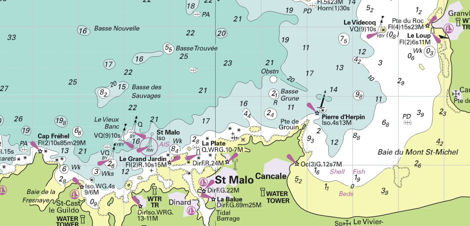
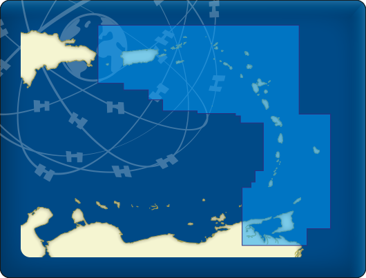
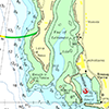
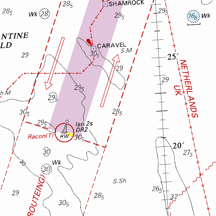
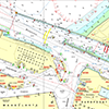
NV-Verlag series
NV-Verlag is a publisher of paper navigational charts which include digital versions of the same chart set. These digital charts can be used in WinGPS 5 and connect seemlessly with Stentecs DKW charts.
The most popular NV-Verlag chart sets are those of the Baltic Sea. These are complete sets with paper charts, digital charts and harbour pilots. The clear chart image is perfect for planning routes and viewing your current location.
Covering area
The different NV-Verlag chart sets cover the following areas:
- Baltic Sea and Kattegat. Including the Göta channel.
- North See coast: Netherlands, Germany, Denmark, United Kingdom and Norway.
- Northeast Germany: inland waters.
- Meditteranean coast: Spain, France, Italy and Croatia.
- Atlantic Ocean coast: United Kingdom, France, Northern Spain and Portugal. Including Cape Verde, Madeira, Azores and Canary Islands.
- Eastcoast United States. Including the Bermuda Islands.
- Atlantic crossing.
- Caribbean.
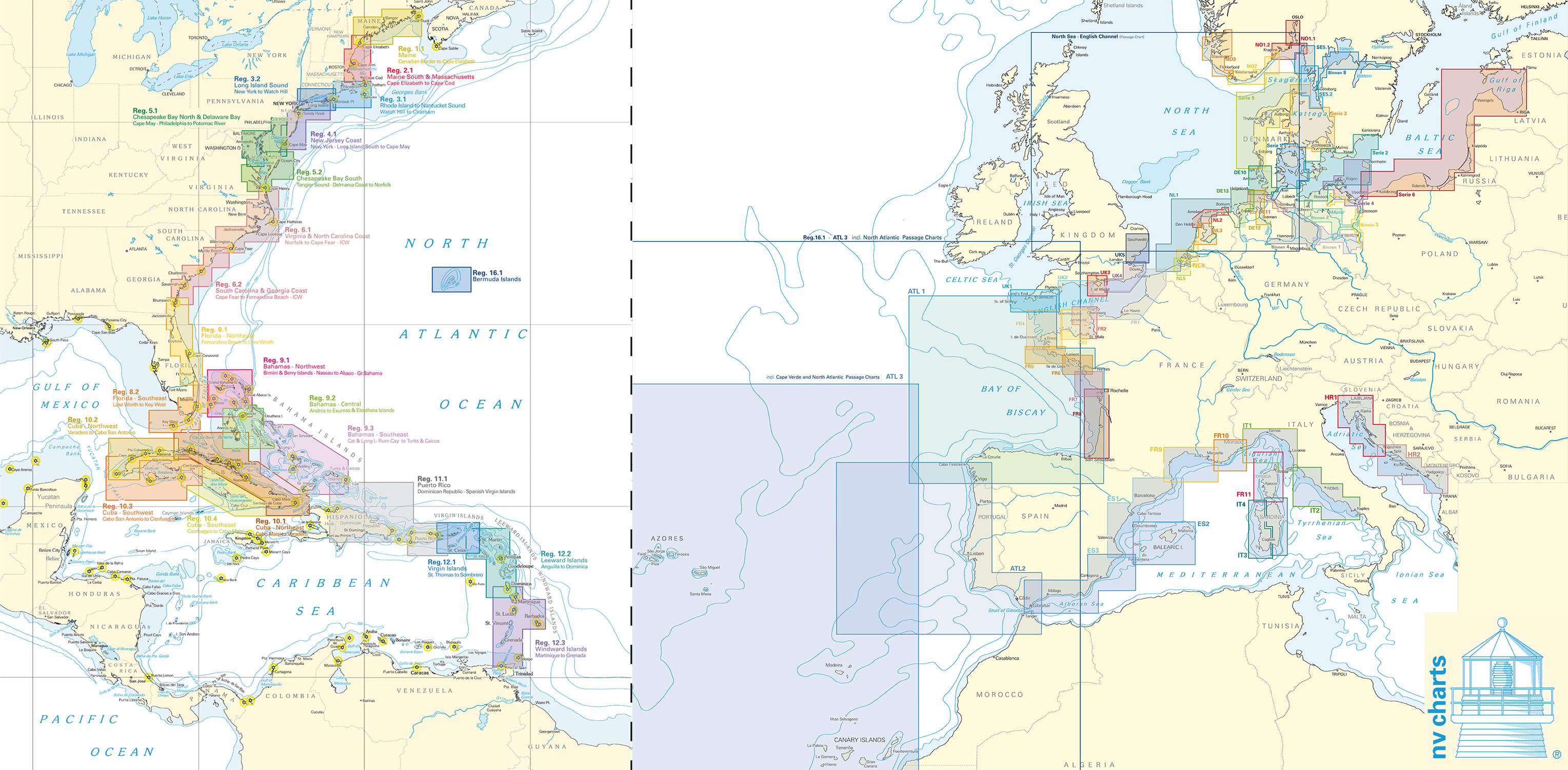
Please mind: these water charts are delivered as paper charts including a download code. For use on an Android tablet we recommend the use of our DKW charts. The NV-Verlags chart sets are as of now not compatible with WinGPS Marine. Follow this link for an installation guide for NV-Verlag charts in WinGPS on your Windows laptop or PC.

|
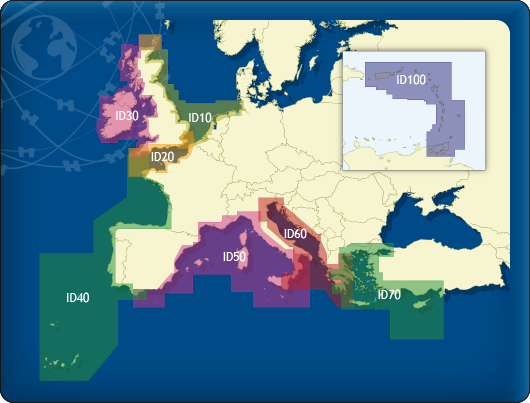
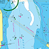
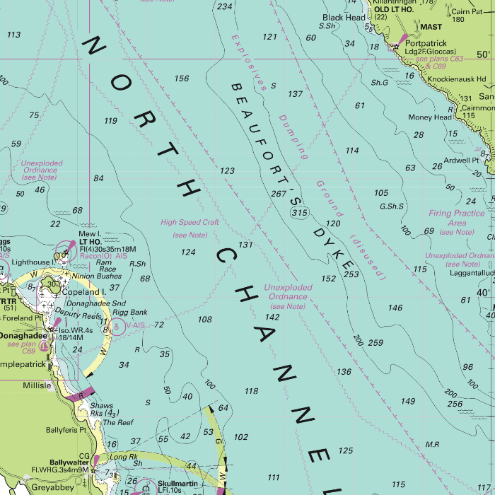
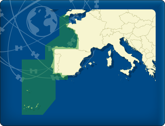
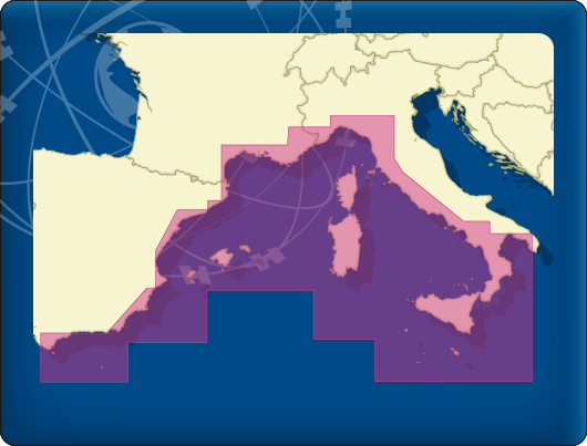
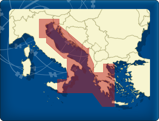
DKW Imray series
Since 2009 Stentec Software publishes the famous Imray charts digitally. These are based on the paper charts and feature the same well known Imray colors.
Covering area
The following DKW Imray charts are available:
- DKW ID10 English & Scottish Eastcoast
- DKW ID20 English Channel
- DKW ID30 British Westcoast & Ireland
- DKW ID40 Alantic coast France, Portugal to Gibraltar
- DKW ID50 Mediterranean West
- DKW ID60 Mediterranean Central
- DKW ID70 Mediterranean East
- DKW ID100 Caribbean East

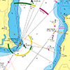
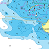
Detailed screenshots
|
|
|
|
|
|
Depth image
The depths are shown in the recognizable Imray colors: deep waters are blue and shallows are shown in whites. This configuration is the opposite of the DKW 1800, DKW German Bight and DKW English & Scottish Eastcoast.
Stentec publishes the DKW Imray series annually. All data is supplied by Imray. During the edition year 2 free updates are published in April and July, giving you the most up-to-date charts during your voyage.
Chart image
The DKW Imray series are comprised of raster charts. Because of this, the charts are an exact copy of the paper versions and you will see pixels when zoomed in to the maximum amount. The advantage of this is that all information, for example buoyage or shallows, are projected on the exact coordinates. When using vector charts a misleading image can show up when zooming in.
All products in the DKW Imray series
Click on an image for more information about the chart set.
|
DKW ID10 |
DKW ID20 |
DKW ID30 |

|
DKW ID40 |
DKW ID50 |
DKW ID60 |
|
DKW ID70 |
DKW ID100 |
|
|
|
System Requirements: This chart can be used in the free WinGPS Lite for Windows and can also be installed on the WinGPS Marine apps for Android and iOS. For accurate route planning with rotating chart and AIS you will need at least WinGPS Pro or the paid version of WinGPS Marine. Click here for more information about the WinGPS series. |
|
|
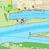
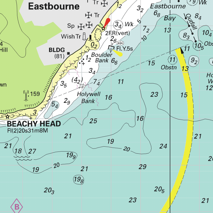
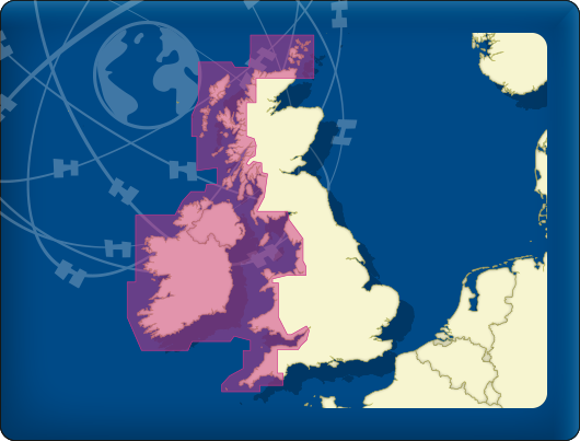
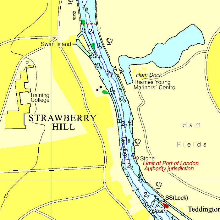
DKW UK1 English & Scottish Eastcoast
The DKW UK1 English & Scottish Eastcoast is developed for sailors, motorboaters and commercial shipping. The chart gives a clear view of the entire English and Scottish Eastcoast and is ideal in combination with the paid versions of WinGPS. You can easily and quickly plan routes on the North Sea and the British coast.
Covering area
The detailed charts in this chart set cover the English coast from Dover to Northern Scotland. The Thames is covered past London up until Teddington. Including passage charts for the North sea, the English Channel, Orkney and the Shetland Islands. This chart set has more detail than the DKW Imray ID10.
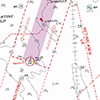
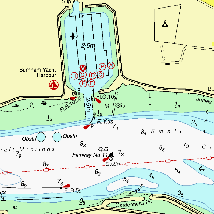
Depth image
This chart set has a unique and clear depth image. The chart is published annually by Stentec, based on OpenStreetMap, IENC charts and user remarks. The chart has a high level of detail with 2 meter per pixel, making it possible to zoom in up until the jetties at your home port.
|
|
|
System Requirements: This chart can be used in the free WinGPS Lite for Windows and can also be installed on the WinGPS Marine apps for Android and iOS. For accurate route planning with rotating chart and AIS you will need at least WinGPS Pro or the paid version of WinGPS Marine. Click here for more information about the WinGPS series. |

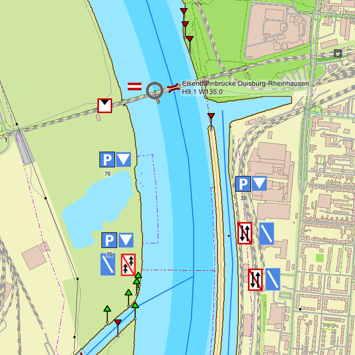
Hybrid charts for added safety
Our new DKW IENC Germany charts are available now in our online shop. The new hybrid charts in DKW format are recommended for navigation on the German rivers.
Hybrid charts offer the best of both worlds; the fast chart processing of raster charts and the clear waypoints of vector charts. While installing the charts, we automatically install a waypoint database. This database is seperate from the charts, so even when you rotate the chart, the waypoints will be clear. Updating your WinGPS 5 and DKW Manager is needed for showing the waypoint database.
We recommend WinGPS 5 Navigator, Pro or Voyager in combination with the DKW IENC charts thanks to the network of (a.o.) Rhine, Saar and Moessel.
We would appreciate input from our users to improve our first version. Feel free to stentec@stentec.com.
DKW IENC Rhine:
Rhein (Lobith-Iffezheim), Ruhr, Rhein-Herne-Kanal, Wesel-Datteln-Kanal, Mosel, Saar, Main, Main-Donau-kanaal, Donau en Neckar.


Shows kilometers, VHF channels and signs.
|
|
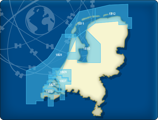
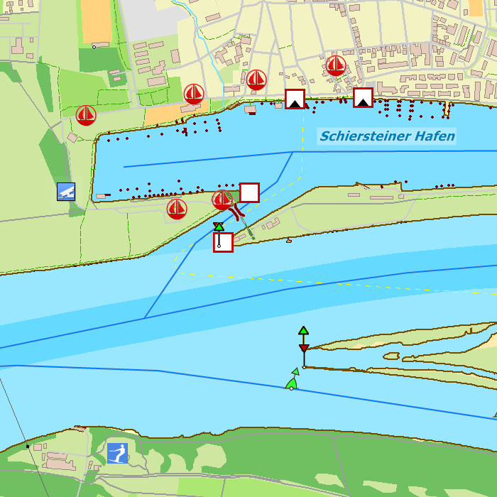
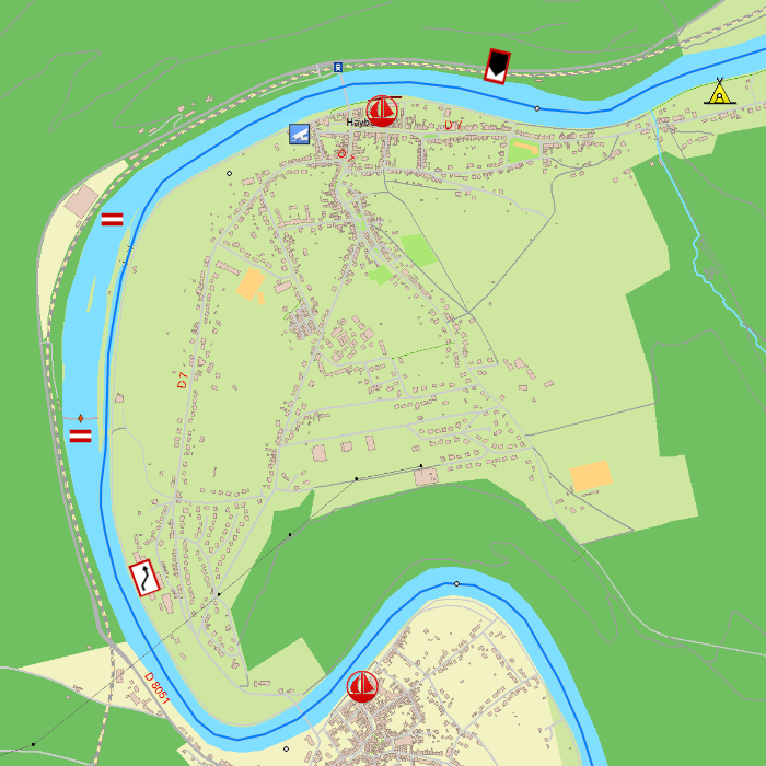
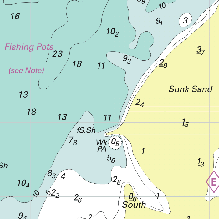
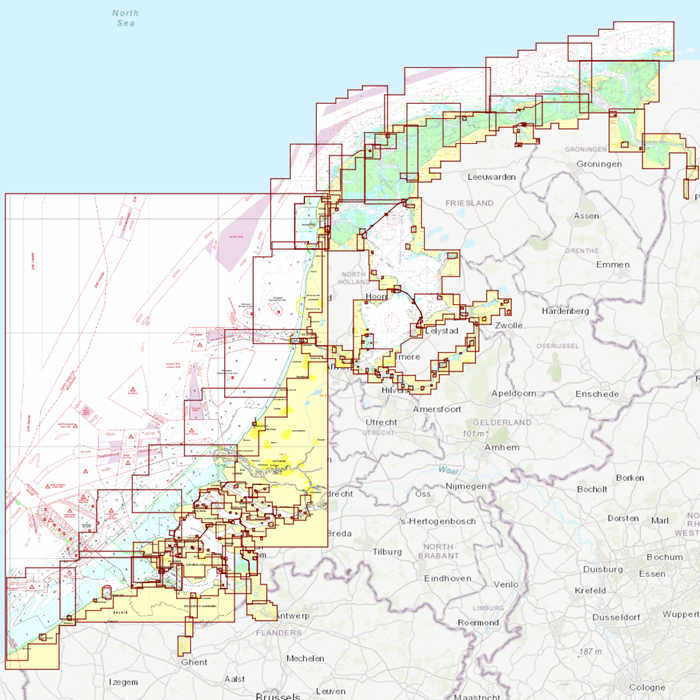
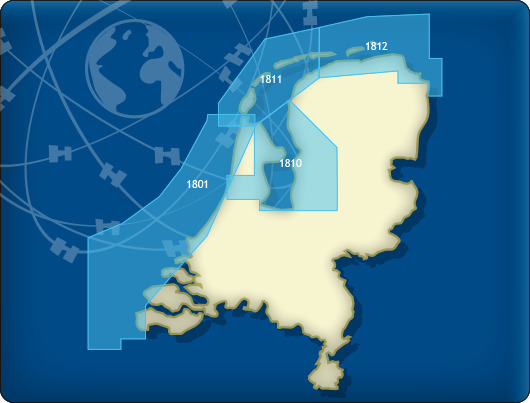
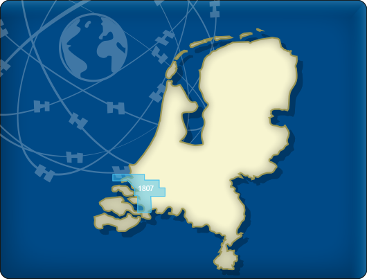
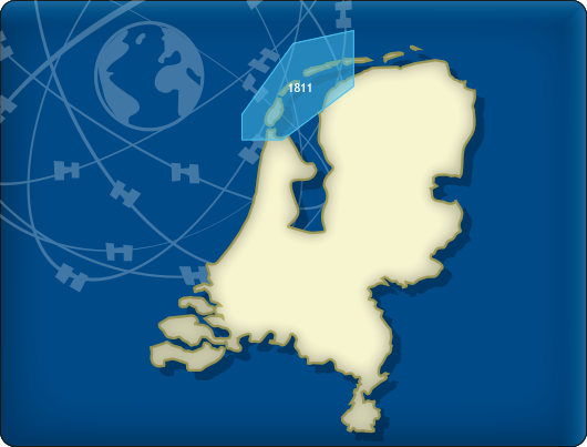
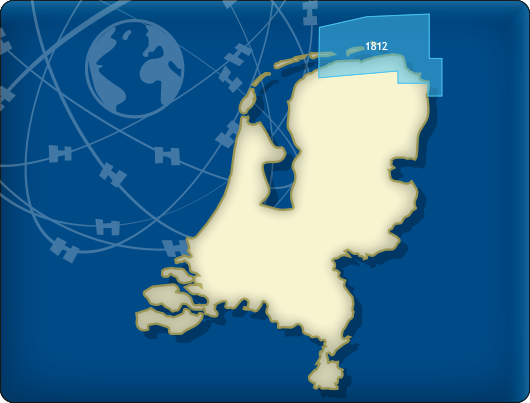
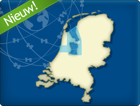
DKW 1800 series
The DKW 1800 Series Complete is the essential digital chart set for the Dutch coastal waters, based on the official Hydrographic Charts and trusted for more than 25 years as the foundation for safe and reliable navigation with WinGPS.
With weekly NtM updates, the chart remains continuously up to date, ensuring that changes in buoyage, depths and waterways are displayed automatically. This means you always navigate with the latest information, without any extra work.
The set includes all available Hydrographic charts from the 1800 series and can be used in WinGPS on Windows, Android and iOS.
The Waddensea charts DKW 1811 and DKW 1812 are supplied with monthly updated depth marks from Rijkswaterstaat. Great when sailing on the tidal waters of the Wadden Sea.
Covering area
The following DKW1800 series are included in this set:
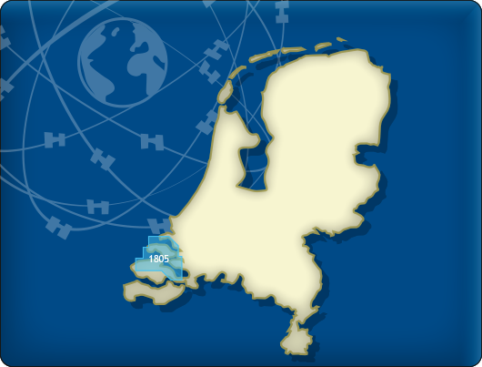
- DKW 1805 Oosterschelde: Veerse Meer and Grevelingenmeer
- DKW 1807 Zoommeer, Volkerak, Spui, Haringvliet and Hollandsch Diep
- DKW 1820 IJsselmeer: Markermeer, Ketelmeer and Noordzeekanaal
- DKW 1811 Wadden Sea West: Wadden Sea West and adjourning North Sea coast
- DKW 1812 Wadden Sea East: Wadden Sea East and adjourning North Sea coast
The DKW 1801, 1803, 1809, and 1810 charts are no longer published by the Hydrographic Service. For these areas, you can now use the following charts:

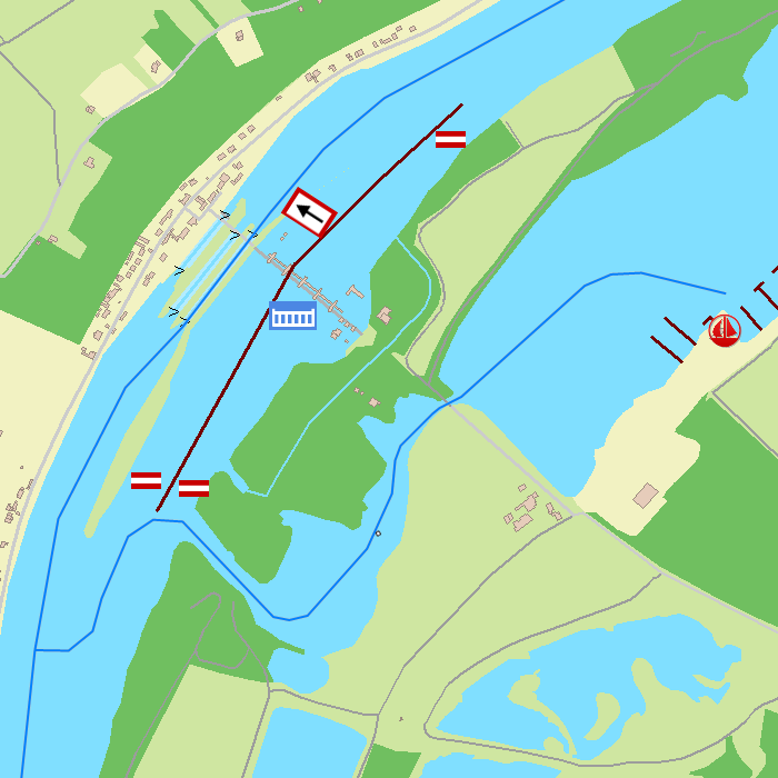
Depth image
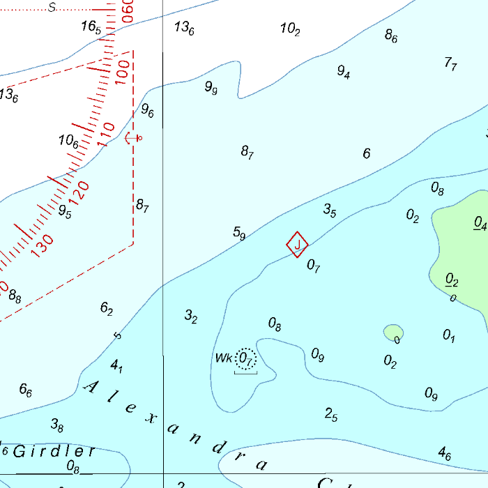
The DKW 1800 series contains a clear depth image and is the same as the well known paper version of the 1800 charts. Deep water is white and shallows are shown in different colors.
Stentec publishes the DKW 1800 series annually. The data is provided by the Dutch hydrographic service and the free weekly updates are based on the 'BaZ - Berichten aan Zeevarenden' (NtM - Notices to Mariners). User remarks are also screened and added to the charts which makes these chart sets the most up-to-date chart for the Dutch coastal waters.
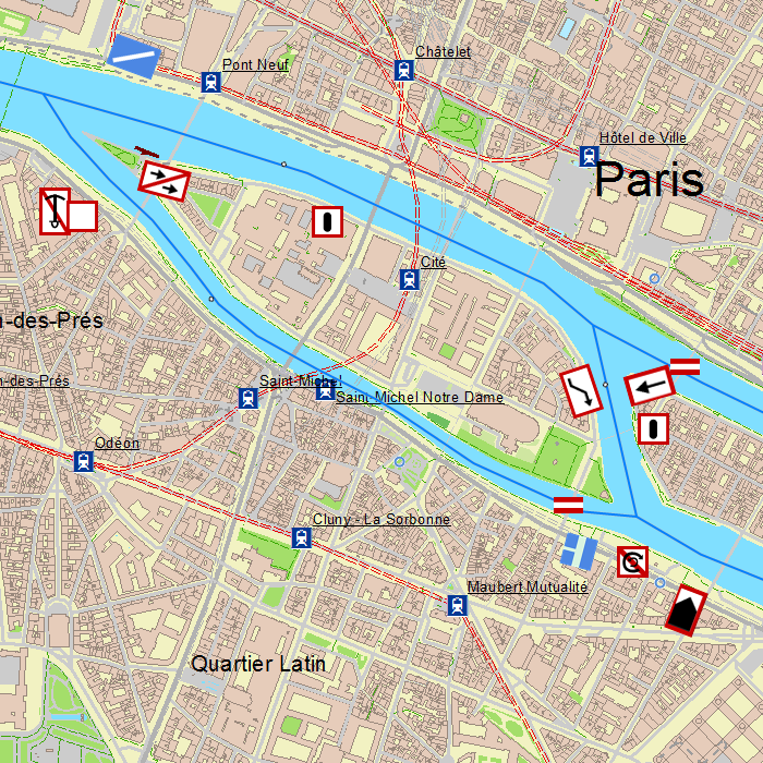
Chart image
The DKW 1800 series contains raster charts. This makes these charts look exactly the same as the paper version and you can see the pixels when zooming in. This has the advantage that the information, such as buoyage or shallows, are on the exact coordinates. This is in contrast to vector charts where a distorted image can be shown when zooming in.
On the Wadden Sea, the current depth status of Rijkswaterstaat is included. This contains the current depths, both in NAP and LAT, with the measurement date at that exact location. As soon as new information is available from RWS, these points are updated and an update becomes available for you. This current depth status is shown as waypoints on the chart and can be switched on/off manually. Ideal for planning a route over a tidal flat!
All products in the DKW 1800 series
Click on an image for more information.
|
DKW 1800 Complete |
DKW 1800 North |
DKW 1805: |

|
DKW 1807: |
DKW 1811: |
DKW 1812: |
|
DKW 1820: |
|
|
|
System Requirements: This chart can be used in WinGPS 6 for Windows and can also be installed on the WinGPS Marine apps for Android and iOS. For accurate route planning with rotating chart and AIS you will need at least WinGPS Pro or the paid version of WinGPS Marine. Click here for more information about the WinGPS series. |
Connecting DKW charts
Click the image for more information.
|
DKW Vaarkaart |
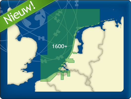
DKW 1600+ |

|
DKW UK1 |
DKW German Bight |
Do you have any questions?
Call us on +31 515 443515, fill in the contact form or make an appointment at our store in Heeg.
Click here for our opening hours.


News
 The boating season is in full swing, and the water is calling! Whether you’re planning a relaxing weekend getaway or a major trip on Europe’s inland...
 The new charts for the Wadden Sea, DKW 1811 and DKW 1812, and DKW 1805 (Oosterschelde, Veerse Meer, and Grevelingenmeer) are now available! The quarterly...
 Are you familiar with our WinGPS Marine Plus for Android? This popular navigation app is now available as an affordable subscription and can be paired with an...
| WinGPS Navigator |
|
• Easy to use route planner |
| WinGPS Marine |
|
A navigation app for use aboard your ship. An upgradable navigation solution for all sailors, from beginner to professional. |

Stentec Navigation is specialised in digital navigation for water sporters and commercial shipping.
Trackpilot-project : 2025-2028


Harinxmastrjitte 29
8621 BJ HEEG
The Netherlands
T +31 (0) 515 443515

Copyright © Stentec Software. All rights reserved.
By using this website you acknowledge that you agree with our user agreement.