- News
- E-mail list
- Signup for our newsletter
- Stentec news
- News
- Developers Blog
- WinGPS
- WinGPS series
- WinGPS versions
- WinGPS specifications
- For Windows
- WinGPS Lite
- WinGPS Navigator
- WinGPS Pro
- WinGPS Voyager
- For Android
- WinGPS Marine
- WinGPS Marine Plus
- For iOS
- Apps for iOS
- WinGPS Marine
- WinGPS Marine Plus
- DKW 1800 series
- Vaarkaart Friese Meren
- Service and upgrades
- Service Subscriptions
- WinGPS Service Card
- WinGPS Yacht Navigator
- Charts
- Chart overview
- DKW Inland waters
- DKW The Netherlands
- DKW Friese meren
- DKW Amsterdam
- DKW Biesbosch
- DKW Belgium
- DKW Northern France
- DKW Southern France
- DKW Northeast Germany
- DKW Northwest Germany
- DKW Southwest Germany
- DKW Rhine and Moselle
- DKW Danube 1-West
- DKW Danube 2-Central
- DKW Danube 3-East
- DKW Coastal waters
- DKW 1800 series
- DKW 1600+
- DKW UK1 English & Scottish Eastcoast
- DKW German Bight
- DKW German Baltic coast
- DKW Imray series
- DKW Delius Klasing series
- NV-Verlag series
- Exclusive for Android
- Subscription - DKW the Netherlands
- Chart apps
- Other
- ADAC Marina Guide
- Hardware
- Simulators
- Shop
- Downloads
- Support
- Downloads
- Help pages
- Documentation
- System Requirements
- Availability GRIB files
- Frequently asked questions - FAQ
- WinGPS 5
- WinGPS Marine (Android)
- WinGPS Marine (iOS)
- Installation help
- WinGPS 5 (Windows)
- WinGPS Marine (Android)
- Tips
- Offline installation DKW charts (Windows)
- Installation ENC charts (Windows)
- Connecting SD card (Android)
- NV Verlag charts
- Offline NOAA Charts
- Download TeamViewer
- Contact
- Contactform - Helpdesk
- Callback Service
- Commercial Shipping


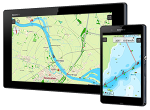
Navigation on a tablet
Navigation has never been this easy thanks to the DKW the Netherlands app. After downloading the chart files and turning on the (internal) GPS, you will immediately see your speed, course and position on the chart. By placing a navigational waypoint on the chart, the shortest route to this point will be plotted on the route network. Giving you information about the total distance to your destination and estimated time of arrival when maintaining your current speed. Discover how simple mobile navigation can be!
Please mind: when plotting a route in the app measurements for bridges, locks and waterways are not taken into account. Our Android app WinGPS Marine does take these measurements into account. Click here for more info on WinGPS Marine.
More info on subscriptions
Payment is done via Google Play and subscriptions are extended automatically. When you cancel your subscription you will continue to have access to the charts up until the end of your last subscription period.
For more information on Google Play subscriptions click here.
With a subscription you are able to view the chart in the 'DKW the Netherlands' app. When you want more functionalities or want to use the chart set on your Windows system as well, you can order a full license in our online shop. The chart set can then be used in WinGPS Marine (Android) or WinGPS 5 (Windows).
Important note: Your subscription will not be automatically cancelled when you delete the app from your device. You need to cancel your subscription manually. When you remove the app without cancelling your subscription, payments will still continue. Follow this link for more information on cancelling subscriptions.
For only € 15,- you can use the DKW the Netherlands North or South on an Android tablet of smartphone for a month. After the DKW the Netherlands other well-known Stentec chart sets will be added to the subscription service, among which the DKW1800 series with weekly BaZ updates.
To go to the ‘DKW the Netherlands’ app in Google Play click here.
Frequently asked questions - FAQ
Click on a question to see the answer.
Navigation has never been this easy thanks to the DKW the Netherlands app. After downloading the chart files and turning on the (internal) GPS, you will immediately see your speed, course and position on the chart. By placing a navigational waypoint on the chart, the shortest route to this point will be plotted on the route network. Giving you information about the total distance to your destination and estimated time of arrival when maintaining your current speed. Discover how simple mobile navigation can be!
Please mind: when plotting a route in the app measurements for bridges, locks and waterways are not taken into account. Our Android app WinGPS Marine does take these measurements into account. Click here for more info on WinGPS Marine.
If this didn't answer your question please contact our helpdesk.
Are there subscriptions for other chart sets?
At this moment we only offer subscriptions for DKW the Netherlands north and south. We expect to add several other chart sets to the subscriptions in future updates of the app, such as the DKW 1800 series.
If this didn't answer your question please contact our helpdesk.
Can I use the subscription in combination with WinGPS Marine?
No, this is not possible. The subscriptions are only offered in this specific app.
If this didn't answer your question please contact our helpdesk.
Can I use the app on multiple devices?
Subscriptions are linked to your Google account, not any specific device. When you start using a new or extra Android device you can install the app on the system. This will grant you immediate access to the app and all functionalities. When you are unable to use the app, please make sure you have entered the correct Google account in your Google Play app.
If this didn't answer your question please contact our helpdesk.
Payment is done within the Google Play app. Payments can be done with Credit Card, Paypal or Google Play coupons.
If this didn't answer your question please contact our helpdesk.
How do I use the free trial period?
With your first subscription you will receive a free 3-day trial period. The trial can be activated by starting a subscription. At the end of the trial period the subscription fee will automatically be debited.
If you don't want to use the app after the trial period you need to cancel your subscription before the end of the 3 day period. More information on cancelling your subscription can be found here.
If this didn't answer your question please contact our helpdesk.
Why do I need to select a payment form and enter my personal details?
When starting a subscription all your personal data needs to be entered. When entering your data you automatically agree to automatically debit the monthly fee after the 3 day trial period.
If this didn't answer your question please contact our helpdesk.
What happens with my personal data, location data and payment data?
How can I cancel my subscription?
For more information on cancelling your subscription visit this link.
Important note: Your subscription will not be automatically cancelled when you delete the app from your device. You need to cancel your subscription manually. When you remove the app without cancelling your subscription, payments will still continue.
If this didn't answer your question please contact our helpdesk.
| WinGPS 6 Voyager 2025 Release Historie | |||||||||||||||||||||||||||||||||||||||||||||||||||||||||||||||||||||||||||||||||||||||||||||||||||||||||||||||||||||||||||||||||||||||||||||||||||||||||||||||||||||||||||||||||||||||||||||||||||||||||||||||||||||||||||||||||||||||||||||||||||||||||||||||||||||||||||||||||||||||||||||||||||||||||||||||||||||||||||||||||||||||||||||||||||||||||||||||||||||||||||||||||||||||||||||||||||||||||||||||||||||||||||||||||||||||||||||||||||||||||||||||||||||||||||||||||||||||||||||||||||||||||||||||||||||||||||||||||||||||||||||||||||||||||||||||||||||||||||||||||||||||||||||||||||||||||||||||||||||||||||||||||||||||||||||||||||||||||||||||||||||||||||||||||||||||||||||||||||||||||||||||||||||||||||||||||||||||||||||||||||||||||||||||||||||||||||||||||||||||||||||||||||||||||||||||||||||||||||||||||||||||||||||||||||||||||||||||||||||||||||||||||||||||||||||||||||||||||||||||||||||||||||||||||||||||||||||||||||||||||||||||||||||||||||||||||||||||||||||||||||||||||||||||||||||||||||||||||||||||
 |
|||||||||||||||||||||||||||||||||||||||||||||||||||||||||||||||||||||||||||||||||||||||||||||||||||||||||||||||||||||||||||||||||||||||||||||||||||||||||||||||||||||||||||||||||||||||||||||||||||||||||||||||||||||||||||||||||||||||||||||||||||||||||||||||||||||||||||||||||||||||||||||||||||||||||||||||||||||||||||||||||||||||||||||||||||||||||||||||||||||||||||||||||||||||||||||||||||||||||||||||||||||||||||||||||||||||||||||||||||||||||||||||||||||||||||||||||||||||||||||||||||||||||||||||||||||||||||||||||||||||||||||||||||||||||||||||||||||||||||||||||||||||||||||||||||||||||||||||||||||||||||||||||||||||||||||||||||||||||||||||||||||||||||||||||||||||||||||||||||||||||||||||||||||||||||||||||||||||||||||||||||||||||||||||||||||||||||||||||||||||||||||||||||||||||||||||||||||||||||||||||||||||||||||||||||||||||||||||||||||||||||||||||||||||||||||||||||||||||||||||||||||||||||||||||||||||||||||||||||||||||||||||||||||||||||||||||||||||||||||||||||||||||||||||||||||||||||||||||||||||
|
|||||||||||||||||||||||||||||||||||||||||||||||||||||||||||||||||||||||||||||||||||||||||||||||||||||||||||||||||||||||||||||||||||||||||||||||||||||||||||||||||||||||||||||||||||||||||||||||||||||||||||||||||||||||||||||||||||||||||||||||||||||||||||||||||||||||||||||||||||||||||||||||||||||||||||||||||||||||||||||||||||||||||||||||||||||||||||||||||||||||||||||||||||||||||||||||||||||||||||||||||||||||||||||||||||||||||||||||||||||||||||||||||||||||||||||||||||||||||||||||||||||||||||||||||||||||||||||||||||||||||||||||||||||||||||||||||||||||||||||||||||||||||||||||||||||||||||||||||||||||||||||||||||||||||||||||||||||||||||||||||||||||||||||||||||||||||||||||||||||||||||||||||||||||||||||||||||||||||||||||||||||||||||||||||||||||||||||||||||||||||||||||||||||||||||||||||||||||||||||||||||||||||||||||||||||||||||||||||||||||||||||||||||||||||||||||||||||||||||||||||||||||||||||||||||||||||||||||||||||||||||||||||||||||||||||||||||||||||||||||||||||||||||||||||||||||||||||||||||||||
| Version 6.25.0.4 (08-04-2025) | |||||||||||||||||||||||||||||||||||||||||||||||||||||||||||||||||||||||||||||||||||||||||||||||||||||||||||||||||||||||||||||||||||||||||||||||||||||||||||||||||||||||||||||||||||||||||||||||||||||||||||||||||||||||||||||||||||||||||||||||||||||||||||||||||||||||||||||||||||||||||||||||||||||||||||||||||||||||||||||||||||||||||||||||||||||||||||||||||||||||||||||||||||||||||||||||||||||||||||||||||||||||||||||||||||||||||||||||||||||||||||||||||||||||||||||||||||||||||||||||||||||||||||||||||||||||||||||||||||||||||||||||||||||||||||||||||||||||||||||||||||||||||||||||||||||||||||||||||||||||||||||||||||||||||||||||||||||||||||||||||||||||||||||||||||||||||||||||||||||||||||||||||||||||||||||||||||||||||||||||||||||||||||||||||||||||||||||||||||||||||||||||||||||||||||||||||||||||||||||||||||||||||||||||||||||||||||||||||||||||||||||||||||||||||||||||||||||||||||||||||||||||||||||||||||||||||||||||||||||||||||||||||||||||||||||||||||||||||||||||||||||||||||||||||||||||||||||||||||||||
|
|||||||||||||||||||||||||||||||||||||||||||||||||||||||||||||||||||||||||||||||||||||||||||||||||||||||||||||||||||||||||||||||||||||||||||||||||||||||||||||||||||||||||||||||||||||||||||||||||||||||||||||||||||||||||||||||||||||||||||||||||||||||||||||||||||||||||||||||||||||||||||||||||||||||||||||||||||||||||||||||||||||||||||||||||||||||||||||||||||||||||||||||||||||||||||||||||||||||||||||||||||||||||||||||||||||||||||||||||||||||||||||||||||||||||||||||||||||||||||||||||||||||||||||||||||||||||||||||||||||||||||||||||||||||||||||||||||||||||||||||||||||||||||||||||||||||||||||||||||||||||||||||||||||||||||||||||||||||||||||||||||||||||||||||||||||||||||||||||||||||||||||||||||||||||||||||||||||||||||||||||||||||||||||||||||||||||||||||||||||||||||||||||||||||||||||||||||||||||||||||||||||||||||||||||||||||||||||||||||||||||||||||||||||||||||||||||||||||||||||||||||||||||||||||||||||||||||||||||||||||||||||||||||||||||||||||||||||||||||||||||||||||||||||||||||||||||||||||||||||||
| Version 6.25.0.3 (06-03-2025) | |||||||||||||||||||||||||||||||||||||||||||||||||||||||||||||||||||||||||||||||||||||||||||||||||||||||||||||||||||||||||||||||||||||||||||||||||||||||||||||||||||||||||||||||||||||||||||||||||||||||||||||||||||||||||||||||||||||||||||||||||||||||||||||||||||||||||||||||||||||||||||||||||||||||||||||||||||||||||||||||||||||||||||||||||||||||||||||||||||||||||||||||||||||||||||||||||||||||||||||||||||||||||||||||||||||||||||||||||||||||||||||||||||||||||||||||||||||||||||||||||||||||||||||||||||||||||||||||||||||||||||||||||||||||||||||||||||||||||||||||||||||||||||||||||||||||||||||||||||||||||||||||||||||||||||||||||||||||||||||||||||||||||||||||||||||||||||||||||||||||||||||||||||||||||||||||||||||||||||||||||||||||||||||||||||||||||||||||||||||||||||||||||||||||||||||||||||||||||||||||||||||||||||||||||||||||||||||||||||||||||||||||||||||||||||||||||||||||||||||||||||||||||||||||||||||||||||||||||||||||||||||||||||||||||||||||||||||||||||||||||||||||||||||||||||||||||||||||||||||||
|
| WinGPS 6 Voyager 2024 Release Historie | |||||||||||||||||||||||||||||||||||||||||||||||||||||||||||||||||||||||||||||||||||||||||||||||||||||||||||||||||||||||||||||||||||||||||||||||||||||||||||||||||||||||||||||||||||||||||||||||||||||||||||||||||||||||||||||||||||||||||||||||||||||||||||||||||||||||||||||||||||||||||||||||||||||||||||||||||||||||||||||||||||||||||||||||||||||||||||||||||||||||||||||||||||||||||||||||||||||||||||||||||||||||||||||||||||||||||||||||||||||||||||||||||||||||||||||||||||||||||||||||||||||||||||||||||||||||||||||||||||||||||||||||||||||||||||||||||||||||||||||||||||||||||||||||||||||||||||||||||||||||||||||||||||||||||||||||||||||||||||||||||||||||||||||||||||||||||||||||||||||||||||||||||||||||||||||||||||||||||||||||||||||||||||||||||||||||||||||||||||||||||||||||||||||||||||||||||||||||||||||||||||||||||||||||||||||||||||||||||||||||||||||||||||||||||||||||||||||||||||||||||||||||||||||||||||||||||||||||||||||||||||||||||||||||||||||||||||||||||||||||||||||||||||||||||||||||||||||||||||||||
 |
|||||||||||||||||||||||||||||||||||||||||||||||||||||||||||||||||||||||||||||||||||||||||||||||||||||||||||||||||||||||||||||||||||||||||||||||||||||||||||||||||||||||||||||||||||||||||||||||||||||||||||||||||||||||||||||||||||||||||||||||||||||||||||||||||||||||||||||||||||||||||||||||||||||||||||||||||||||||||||||||||||||||||||||||||||||||||||||||||||||||||||||||||||||||||||||||||||||||||||||||||||||||||||||||||||||||||||||||||||||||||||||||||||||||||||||||||||||||||||||||||||||||||||||||||||||||||||||||||||||||||||||||||||||||||||||||||||||||||||||||||||||||||||||||||||||||||||||||||||||||||||||||||||||||||||||||||||||||||||||||||||||||||||||||||||||||||||||||||||||||||||||||||||||||||||||||||||||||||||||||||||||||||||||||||||||||||||||||||||||||||||||||||||||||||||||||||||||||||||||||||||||||||||||||||||||||||||||||||||||||||||||||||||||||||||||||||||||||||||||||||||||||||||||||||||||||||||||||||||||||||||||||||||||||||||||||||||||||||||||||||||||||||||||||||||||||||||||||||||||||
|
|||||||||||||||||||||||||||||||||||||||||||||||||||||||||||||||||||||||||||||||||||||||||||||||||||||||||||||||||||||||||||||||||||||||||||||||||||||||||||||||||||||||||||||||||||||||||||||||||||||||||||||||||||||||||||||||||||||||||||||||||||||||||||||||||||||||||||||||||||||||||||||||||||||||||||||||||||||||||||||||||||||||||||||||||||||||||||||||||||||||||||||||||||||||||||||||||||||||||||||||||||||||||||||||||||||||||||||||||||||||||||||||||||||||||||||||||||||||||||||||||||||||||||||||||||||||||||||||||||||||||||||||||||||||||||||||||||||||||||||||||||||||||||||||||||||||||||||||||||||||||||||||||||||||||||||||||||||||||||||||||||||||||||||||||||||||||||||||||||||||||||||||||||||||||||||||||||||||||||||||||||||||||||||||||||||||||||||||||||||||||||||||||||||||||||||||||||||||||||||||||||||||||||||||||||||||||||||||||||||||||||||||||||||||||||||||||||||||||||||||||||||||||||||||||||||||||||||||||||||||||||||||||||||||||||||||||||||||||||||||||||||||||||||||||||||||||||||||||||||||
| Version 6.24.1.3 (16-12-2024) | |||||||||||||||||||||||||||||||||||||||||||||||||||||||||||||||||||||||||||||||||||||||||||||||||||||||||||||||||||||||||||||||||||||||||||||||||||||||||||||||||||||||||||||||||||||||||||||||||||||||||||||||||||||||||||||||||||||||||||||||||||||||||||||||||||||||||||||||||||||||||||||||||||||||||||||||||||||||||||||||||||||||||||||||||||||||||||||||||||||||||||||||||||||||||||||||||||||||||||||||||||||||||||||||||||||||||||||||||||||||||||||||||||||||||||||||||||||||||||||||||||||||||||||||||||||||||||||||||||||||||||||||||||||||||||||||||||||||||||||||||||||||||||||||||||||||||||||||||||||||||||||||||||||||||||||||||||||||||||||||||||||||||||||||||||||||||||||||||||||||||||||||||||||||||||||||||||||||||||||||||||||||||||||||||||||||||||||||||||||||||||||||||||||||||||||||||||||||||||||||||||||||||||||||||||||||||||||||||||||||||||||||||||||||||||||||||||||||||||||||||||||||||||||||||||||||||||||||||||||||||||||||||||||||||||||||||||||||||||||||||||||||||||||||||||||||||||||||||||||||
|
|||||||||||||||||||||||||||||||||||||||||||||||||||||||||||||||||||||||||||||||||||||||||||||||||||||||||||||||||||||||||||||||||||||||||||||||||||||||||||||||||||||||||||||||||||||||||||||||||||||||||||||||||||||||||||||||||||||||||||||||||||||||||||||||||||||||||||||||||||||||||||||||||||||||||||||||||||||||||||||||||||||||||||||||||||||||||||||||||||||||||||||||||||||||||||||||||||||||||||||||||||||||||||||||||||||||||||||||||||||||||||||||||||||||||||||||||||||||||||||||||||||||||||||||||||||||||||||||||||||||||||||||||||||||||||||||||||||||||||||||||||||||||||||||||||||||||||||||||||||||||||||||||||||||||||||||||||||||||||||||||||||||||||||||||||||||||||||||||||||||||||||||||||||||||||||||||||||||||||||||||||||||||||||||||||||||||||||||||||||||||||||||||||||||||||||||||||||||||||||||||||||||||||||||||||||||||||||||||||||||||||||||||||||||||||||||||||||||||||||||||||||||||||||||||||||||||||||||||||||||||||||||||||||||||||||||||||||||||||||||||||||||||||||||||||||||||||||||||||||||
| Version 6.24.1.1 (12-12-2024) | |||||||||||||||||||||||||||||||||||||||||||||||||||||||||||||||||||||||||||||||||||||||||||||||||||||||||||||||||||||||||||||||||||||||||||||||||||||||||||||||||||||||||||||||||||||||||||||||||||||||||||||||||||||||||||||||||||||||||||||||||||||||||||||||||||||||||||||||||||||||||||||||||||||||||||||||||||||||||||||||||||||||||||||||||||||||||||||||||||||||||||||||||||||||||||||||||||||||||||||||||||||||||||||||||||||||||||||||||||||||||||||||||||||||||||||||||||||||||||||||||||||||||||||||||||||||||||||||||||||||||||||||||||||||||||||||||||||||||||||||||||||||||||||||||||||||||||||||||||||||||||||||||||||||||||||||||||||||||||||||||||||||||||||||||||||||||||||||||||||||||||||||||||||||||||||||||||||||||||||||||||||||||||||||||||||||||||||||||||||||||||||||||||||||||||||||||||||||||||||||||||||||||||||||||||||||||||||||||||||||||||||||||||||||||||||||||||||||||||||||||||||||||||||||||||||||||||||||||||||||||||||||||||||||||||||||||||||||||||||||||||||||||||||||||||||||||||||||||||||||
|
|||||||||||||||||||||||||||||||||||||||||||||||||||||||||||||||||||||||||||||||||||||||||||||||||||||||||||||||||||||||||||||||||||||||||||||||||||||||||||||||||||||||||||||||||||||||||||||||||||||||||||||||||||||||||||||||||||||||||||||||||||||||||||||||||||||||||||||||||||||||||||||||||||||||||||||||||||||||||||||||||||||||||||||||||||||||||||||||||||||||||||||||||||||||||||||||||||||||||||||||||||||||||||||||||||||||||||||||||||||||||||||||||||||||||||||||||||||||||||||||||||||||||||||||||||||||||||||||||||||||||||||||||||||||||||||||||||||||||||||||||||||||||||||||||||||||||||||||||||||||||||||||||||||||||||||||||||||||||||||||||||||||||||||||||||||||||||||||||||||||||||||||||||||||||||||||||||||||||||||||||||||||||||||||||||||||||||||||||||||||||||||||||||||||||||||||||||||||||||||||||||||||||||||||||||||||||||||||||||||||||||||||||||||||||||||||||||||||||||||||||||||||||||||||||||||||||||||||||||||||||||||||||||||||||||||||||||||||||||||||||||||||||||||||||||||||||||||||||||||||
| Version 6.24.1.0 (02-12-2024) | |||||||||||||||||||||||||||||||||||||||||||||||||||||||||||||||||||||||||||||||||||||||||||||||||||||||||||||||||||||||||||||||||||||||||||||||||||||||||||||||||||||||||||||||||||||||||||||||||||||||||||||||||||||||||||||||||||||||||||||||||||||||||||||||||||||||||||||||||||||||||||||||||||||||||||||||||||||||||||||||||||||||||||||||||||||||||||||||||||||||||||||||||||||||||||||||||||||||||||||||||||||||||||||||||||||||||||||||||||||||||||||||||||||||||||||||||||||||||||||||||||||||||||||||||||||||||||||||||||||||||||||||||||||||||||||||||||||||||||||||||||||||||||||||||||||||||||||||||||||||||||||||||||||||||||||||||||||||||||||||||||||||||||||||||||||||||||||||||||||||||||||||||||||||||||||||||||||||||||||||||||||||||||||||||||||||||||||||||||||||||||||||||||||||||||||||||||||||||||||||||||||||||||||||||||||||||||||||||||||||||||||||||||||||||||||||||||||||||||||||||||||||||||||||||||||||||||||||||||||||||||||||||||||||||||||||||||||||||||||||||||||||||||||||||||||||||||||||||||||||
|
|||||||||||||||||||||||||||||||||||||||||||||||||||||||||||||||||||||||||||||||||||||||||||||||||||||||||||||||||||||||||||||||||||||||||||||||||||||||||||||||||||||||||||||||||||||||||||||||||||||||||||||||||||||||||||||||||||||||||||||||||||||||||||||||||||||||||||||||||||||||||||||||||||||||||||||||||||||||||||||||||||||||||||||||||||||||||||||||||||||||||||||||||||||||||||||||||||||||||||||||||||||||||||||||||||||||||||||||||||||||||||||||||||||||||||||||||||||||||||||||||||||||||||||||||||||||||||||||||||||||||||||||||||||||||||||||||||||||||||||||||||||||||||||||||||||||||||||||||||||||||||||||||||||||||||||||||||||||||||||||||||||||||||||||||||||||||||||||||||||||||||||||||||||||||||||||||||||||||||||||||||||||||||||||||||||||||||||||||||||||||||||||||||||||||||||||||||||||||||||||||||||||||||||||||||||||||||||||||||||||||||||||||||||||||||||||||||||||||||||||||||||||||||||||||||||||||||||||||||||||||||||||||||||||||||||||||||||||||||||||||||||||||||||||||||||||||||||||||||||||
| Version 6.24.0.6 (04-07-2024) | |||||||||||||||||||||||||||||||||||||||||||||||||||||||||||||||||||||||||||||||||||||||||||||||||||||||||||||||||||||||||||||||||||||||||||||||||||||||||||||||||||||||||||||||||||||||||||||||||||||||||||||||||||||||||||||||||||||||||||||||||||||||||||||||||||||||||||||||||||||||||||||||||||||||||||||||||||||||||||||||||||||||||||||||||||||||||||||||||||||||||||||||||||||||||||||||||||||||||||||||||||||||||||||||||||||||||||||||||||||||||||||||||||||||||||||||||||||||||||||||||||||||||||||||||||||||||||||||||||||||||||||||||||||||||||||||||||||||||||||||||||||||||||||||||||||||||||||||||||||||||||||||||||||||||||||||||||||||||||||||||||||||||||||||||||||||||||||||||||||||||||||||||||||||||||||||||||||||||||||||||||||||||||||||||||||||||||||||||||||||||||||||||||||||||||||||||||||||||||||||||||||||||||||||||||||||||||||||||||||||||||||||||||||||||||||||||||||||||||||||||||||||||||||||||||||||||||||||||||||||||||||||||||||||||||||||||||||||||||||||||||||||||||||||||||||||||||||||||||||||
|
|||||||||||||||||||||||||||||||||||||||||||||||||||||||||||||||||||||||||||||||||||||||||||||||||||||||||||||||||||||||||||||||||||||||||||||||||||||||||||||||||||||||||||||||||||||||||||||||||||||||||||||||||||||||||||||||||||||||||||||||||||||||||||||||||||||||||||||||||||||||||||||||||||||||||||||||||||||||||||||||||||||||||||||||||||||||||||||||||||||||||||||||||||||||||||||||||||||||||||||||||||||||||||||||||||||||||||||||||||||||||||||||||||||||||||||||||||||||||||||||||||||||||||||||||||||||||||||||||||||||||||||||||||||||||||||||||||||||||||||||||||||||||||||||||||||||||||||||||||||||||||||||||||||||||||||||||||||||||||||||||||||||||||||||||||||||||||||||||||||||||||||||||||||||||||||||||||||||||||||||||||||||||||||||||||||||||||||||||||||||||||||||||||||||||||||||||||||||||||||||||||||||||||||||||||||||||||||||||||||||||||||||||||||||||||||||||||||||||||||||||||||||||||||||||||||||||||||||||||||||||||||||||||||||||||||||||||||||||||||||||||||||||||||||||||||||||||||||||||||||
| Version 6.24.0.4 (21-03-2024) | |||||||||||||||||||||||||||||||||||||||||||||||||||||||||||||||||||||||||||||||||||||||||||||||||||||||||||||||||||||||||||||||||||||||||||||||||||||||||||||||||||||||||||||||||||||||||||||||||||||||||||||||||||||||||||||||||||||||||||||||||||||||||||||||||||||||||||||||||||||||||||||||||||||||||||||||||||||||||||||||||||||||||||||||||||||||||||||||||||||||||||||||||||||||||||||||||||||||||||||||||||||||||||||||||||||||||||||||||||||||||||||||||||||||||||||||||||||||||||||||||||||||||||||||||||||||||||||||||||||||||||||||||||||||||||||||||||||||||||||||||||||||||||||||||||||||||||||||||||||||||||||||||||||||||||||||||||||||||||||||||||||||||||||||||||||||||||||||||||||||||||||||||||||||||||||||||||||||||||||||||||||||||||||||||||||||||||||||||||||||||||||||||||||||||||||||||||||||||||||||||||||||||||||||||||||||||||||||||||||||||||||||||||||||||||||||||||||||||||||||||||||||||||||||||||||||||||||||||||||||||||||||||||||||||||||||||||||||||||||||||||||||||||||||||||||||||||||||||||||||
|
|||||||||||||||||||||||||||||||||||||||||||||||||||||||||||||||||||||||||||||||||||||||||||||||||||||||||||||||||||||||||||||||||||||||||||||||||||||||||||||||||||||||||||||||||||||||||||||||||||||||||||||||||||||||||||||||||||||||||||||||||||||||||||||||||||||||||||||||||||||||||||||||||||||||||||||||||||||||||||||||||||||||||||||||||||||||||||||||||||||||||||||||||||||||||||||||||||||||||||||||||||||||||||||||||||||||||||||||||||||||||||||||||||||||||||||||||||||||||||||||||||||||||||||||||||||||||||||||||||||||||||||||||||||||||||||||||||||||||||||||||||||||||||||||||||||||||||||||||||||||||||||||||||||||||||||||||||||||||||||||||||||||||||||||||||||||||||||||||||||||||||||||||||||||||||||||||||||||||||||||||||||||||||||||||||||||||||||||||||||||||||||||||||||||||||||||||||||||||||||||||||||||||||||||||||||||||||||||||||||||||||||||||||||||||||||||||||||||||||||||||||||||||||||||||||||||||||||||||||||||||||||||||||||||||||||||||||||||||||||||||||||||||||||||||||||||||||||||||||||||
| Version 6.24.0.3 (06-02-2024) | |||||||||||||||||||||||||||||||||||||||||||||||||||||||||||||||||||||||||||||||||||||||||||||||||||||||||||||||||||||||||||||||||||||||||||||||||||||||||||||||||||||||||||||||||||||||||||||||||||||||||||||||||||||||||||||||||||||||||||||||||||||||||||||||||||||||||||||||||||||||||||||||||||||||||||||||||||||||||||||||||||||||||||||||||||||||||||||||||||||||||||||||||||||||||||||||||||||||||||||||||||||||||||||||||||||||||||||||||||||||||||||||||||||||||||||||||||||||||||||||||||||||||||||||||||||||||||||||||||||||||||||||||||||||||||||||||||||||||||||||||||||||||||||||||||||||||||||||||||||||||||||||||||||||||||||||||||||||||||||||||||||||||||||||||||||||||||||||||||||||||||||||||||||||||||||||||||||||||||||||||||||||||||||||||||||||||||||||||||||||||||||||||||||||||||||||||||||||||||||||||||||||||||||||||||||||||||||||||||||||||||||||||||||||||||||||||||||||||||||||||||||||||||||||||||||||||||||||||||||||||||||||||||||||||||||||||||||||||||||||||||||||||||||||||||||||||||||||||||||||
|
| WinGPS 6 Voyager 2023 Release Historie | |||||||||||||||||||||||||||||||||
 |
|||||||||||||||||||||||||||||||||
|
|||||||||||||||||||||||||||||||||
| Version 6.23.2.0 (03-10-2023) | |||||||||||||||||||||||||||||||||
|
|||||||||||||||||||||||||||||||||
| Version 6.23.1.25 (12-07-2023) | |||||||||||||||||||||||||||||||||
|
|||||||||||||||||||||||||||||||||
| Version 6.23.1.23 (30-06-2023) | |||||||||||||||||||||||||||||||||
|
|||||||||||||||||||||||||||||||||
| Version 6.23.1.17 (12-06-2023) | |||||||||||||||||||||||||||||||||
|
|||||||||||||||||||||||||||||||||
| Version 6.23.1.16 (08-06-2023) | |||||||||||||||||||||||||||||||||
|
|||||||||||||||||||||||||||||||||
| Version 6.23.1.15 (07-06-2023) | |||||||||||||||||||||||||||||||||
|
|||||||||||||||||||||||||||||||||
| Version 6.23.1.9 (23-05-2023) | |||||||||||||||||||||||||||||||||
|
|||||||||||||||||||||||||||||||||
| Version 6.23.1.7 (17-05-2023) | |||||||||||||||||||||||||||||||||
|
|||||||||||||||||||||||||||||||||
| Version 6.23.1.4 (13-04-2023) | |||||||||||||||||||||||||||||||||
|
|||||||||||||||||||||||||||||||||
| Version 6.23.1.3 (06-04-2023) | |||||||||||||||||||||||||||||||||
|
|||||||||||||||||||||||||||||||||
| Version 6.23.1.1 (24-03-2023) | |||||||||||||||||||||||||||||||||
|
|||||||||||||||||||||||||||||||||
| Version 6.23.1.0 (15-03-2023) | |||||||||||||||||||||||||||||||||
|
|||||||||||||||||||||||||||||||||
| Version 6.22.1.0 (21-12-2022) | |||||||||||||||||||||||||||||||||
|
| WinGPS 5 Voyager 2021 Release History | ||||||||||||||||||||||||
 |
||||||||||||||||||||||||
|
||||||||||||||||||||||||
| Version 5.21.1.0 (31-03-2021) | ||||||||||||||||||||||||
|
||||||||||||||||||||||||
| Version 5.21.0.0 (25-02-2021) | ||||||||||||||||||||||||
|
| WinGPS 5 Voyager 2020 Release History | |||||||||||||||||||||||||||
 |
|||||||||||||||||||||||||||
|
|||||||||||||||||||||||||||
| Version 5.20.3.0 (25-01-2021) | |||||||||||||||||||||||||||
|
|||||||||||||||||||||||||||
| Version 5.20.2.0 (16-12-2020) | |||||||||||||||||||||||||||
|
|||||||||||||||||||||||||||
| Version 5.20.1.0 (20-07-2020) | |||||||||||||||||||||||||||
|
|||||||||||||||||||||||||||
| Version 5.20.0.1 (04-02-2020) | |||||||||||||||||||||||||||
|
| WinGPS 5 Voyager 2019 Release History | ||||||||||||||||
 |
||||||||||||||||
|
||||||||||||||||
| Version 5.19.2.2 (06-12-2019) | ||||||||||||||||
|
||||||||||||||||
| Version 5.19.2.1 (20-09-2019) | ||||||||||||||||
|
||||||||||||||||
| Version 5.19.2.0 (11-09-2019) | ||||||||||||||||
|
||||||||||||||||
| Version 5.19.1.0 (22-05-2019) | ||||||||||||||||
|
| WinGPS 5 Voyager 2018 Release History | ||||||||||||||||||||||||||||||||||||
 |
||||||||||||||||||||||||||||||||||||
|
||||||||||||||||||||||||||||||||||||
| Version 5.18.1.2 (09-01-2019) | ||||||||||||||||||||||||||||||||||||
|
||||||||||||||||||||||||||||||||||||
| Version 5.18.1.1 (20-12-2018) | ||||||||||||||||||||||||||||||||||||
|
||||||||||||||||||||||||||||||||||||
| Version 5.18.0.3 (19-02-2018) | ||||||||||||||||||||||||||||||||||||
|
| WinGPS 5 Voyager 2017 Release History | |||||||||||||||||||||||||||||||||||||||||||||
 |
|||||||||||||||||||||||||||||||||||||||||||||
|
|||||||||||||||||||||||||||||||||||||||||||||
| Version 5.17.3.0 (18-12-2017) | |||||||||||||||||||||||||||||||||||||||||||||
|
|||||||||||||||||||||||||||||||||||||||||||||
| Version 5.17.2.0 (17-05-2017) | |||||||||||||||||||||||||||||||||||||||||||||
|
|||||||||||||||||||||||||||||||||||||||||||||
| Version 5.17.1.0 (06-03-2017) | |||||||||||||||||||||||||||||||||||||||||||||
|
|||||||||||||||||||||||||||||||||||||||||||||
| Version 5.17.0.3 (07-02-2017) | |||||||||||||||||||||||||||||||||||||||||||||
|
|||||||||||||||||||||||||||||||||||||||||||||
| WinGPS 5 Voyager 2016 Release History | ||||||||||||||||||||||||||||||||||||
 |
||||||||||||||||||||||||||||||||||||
|
||||||||||||||||||||||||||||||||||||
| Version 5.16.3.4 (28-11-2016) | ||||||||||||||||||||||||||||||||||||
|
||||||||||||||||||||||||||||||||||||
| Version 5.16.3.3 (09-11-2016) | ||||||||||||||||||||||||||||||||||||
|
||||||||||||||||||||||||||||||||||||
| Version 5.16.3.0 (19-07-2016) | ||||||||||||||||||||||||||||||||||||
|
||||||||||||||||||||||||||||||||||||
| Version 5.16.2.0 (13-06-2016) | ||||||||||||||||||||||||||||||||||||
|
||||||||||||||||||||||||||||||||||||
| Version 5.16.1.0 (12-05-2016) | ||||||||||||||||||||||||||||||||||||
|
||||||||||||||||||||||||||||||||||||
| Version 5.16.0.12 (17-03-2016) | ||||||||||||||||||||||||||||||||||||
|
||||||||||||||||||||||||||||||||||||
| Version 5.16.0.9 (19-02-2016) | ||||||||||||||||||||||||||||||||||||
|
||||||||||||||||||||||||||||||||||||
| Version 5.16.0.7 (10-02-2016) | ||||||||||||||||||||||||||||||||||||
|
| WinGPS 5 Voyager 2015 Release History | ||||||||||||||||||||||||||||||
 |
||||||||||||||||||||||||||||||
|
||||||||||||||||||||||||||||||
| Version 5.15.2.0 (17-06-2015) | ||||||||||||||||||||||||||||||
|
||||||||||||||||||||||||||||||
| Version 5.15.1.0 (22-04-2015) | ||||||||||||||||||||||||||||||
|
||||||||||||||||||||||||||||||
| Version 5.15.0.3 (05-02-2015) | ||||||||||||||||||||||||||||||
|
| WinGPS 5 Voyager 2014 Release History | ||||||||||||||||||||||||||||||
 |
||||||||||||||||||||||||||||||
|
||||||||||||||||||||||||||||||
| Version 5.14.1.1 (13-08-2014) | ||||||||||||||||||||||||||||||
|
||||||||||||||||||||||||||||||
| Version 5.14.1.0 (19-06-2014) | ||||||||||||||||||||||||||||||
|
||||||||||||||||||||||||||||||
| Version 5.14.0.1 (07-02-2014) | ||||||||||||||||||||||||||||||
|
| WinGPS 5 Voyager 2013 Release History | |||||||||||||||||||||||||||||||||
 |
|||||||||||||||||||||||||||||||||
|
|||||||||||||||||||||||||||||||||
| Version 5.13.1.1 (20-06-2013) | |||||||||||||||||||||||||||||||||
|
|||||||||||||||||||||||||||||||||
| Version 5.13.0.7 (01-05-2013) | |||||||||||||||||||||||||||||||||
|
|||||||||||||||||||||||||||||||||
| Version 5.13.0.5 (11-02-2013) | |||||||||||||||||||||||||||||||||
|
|||||||||||||||||||||||||||||||||
| Version 5.13.0.4 (07-02-2013) | |||||||||||||||||||||||||||||||||
|
| WinGPS 5 Voyager 2012 Release History | ||||||||||||||||||||||||||||||||||||||||||||||||
 |
||||||||||||||||||||||||||||||||||||||||||||||||
|
||||||||||||||||||||||||||||||||||||||||||||||||
| Version 5.12.3.0 (01-08-2012) | ||||||||||||||||||||||||||||||||||||||||||||||||
|
||||||||||||||||||||||||||||||||||||||||||||||||
| Version 5.12.2.3 (28-06-2012) | ||||||||||||||||||||||||||||||||||||||||||||||||
|
||||||||||||||||||||||||||||||||||||||||||||||||
| Version 5.12.2.2 (26-06-2012) | ||||||||||||||||||||||||||||||||||||||||||||||||
|
||||||||||||||||||||||||||||||||||||||||||||||||
| Version 5.12.2.0 (15-06-2012) | ||||||||||||||||||||||||||||||||||||||||||||||||
|
||||||||||||||||||||||||||||||||||||||||||||||||
| Version 5.12.1.0 (20-01-2012) | ||||||||||||||||||||||||||||||||||||||||||||||||
|
||||||||||||||||||||||||||||||||||||||||||||||||
| Version 5.12.0.1 (16-01-2012) | ||||||||||||||||||||||||||||||||||||||||||||||||
|
| WinGPS 5 Voyager 2011 Release History | |||||||||||||||||||||
 |
|||||||||||||||||||||
|
|||||||||||||||||||||
| Version 5.0.1.0 (10-08-2011) | |||||||||||||||||||||
|
| WinGPS 6 Pro 2024 Release History | |||||||||||||||||||||||||||||||||||||||||||||||||||||||||||||||||||||||||||||||||||||||||||||||||||||||||||||||||||||||||||||||||||||||||||||||||||||||||||||||||||||||||||||||||||||||||||||||||||||||||||||||||||||||||||||||||||||||||||||||||||||||||||||||||||||||||||||||||||||||||||||||||||||||||||||||||||||||||||||||||||||||||||||||||||||||||||||||||||||||||||||||||||||||||||||||||||||||||||||||||||||||||||||||||||||||||||||||||||||||||||||||||||||||||||||||||||||||||||||||||||||||||||||||||||||||||||||||||||||||||||||||||||||||||||||||||||||||||||||||||||||||||||||||||||||||||||||||||||||||||||||||||||||||||||||||||||||||||||||||||||||||||||||||||||||||||||||||||||||||||||||||||||||||||||||||||||||||||||||||||||||||||||||||||||||||||||||||||||||||||||||||||||||||||||||||||||||||||||||||||||||||||||||||||||||||||||||||||||||||||||||||||||||||||||||||||||||||||||||||||||||||||||||||||||||||||||||||||||||||||||||||||||||||||||||||||||||||||||||||||||||||||||||||||||||||||||||||||||||||
 |
|||||||||||||||||||||||||||||||||||||||||||||||||||||||||||||||||||||||||||||||||||||||||||||||||||||||||||||||||||||||||||||||||||||||||||||||||||||||||||||||||||||||||||||||||||||||||||||||||||||||||||||||||||||||||||||||||||||||||||||||||||||||||||||||||||||||||||||||||||||||||||||||||||||||||||||||||||||||||||||||||||||||||||||||||||||||||||||||||||||||||||||||||||||||||||||||||||||||||||||||||||||||||||||||||||||||||||||||||||||||||||||||||||||||||||||||||||||||||||||||||||||||||||||||||||||||||||||||||||||||||||||||||||||||||||||||||||||||||||||||||||||||||||||||||||||||||||||||||||||||||||||||||||||||||||||||||||||||||||||||||||||||||||||||||||||||||||||||||||||||||||||||||||||||||||||||||||||||||||||||||||||||||||||||||||||||||||||||||||||||||||||||||||||||||||||||||||||||||||||||||||||||||||||||||||||||||||||||||||||||||||||||||||||||||||||||||||||||||||||||||||||||||||||||||||||||||||||||||||||||||||||||||||||||||||||||||||||||||||||||||||||||||||||||||||||||||||||||||||||||
|
|||||||||||||||||||||||||||||||||||||||||||||||||||||||||||||||||||||||||||||||||||||||||||||||||||||||||||||||||||||||||||||||||||||||||||||||||||||||||||||||||||||||||||||||||||||||||||||||||||||||||||||||||||||||||||||||||||||||||||||||||||||||||||||||||||||||||||||||||||||||||||||||||||||||||||||||||||||||||||||||||||||||||||||||||||||||||||||||||||||||||||||||||||||||||||||||||||||||||||||||||||||||||||||||||||||||||||||||||||||||||||||||||||||||||||||||||||||||||||||||||||||||||||||||||||||||||||||||||||||||||||||||||||||||||||||||||||||||||||||||||||||||||||||||||||||||||||||||||||||||||||||||||||||||||||||||||||||||||||||||||||||||||||||||||||||||||||||||||||||||||||||||||||||||||||||||||||||||||||||||||||||||||||||||||||||||||||||||||||||||||||||||||||||||||||||||||||||||||||||||||||||||||||||||||||||||||||||||||||||||||||||||||||||||||||||||||||||||||||||||||||||||||||||||||||||||||||||||||||||||||||||||||||||||||||||||||||||||||||||||||||||||||||||||||||||||||||||||||||||||
| Version 6.25.0.5 (08-04-2025) | |||||||||||||||||||||||||||||||||||||||||||||||||||||||||||||||||||||||||||||||||||||||||||||||||||||||||||||||||||||||||||||||||||||||||||||||||||||||||||||||||||||||||||||||||||||||||||||||||||||||||||||||||||||||||||||||||||||||||||||||||||||||||||||||||||||||||||||||||||||||||||||||||||||||||||||||||||||||||||||||||||||||||||||||||||||||||||||||||||||||||||||||||||||||||||||||||||||||||||||||||||||||||||||||||||||||||||||||||||||||||||||||||||||||||||||||||||||||||||||||||||||||||||||||||||||||||||||||||||||||||||||||||||||||||||||||||||||||||||||||||||||||||||||||||||||||||||||||||||||||||||||||||||||||||||||||||||||||||||||||||||||||||||||||||||||||||||||||||||||||||||||||||||||||||||||||||||||||||||||||||||||||||||||||||||||||||||||||||||||||||||||||||||||||||||||||||||||||||||||||||||||||||||||||||||||||||||||||||||||||||||||||||||||||||||||||||||||||||||||||||||||||||||||||||||||||||||||||||||||||||||||||||||||||||||||||||||||||||||||||||||||||||||||||||||||||||||||||||||||||
|
|||||||||||||||||||||||||||||||||||||||||||||||||||||||||||||||||||||||||||||||||||||||||||||||||||||||||||||||||||||||||||||||||||||||||||||||||||||||||||||||||||||||||||||||||||||||||||||||||||||||||||||||||||||||||||||||||||||||||||||||||||||||||||||||||||||||||||||||||||||||||||||||||||||||||||||||||||||||||||||||||||||||||||||||||||||||||||||||||||||||||||||||||||||||||||||||||||||||||||||||||||||||||||||||||||||||||||||||||||||||||||||||||||||||||||||||||||||||||||||||||||||||||||||||||||||||||||||||||||||||||||||||||||||||||||||||||||||||||||||||||||||||||||||||||||||||||||||||||||||||||||||||||||||||||||||||||||||||||||||||||||||||||||||||||||||||||||||||||||||||||||||||||||||||||||||||||||||||||||||||||||||||||||||||||||||||||||||||||||||||||||||||||||||||||||||||||||||||||||||||||||||||||||||||||||||||||||||||||||||||||||||||||||||||||||||||||||||||||||||||||||||||||||||||||||||||||||||||||||||||||||||||||||||||||||||||||||||||||||||||||||||||||||||||||||||||||||||||||||||||
| Version 6.25.0.3 (06-03-2025) | |||||||||||||||||||||||||||||||||||||||||||||||||||||||||||||||||||||||||||||||||||||||||||||||||||||||||||||||||||||||||||||||||||||||||||||||||||||||||||||||||||||||||||||||||||||||||||||||||||||||||||||||||||||||||||||||||||||||||||||||||||||||||||||||||||||||||||||||||||||||||||||||||||||||||||||||||||||||||||||||||||||||||||||||||||||||||||||||||||||||||||||||||||||||||||||||||||||||||||||||||||||||||||||||||||||||||||||||||||||||||||||||||||||||||||||||||||||||||||||||||||||||||||||||||||||||||||||||||||||||||||||||||||||||||||||||||||||||||||||||||||||||||||||||||||||||||||||||||||||||||||||||||||||||||||||||||||||||||||||||||||||||||||||||||||||||||||||||||||||||||||||||||||||||||||||||||||||||||||||||||||||||||||||||||||||||||||||||||||||||||||||||||||||||||||||||||||||||||||||||||||||||||||||||||||||||||||||||||||||||||||||||||||||||||||||||||||||||||||||||||||||||||||||||||||||||||||||||||||||||||||||||||||||||||||||||||||||||||||||||||||||||||||||||||||||||||||||||||||||||
|
| WinGPS 6 Pro 2024 Release History | |||||||||||||||||||||||||||||||||||||||||||||||||||||||||||||||||||||||||||||||||||||||||||||||||||||||||||||||||||||||||||||||||||||||||||||||||||||||||||||||||||||||||||||||||||||||||||||||||||||||||||||||||||||||||||||||||||||||||||||||||||||||||||||||||||||||||||||||||||||||||||||||||||||||||||||||||||||||||||||||||||||||||||||||||||||||||||||||||||||||||||||||||||||||||||||||||||||||||||||||||||||||||||||||||||||||||||||||||||||||||||||||||||||||||||||||||||||||||||||||||||||||||||||||||||||||||||||||||||||||||||||||||||||||||||||||||||||||||||||||||||||||||||||||||||||||||||||||||||||||||||||||||||||||||||||||||||||||||||||||||||||||||||||||||||||||||||||||||||||||||||||||||||||||||||||||||||||||||||||||||||||||||||||||||||||||||||||||||||||||||||||||||||||||||||||||||||||||||||||||||||||||||||||||||||||||||||||||||||||||||||||||||||||||||||||||||||||||||||||||||||||||||||||||||||||||||||||||||||||||||||||||||||||||||||||||||||||||||||||||||||||||||||||||||||||||||||||||||||||||
 |
|||||||||||||||||||||||||||||||||||||||||||||||||||||||||||||||||||||||||||||||||||||||||||||||||||||||||||||||||||||||||||||||||||||||||||||||||||||||||||||||||||||||||||||||||||||||||||||||||||||||||||||||||||||||||||||||||||||||||||||||||||||||||||||||||||||||||||||||||||||||||||||||||||||||||||||||||||||||||||||||||||||||||||||||||||||||||||||||||||||||||||||||||||||||||||||||||||||||||||||||||||||||||||||||||||||||||||||||||||||||||||||||||||||||||||||||||||||||||||||||||||||||||||||||||||||||||||||||||||||||||||||||||||||||||||||||||||||||||||||||||||||||||||||||||||||||||||||||||||||||||||||||||||||||||||||||||||||||||||||||||||||||||||||||||||||||||||||||||||||||||||||||||||||||||||||||||||||||||||||||||||||||||||||||||||||||||||||||||||||||||||||||||||||||||||||||||||||||||||||||||||||||||||||||||||||||||||||||||||||||||||||||||||||||||||||||||||||||||||||||||||||||||||||||||||||||||||||||||||||||||||||||||||||||||||||||||||||||||||||||||||||||||||||||||||||||||||||||||||||||
|
|||||||||||||||||||||||||||||||||||||||||||||||||||||||||||||||||||||||||||||||||||||||||||||||||||||||||||||||||||||||||||||||||||||||||||||||||||||||||||||||||||||||||||||||||||||||||||||||||||||||||||||||||||||||||||||||||||||||||||||||||||||||||||||||||||||||||||||||||||||||||||||||||||||||||||||||||||||||||||||||||||||||||||||||||||||||||||||||||||||||||||||||||||||||||||||||||||||||||||||||||||||||||||||||||||||||||||||||||||||||||||||||||||||||||||||||||||||||||||||||||||||||||||||||||||||||||||||||||||||||||||||||||||||||||||||||||||||||||||||||||||||||||||||||||||||||||||||||||||||||||||||||||||||||||||||||||||||||||||||||||||||||||||||||||||||||||||||||||||||||||||||||||||||||||||||||||||||||||||||||||||||||||||||||||||||||||||||||||||||||||||||||||||||||||||||||||||||||||||||||||||||||||||||||||||||||||||||||||||||||||||||||||||||||||||||||||||||||||||||||||||||||||||||||||||||||||||||||||||||||||||||||||||||||||||||||||||||||||||||||||||||||||||||||||||||||||||||||||||||||
| Version 6.24.1.3 (16-12-2024) | |||||||||||||||||||||||||||||||||||||||||||||||||||||||||||||||||||||||||||||||||||||||||||||||||||||||||||||||||||||||||||||||||||||||||||||||||||||||||||||||||||||||||||||||||||||||||||||||||||||||||||||||||||||||||||||||||||||||||||||||||||||||||||||||||||||||||||||||||||||||||||||||||||||||||||||||||||||||||||||||||||||||||||||||||||||||||||||||||||||||||||||||||||||||||||||||||||||||||||||||||||||||||||||||||||||||||||||||||||||||||||||||||||||||||||||||||||||||||||||||||||||||||||||||||||||||||||||||||||||||||||||||||||||||||||||||||||||||||||||||||||||||||||||||||||||||||||||||||||||||||||||||||||||||||||||||||||||||||||||||||||||||||||||||||||||||||||||||||||||||||||||||||||||||||||||||||||||||||||||||||||||||||||||||||||||||||||||||||||||||||||||||||||||||||||||||||||||||||||||||||||||||||||||||||||||||||||||||||||||||||||||||||||||||||||||||||||||||||||||||||||||||||||||||||||||||||||||||||||||||||||||||||||||||||||||||||||||||||||||||||||||||||||||||||||||||||||||||||||||||
|
|||||||||||||||||||||||||||||||||||||||||||||||||||||||||||||||||||||||||||||||||||||||||||||||||||||||||||||||||||||||||||||||||||||||||||||||||||||||||||||||||||||||||||||||||||||||||||||||||||||||||||||||||||||||||||||||||||||||||||||||||||||||||||||||||||||||||||||||||||||||||||||||||||||||||||||||||||||||||||||||||||||||||||||||||||||||||||||||||||||||||||||||||||||||||||||||||||||||||||||||||||||||||||||||||||||||||||||||||||||||||||||||||||||||||||||||||||||||||||||||||||||||||||||||||||||||||||||||||||||||||||||||||||||||||||||||||||||||||||||||||||||||||||||||||||||||||||||||||||||||||||||||||||||||||||||||||||||||||||||||||||||||||||||||||||||||||||||||||||||||||||||||||||||||||||||||||||||||||||||||||||||||||||||||||||||||||||||||||||||||||||||||||||||||||||||||||||||||||||||||||||||||||||||||||||||||||||||||||||||||||||||||||||||||||||||||||||||||||||||||||||||||||||||||||||||||||||||||||||||||||||||||||||||||||||||||||||||||||||||||||||||||||||||||||||||||||||||||||||||||
| Version 6.24.1.1 (12-12-2024) | |||||||||||||||||||||||||||||||||||||||||||||||||||||||||||||||||||||||||||||||||||||||||||||||||||||||||||||||||||||||||||||||||||||||||||||||||||||||||||||||||||||||||||||||||||||||||||||||||||||||||||||||||||||||||||||||||||||||||||||||||||||||||||||||||||||||||||||||||||||||||||||||||||||||||||||||||||||||||||||||||||||||||||||||||||||||||||||||||||||||||||||||||||||||||||||||||||||||||||||||||||||||||||||||||||||||||||||||||||||||||||||||||||||||||||||||||||||||||||||||||||||||||||||||||||||||||||||||||||||||||||||||||||||||||||||||||||||||||||||||||||||||||||||||||||||||||||||||||||||||||||||||||||||||||||||||||||||||||||||||||||||||||||||||||||||||||||||||||||||||||||||||||||||||||||||||||||||||||||||||||||||||||||||||||||||||||||||||||||||||||||||||||||||||||||||||||||||||||||||||||||||||||||||||||||||||||||||||||||||||||||||||||||||||||||||||||||||||||||||||||||||||||||||||||||||||||||||||||||||||||||||||||||||||||||||||||||||||||||||||||||||||||||||||||||||||||||||||||||||||
|
|||||||||||||||||||||||||||||||||||||||||||||||||||||||||||||||||||||||||||||||||||||||||||||||||||||||||||||||||||||||||||||||||||||||||||||||||||||||||||||||||||||||||||||||||||||||||||||||||||||||||||||||||||||||||||||||||||||||||||||||||||||||||||||||||||||||||||||||||||||||||||||||||||||||||||||||||||||||||||||||||||||||||||||||||||||||||||||||||||||||||||||||||||||||||||||||||||||||||||||||||||||||||||||||||||||||||||||||||||||||||||||||||||||||||||||||||||||||||||||||||||||||||||||||||||||||||||||||||||||||||||||||||||||||||||||||||||||||||||||||||||||||||||||||||||||||||||||||||||||||||||||||||||||||||||||||||||||||||||||||||||||||||||||||||||||||||||||||||||||||||||||||||||||||||||||||||||||||||||||||||||||||||||||||||||||||||||||||||||||||||||||||||||||||||||||||||||||||||||||||||||||||||||||||||||||||||||||||||||||||||||||||||||||||||||||||||||||||||||||||||||||||||||||||||||||||||||||||||||||||||||||||||||||||||||||||||||||||||||||||||||||||||||||||||||||||||||||||||||||||
| Version 6.24.1.0 (02-12-2024) | |||||||||||||||||||||||||||||||||||||||||||||||||||||||||||||||||||||||||||||||||||||||||||||||||||||||||||||||||||||||||||||||||||||||||||||||||||||||||||||||||||||||||||||||||||||||||||||||||||||||||||||||||||||||||||||||||||||||||||||||||||||||||||||||||||||||||||||||||||||||||||||||||||||||||||||||||||||||||||||||||||||||||||||||||||||||||||||||||||||||||||||||||||||||||||||||||||||||||||||||||||||||||||||||||||||||||||||||||||||||||||||||||||||||||||||||||||||||||||||||||||||||||||||||||||||||||||||||||||||||||||||||||||||||||||||||||||||||||||||||||||||||||||||||||||||||||||||||||||||||||||||||||||||||||||||||||||||||||||||||||||||||||||||||||||||||||||||||||||||||||||||||||||||||||||||||||||||||||||||||||||||||||||||||||||||||||||||||||||||||||||||||||||||||||||||||||||||||||||||||||||||||||||||||||||||||||||||||||||||||||||||||||||||||||||||||||||||||||||||||||||||||||||||||||||||||||||||||||||||||||||||||||||||||||||||||||||||||||||||||||||||||||||||||||||||||||||||||||||||||
|
|||||||||||||||||||||||||||||||||||||||||||||||||||||||||||||||||||||||||||||||||||||||||||||||||||||||||||||||||||||||||||||||||||||||||||||||||||||||||||||||||||||||||||||||||||||||||||||||||||||||||||||||||||||||||||||||||||||||||||||||||||||||||||||||||||||||||||||||||||||||||||||||||||||||||||||||||||||||||||||||||||||||||||||||||||||||||||||||||||||||||||||||||||||||||||||||||||||||||||||||||||||||||||||||||||||||||||||||||||||||||||||||||||||||||||||||||||||||||||||||||||||||||||||||||||||||||||||||||||||||||||||||||||||||||||||||||||||||||||||||||||||||||||||||||||||||||||||||||||||||||||||||||||||||||||||||||||||||||||||||||||||||||||||||||||||||||||||||||||||||||||||||||||||||||||||||||||||||||||||||||||||||||||||||||||||||||||||||||||||||||||||||||||||||||||||||||||||||||||||||||||||||||||||||||||||||||||||||||||||||||||||||||||||||||||||||||||||||||||||||||||||||||||||||||||||||||||||||||||||||||||||||||||||||||||||||||||||||||||||||||||||||||||||||||||||||||||||||||||||||
| Version 6.24.0.16 (04-07-2024) | |||||||||||||||||||||||||||||||||||||||||||||||||||||||||||||||||||||||||||||||||||||||||||||||||||||||||||||||||||||||||||||||||||||||||||||||||||||||||||||||||||||||||||||||||||||||||||||||||||||||||||||||||||||||||||||||||||||||||||||||||||||||||||||||||||||||||||||||||||||||||||||||||||||||||||||||||||||||||||||||||||||||||||||||||||||||||||||||||||||||||||||||||||||||||||||||||||||||||||||||||||||||||||||||||||||||||||||||||||||||||||||||||||||||||||||||||||||||||||||||||||||||||||||||||||||||||||||||||||||||||||||||||||||||||||||||||||||||||||||||||||||||||||||||||||||||||||||||||||||||||||||||||||||||||||||||||||||||||||||||||||||||||||||||||||||||||||||||||||||||||||||||||||||||||||||||||||||||||||||||||||||||||||||||||||||||||||||||||||||||||||||||||||||||||||||||||||||||||||||||||||||||||||||||||||||||||||||||||||||||||||||||||||||||||||||||||||||||||||||||||||||||||||||||||||||||||||||||||||||||||||||||||||||||||||||||||||||||||||||||||||||||||||||||||||||||||||||||||||||||
|
|||||||||||||||||||||||||||||||||||||||||||||||||||||||||||||||||||||||||||||||||||||||||||||||||||||||||||||||||||||||||||||||||||||||||||||||||||||||||||||||||||||||||||||||||||||||||||||||||||||||||||||||||||||||||||||||||||||||||||||||||||||||||||||||||||||||||||||||||||||||||||||||||||||||||||||||||||||||||||||||||||||||||||||||||||||||||||||||||||||||||||||||||||||||||||||||||||||||||||||||||||||||||||||||||||||||||||||||||||||||||||||||||||||||||||||||||||||||||||||||||||||||||||||||||||||||||||||||||||||||||||||||||||||||||||||||||||||||||||||||||||||||||||||||||||||||||||||||||||||||||||||||||||||||||||||||||||||||||||||||||||||||||||||||||||||||||||||||||||||||||||||||||||||||||||||||||||||||||||||||||||||||||||||||||||||||||||||||||||||||||||||||||||||||||||||||||||||||||||||||||||||||||||||||||||||||||||||||||||||||||||||||||||||||||||||||||||||||||||||||||||||||||||||||||||||||||||||||||||||||||||||||||||||||||||||||||||||||||||||||||||||||||||||||||||||||||||||||||||||||
| Version 6.24.0.11 (21-03-2024) | |||||||||||||||||||||||||||||||||||||||||||||||||||||||||||||||||||||||||||||||||||||||||||||||||||||||||||||||||||||||||||||||||||||||||||||||||||||||||||||||||||||||||||||||||||||||||||||||||||||||||||||||||||||||||||||||||||||||||||||||||||||||||||||||||||||||||||||||||||||||||||||||||||||||||||||||||||||||||||||||||||||||||||||||||||||||||||||||||||||||||||||||||||||||||||||||||||||||||||||||||||||||||||||||||||||||||||||||||||||||||||||||||||||||||||||||||||||||||||||||||||||||||||||||||||||||||||||||||||||||||||||||||||||||||||||||||||||||||||||||||||||||||||||||||||||||||||||||||||||||||||||||||||||||||||||||||||||||||||||||||||||||||||||||||||||||||||||||||||||||||||||||||||||||||||||||||||||||||||||||||||||||||||||||||||||||||||||||||||||||||||||||||||||||||||||||||||||||||||||||||||||||||||||||||||||||||||||||||||||||||||||||||||||||||||||||||||||||||||||||||||||||||||||||||||||||||||||||||||||||||||||||||||||||||||||||||||||||||||||||||||||||||||||||||||||||||||||||||||||||
|
|||||||||||||||||||||||||||||||||||||||||||||||||||||||||||||||||||||||||||||||||||||||||||||||||||||||||||||||||||||||||||||||||||||||||||||||||||||||||||||||||||||||||||||||||||||||||||||||||||||||||||||||||||||||||||||||||||||||||||||||||||||||||||||||||||||||||||||||||||||||||||||||||||||||||||||||||||||||||||||||||||||||||||||||||||||||||||||||||||||||||||||||||||||||||||||||||||||||||||||||||||||||||||||||||||||||||||||||||||||||||||||||||||||||||||||||||||||||||||||||||||||||||||||||||||||||||||||||||||||||||||||||||||||||||||||||||||||||||||||||||||||||||||||||||||||||||||||||||||||||||||||||||||||||||||||||||||||||||||||||||||||||||||||||||||||||||||||||||||||||||||||||||||||||||||||||||||||||||||||||||||||||||||||||||||||||||||||||||||||||||||||||||||||||||||||||||||||||||||||||||||||||||||||||||||||||||||||||||||||||||||||||||||||||||||||||||||||||||||||||||||||||||||||||||||||||||||||||||||||||||||||||||||||||||||||||||||||||||||||||||||||||||||||||||||||||||||||||||||||||
| Version 6.24.0.6 (06-02-2024) | |||||||||||||||||||||||||||||||||||||||||||||||||||||||||||||||||||||||||||||||||||||||||||||||||||||||||||||||||||||||||||||||||||||||||||||||||||||||||||||||||||||||||||||||||||||||||||||||||||||||||||||||||||||||||||||||||||||||||||||||||||||||||||||||||||||||||||||||||||||||||||||||||||||||||||||||||||||||||||||||||||||||||||||||||||||||||||||||||||||||||||||||||||||||||||||||||||||||||||||||||||||||||||||||||||||||||||||||||||||||||||||||||||||||||||||||||||||||||||||||||||||||||||||||||||||||||||||||||||||||||||||||||||||||||||||||||||||||||||||||||||||||||||||||||||||||||||||||||||||||||||||||||||||||||||||||||||||||||||||||||||||||||||||||||||||||||||||||||||||||||||||||||||||||||||||||||||||||||||||||||||||||||||||||||||||||||||||||||||||||||||||||||||||||||||||||||||||||||||||||||||||||||||||||||||||||||||||||||||||||||||||||||||||||||||||||||||||||||||||||||||||||||||||||||||||||||||||||||||||||||||||||||||||||||||||||||||||||||||||||||||||||||||||||||||||||||||||||||||||||
|
| WinGPS 6 Pro 2023 Release History | ||||||||||||||||||||||||||||||
 |
||||||||||||||||||||||||||||||
|
||||||||||||||||||||||||||||||
| Version 6.23.2.0 (03-10-2023) | ||||||||||||||||||||||||||||||
|
||||||||||||||||||||||||||||||
| Version 6.23.1.25 (12-07-2023) | ||||||||||||||||||||||||||||||
|
||||||||||||||||||||||||||||||
| Version 6.23.1.23 (30-06-2023) | ||||||||||||||||||||||||||||||
|
||||||||||||||||||||||||||||||
| Version 6.23.1.17 (12-06-2023) | ||||||||||||||||||||||||||||||
|
||||||||||||||||||||||||||||||
| Version 6.23.1.16 (08-06-2023) | ||||||||||||||||||||||||||||||
|
||||||||||||||||||||||||||||||
| Version 6.23.1.15 (07-06-2023) | ||||||||||||||||||||||||||||||
|
||||||||||||||||||||||||||||||
| Version 6.23.1.12 (02-06-2023) | ||||||||||||||||||||||||||||||
|
||||||||||||||||||||||||||||||
| Version 6.23.1.9 (23-05-2023) | ||||||||||||||||||||||||||||||
|
||||||||||||||||||||||||||||||
| Version 6.23.1.7 (17-05-2023) | ||||||||||||||||||||||||||||||
|
||||||||||||||||||||||||||||||
| Version 6.23.1.4 (13-04-2023) | ||||||||||||||||||||||||||||||
|
||||||||||||||||||||||||||||||
| Version 6.23.1.3 (06-04-2023) | ||||||||||||||||||||||||||||||
|
||||||||||||||||||||||||||||||
| Version 6.23.1.1 (24-03-2023) | ||||||||||||||||||||||||||||||
|
||||||||||||||||||||||||||||||
| Version 6.23.1.0 (15-03-2023) | ||||||||||||||||||||||||||||||
|
||||||||||||||||||||||||||||||
| Version 6.22.1.0 (12-12-2022) | ||||||||||||||||||||||||||||||
|
| WinGPS 5 Pro 2021 Release History | ||||||||||||||||
 |
||||||||||||||||
|
||||||||||||||||
| Version 5.21.1.0 (31-03-2021) | ||||||||||||||||
|
||||||||||||||||
| Version 5.21.0.0 (25-02-2021) | ||||||||||||||||
|
| WinGPS 5 Pro 2020 Release History | |||||||||||||||||||||||||||
 |
|||||||||||||||||||||||||||
|
|||||||||||||||||||||||||||
| Version 5.20.3.0 (25-01-2021) | |||||||||||||||||||||||||||
|
|||||||||||||||||||||||||||
| Version 5.20.2.1 (21-12-2020) | |||||||||||||||||||||||||||
|
|||||||||||||||||||||||||||
| Version 5.20.2.0 (16-12-2020) | |||||||||||||||||||||||||||
|
|||||||||||||||||||||||||||
| Version 5.20.1.0 (20-07-2020) | |||||||||||||||||||||||||||
|
|||||||||||||||||||||||||||
| Version 5.20.0.1 (04-02-2020) | |||||||||||||||||||||||||||
|
| WinGPS 5 Pro 2019 Release History | ||||||||||||||||
 |
||||||||||||||||
|
||||||||||||||||
| Version 5.19.2.2 (06-12-2019) | ||||||||||||||||
|
||||||||||||||||
| Version 5.19.2.1 (20-09-2019) | ||||||||||||||||
|
||||||||||||||||
| Version 5.19.2.0 (11-09-2019) | ||||||||||||||||
|
||||||||||||||||
| Version 5.19.1.0 (22-05-2019) | ||||||||||||||||
|
||||||||||||||||
| Version 5.19.0.0 (05-02-2019) | ||||||||||||||||
|
| WinGPS 5 Pro 2018 Release History | ||||||||||||||||||||||||||||||||||||
 |
||||||||||||||||||||||||||||||||||||
|
||||||||||||||||||||||||||||||||||||
| Version 5.18.1.2 (09-01-2019) | ||||||||||||||||||||||||||||||||||||
|
||||||||||||||||||||||||||||||||||||
| Version 5.18.1.1 (20-12-2018) | ||||||||||||||||||||||||||||||||||||
|
||||||||||||||||||||||||||||||||||||
| Version 5.18.0.2 (19-02-2018) | ||||||||||||||||||||||||||||||||||||
|
| WinGPS 5 Pro 2017 Release History | ||||||||||||||||||||||||||||||||||||||||||
 |
||||||||||||||||||||||||||||||||||||||||||
|
||||||||||||||||||||||||||||||||||||||||||
| Version 5.17.3.0 (18-12-2017) | ||||||||||||||||||||||||||||||||||||||||||
|
||||||||||||||||||||||||||||||||||||||||||
| Version 5.17.2.0 (17-05-2017) | ||||||||||||||||||||||||||||||||||||||||||
|
||||||||||||||||||||||||||||||||||||||||||
| Version 5.17.1.0 (06-03-2017) | ||||||||||||||||||||||||||||||||||||||||||
|
||||||||||||||||||||||||||||||||||||||||||
| Version 5.17.0.2 (07-02-2017) | ||||||||||||||||||||||||||||||||||||||||||
|
| WinGPS 5 Pro 2016 Release History | ||||||||||||||||||||||||||||||
 |
||||||||||||||||||||||||||||||
|
||||||||||||||||||||||||||||||
| Version 5.16.3.2 (28-11-2016) | ||||||||||||||||||||||||||||||
|
||||||||||||||||||||||||||||||
| Version 5.16.3.1 (09-11-2016) | ||||||||||||||||||||||||||||||
|
||||||||||||||||||||||||||||||
| Version 5.16.3.0 (19-07-2016) | ||||||||||||||||||||||||||||||
|
||||||||||||||||||||||||||||||
| Version 5.16.2.0 (13-06-2016) | ||||||||||||||||||||||||||||||
|
||||||||||||||||||||||||||||||
| Version 5.16.1.0 (12-05-2016) | ||||||||||||||||||||||||||||||
|
||||||||||||||||||||||||||||||
| Version 5.16.0.3 (17-03-2016) | ||||||||||||||||||||||||||||||
|
||||||||||||||||||||||||||||||
| Version 5.16.0.2 (19-02-2016) | ||||||||||||||||||||||||||||||
|
||||||||||||||||||||||||||||||
| Version 5.16.0.1 (10-02-2016) | ||||||||||||||||||||||||||||||
|
| WinGPS 5 Pro 2015 Release History | ||||||||||||||||||||||||||||||
 |
||||||||||||||||||||||||||||||
|
||||||||||||||||||||||||||||||
| Version 5.16.2.0 (13-06-2016) | ||||||||||||||||||||||||||||||
|
||||||||||||||||||||||||||||||
| Version 5.15.2.0 (17-06-2015) | ||||||||||||||||||||||||||||||
|
||||||||||||||||||||||||||||||
| Version 5.15.1.0 (22-04-2015) | ||||||||||||||||||||||||||||||
|
||||||||||||||||||||||||||||||
| Version 5.15.0.0 (05-02-2015) | ||||||||||||||||||||||||||||||
|
| WinGPS 5 Pro 2014 Release History | ||||||||||||||||||||||||
 |
||||||||||||||||||||||||
|
||||||||||||||||||||||||
| Version 5.14.1.1 (18-08-2014) | ||||||||||||||||||||||||
|
||||||||||||||||||||||||
| Version 5.14.1.0 (19-06-2014) | ||||||||||||||||||||||||
|
||||||||||||||||||||||||
| Version 5.14.0.0 (07-02-2014) | ||||||||||||||||||||||||
|
| WinGPS 5 Pro 2013 Release History | |||||||||||||||||||||||||||||||||
 |
|||||||||||||||||||||||||||||||||
|
|||||||||||||||||||||||||||||||||
| Version 5.13.1.1 (20-06-2013) | |||||||||||||||||||||||||||||||||
|
|||||||||||||||||||||||||||||||||
| Version 5.13.0.3 (01-05-2013) | |||||||||||||||||||||||||||||||||
|
|||||||||||||||||||||||||||||||||
| Version 5.13.0.2 (11-02-2013) | |||||||||||||||||||||||||||||||||
|
|||||||||||||||||||||||||||||||||
| Version 5.13.0.1 (07-02-2013) | |||||||||||||||||||||||||||||||||
|
| WinGPS 5 Pro 2012 Release History | |||||||||||||||||||||||||||||||||||||||||||||
 |
|||||||||||||||||||||||||||||||||||||||||||||
|
|||||||||||||||||||||||||||||||||||||||||||||
| Version 5.12.3.0 (01-08-2012) | |||||||||||||||||||||||||||||||||||||||||||||
|
|||||||||||||||||||||||||||||||||||||||||||||
| Version 5.12.2.2 (28-06-2012) | |||||||||||||||||||||||||||||||||||||||||||||
|
|||||||||||||||||||||||||||||||||||||||||||||
| Version 5.12.2.1 (26-06-2012) | |||||||||||||||||||||||||||||||||||||||||||||
|
|||||||||||||||||||||||||||||||||||||||||||||
| Version 5.12.2.0 (15-06-2012) | |||||||||||||||||||||||||||||||||||||||||||||
|
|||||||||||||||||||||||||||||||||||||||||||||
| Version 5.12.1.0 (20-01-2012) | |||||||||||||||||||||||||||||||||||||||||||||
|
|||||||||||||||||||||||||||||||||||||||||||||
| Version 5.12.0.1 (16-01-2012) | |||||||||||||||||||||||||||||||||||||||||||||
|
| WinGPS 5 Pro 2011 Release History | ||||||||||||||||||
 |
||||||||||||||||||
|
||||||||||||||||||
| Version 5.0.1.0 (11-08-2011) | ||||||||||||||||||
|
| WinGPS 6 Navigator 2025 Release Historie | |||||||||||||||||||||||||||||||||||||||||||||||||||||||||||||||||||||||||||||||||||||||||||||||||||||||||||||||||||||||||||||||||||||||||||||||||||||||||||||||||||||||||||||||||||||||||||||||||||||||||||||||||||||||||||||||||||||||||||||||||||||||||||||||||||||||||||||||||||||||||||||||||||||||||||||||||||||||||||||||||||||||||||||||||||||||||||||||||||||||||||||||||||||||||||||||||||||||||||||||||||||||||||||||||||||||||||||||||||||||||||||||||||||||||||||||||||||||||||||||||||||||||||||||||||||||||||||||||||||||||||||||||||||||||||||||||||||||||||||||||||||||||||||||||||||||||||||||||||||||||||||||||||||||||||||||||||||||||||||||||||||||||||||||||||||||||||||||||||||||||||||||||||||||||||||||||||||||||||||||||||||||||||||||||||||||||||||||||||||||||||||||||||||||||||||||||||||||||||||||||||||||||||||||||||||||||||||||||||||||||||||||||||||||||||||||||||||||||||||||||||||||||||||||||||||||||||||||||||||||||||||||||||||||||||||||||||||||||||||||||||||||||||||||||||||||||||||||||||||||
 |
|||||||||||||||||||||||||||||||||||||||||||||||||||||||||||||||||||||||||||||||||||||||||||||||||||||||||||||||||||||||||||||||||||||||||||||||||||||||||||||||||||||||||||||||||||||||||||||||||||||||||||||||||||||||||||||||||||||||||||||||||||||||||||||||||||||||||||||||||||||||||||||||||||||||||||||||||||||||||||||||||||||||||||||||||||||||||||||||||||||||||||||||||||||||||||||||||||||||||||||||||||||||||||||||||||||||||||||||||||||||||||||||||||||||||||||||||||||||||||||||||||||||||||||||||||||||||||||||||||||||||||||||||||||||||||||||||||||||||||||||||||||||||||||||||||||||||||||||||||||||||||||||||||||||||||||||||||||||||||||||||||||||||||||||||||||||||||||||||||||||||||||||||||||||||||||||||||||||||||||||||||||||||||||||||||||||||||||||||||||||||||||||||||||||||||||||||||||||||||||||||||||||||||||||||||||||||||||||||||||||||||||||||||||||||||||||||||||||||||||||||||||||||||||||||||||||||||||||||||||||||||||||||||||||||||||||||||||||||||||||||||||||||||||||||||||||||||||||||||||||
|
|||||||||||||||||||||||||||||||||||||||||||||||||||||||||||||||||||||||||||||||||||||||||||||||||||||||||||||||||||||||||||||||||||||||||||||||||||||||||||||||||||||||||||||||||||||||||||||||||||||||||||||||||||||||||||||||||||||||||||||||||||||||||||||||||||||||||||||||||||||||||||||||||||||||||||||||||||||||||||||||||||||||||||||||||||||||||||||||||||||||||||||||||||||||||||||||||||||||||||||||||||||||||||||||||||||||||||||||||||||||||||||||||||||||||||||||||||||||||||||||||||||||||||||||||||||||||||||||||||||||||||||||||||||||||||||||||||||||||||||||||||||||||||||||||||||||||||||||||||||||||||||||||||||||||||||||||||||||||||||||||||||||||||||||||||||||||||||||||||||||||||||||||||||||||||||||||||||||||||||||||||||||||||||||||||||||||||||||||||||||||||||||||||||||||||||||||||||||||||||||||||||||||||||||||||||||||||||||||||||||||||||||||||||||||||||||||||||||||||||||||||||||||||||||||||||||||||||||||||||||||||||||||||||||||||||||||||||||||||||||||||||||||||||||||||||||||||||||||||||||
| Version 6.25.0.3 (06-03-2025) | |||||||||||||||||||||||||||||||||||||||||||||||||||||||||||||||||||||||||||||||||||||||||||||||||||||||||||||||||||||||||||||||||||||||||||||||||||||||||||||||||||||||||||||||||||||||||||||||||||||||||||||||||||||||||||||||||||||||||||||||||||||||||||||||||||||||||||||||||||||||||||||||||||||||||||||||||||||||||||||||||||||||||||||||||||||||||||||||||||||||||||||||||||||||||||||||||||||||||||||||||||||||||||||||||||||||||||||||||||||||||||||||||||||||||||||||||||||||||||||||||||||||||||||||||||||||||||||||||||||||||||||||||||||||||||||||||||||||||||||||||||||||||||||||||||||||||||||||||||||||||||||||||||||||||||||||||||||||||||||||||||||||||||||||||||||||||||||||||||||||||||||||||||||||||||||||||||||||||||||||||||||||||||||||||||||||||||||||||||||||||||||||||||||||||||||||||||||||||||||||||||||||||||||||||||||||||||||||||||||||||||||||||||||||||||||||||||||||||||||||||||||||||||||||||||||||||||||||||||||||||||||||||||||||||||||||||||||||||||||||||||||||||||||||||||||||||||||||||||||||
|
| WinGPS 6 Navigator 2024 Release Historie | ||||||||||||||||||||||||||||||||||||||||||||||||||||||||||||||||||||||||||||||||||||||||||||||||||||||||||||||||||||||||||||||||||||||||||||||||||||||||||||||||||||||||||||||||||||||||||||||||||||||||||||||||||||||||||||||||||||||||||||||||||||||||||||||||||||||||||||||||||||||||||||||||||||||
 |
||||||||||||||||||||||||||||||||||||||||||||||||||||||||||||||||||||||||||||||||||||||||||||||||||||||||||||||||||||||||||||||||||||||||||||||||||||||||||||||||||||||||||||||||||||||||||||||||||||||||||||||||||||||||||||||||||||||||||||||||||||||||||||||||||||||||||||||||||||||||||||||||||||||
|
||||||||||||||||||||||||||||||||||||||||||||||||||||||||||||||||||||||||||||||||||||||||||||||||||||||||||||||||||||||||||||||||||||||||||||||||||||||||||||||||||||||||||||||||||||||||||||||||||||||||||||||||||||||||||||||||||||||||||||||||||||||||||||||||||||||||||||||||||||||||||||||||||||||
| Version 6.24.0.7 (04-07-2024) | ||||||||||||||||||||||||||||||||||||||||||||||||||||||||||||||||||||||||||||||||||||||||||||||||||||||||||||||||||||||||||||||||||||||||||||||||||||||||||||||||||||||||||||||||||||||||||||||||||||||||||||||||||||||||||||||||||||||||||||||||||||||||||||||||||||||||||||||||||||||||||||||||||||||
|
||||||||||||||||||||||||||||||||||||||||||||||||||||||||||||||||||||||||||||||||||||||||||||||||||||||||||||||||||||||||||||||||||||||||||||||||||||||||||||||||||||||||||||||||||||||||||||||||||||||||||||||||||||||||||||||||||||||||||||||||||||||||||||||||||||||||||||||||||||||||||||||||||||||
| Version 6.24.0.5 (21-03-2024) | ||||||||||||||||||||||||||||||||||||||||||||||||||||||||||||||||||||||||||||||||||||||||||||||||||||||||||||||||||||||||||||||||||||||||||||||||||||||||||||||||||||||||||||||||||||||||||||||||||||||||||||||||||||||||||||||||||||||||||||||||||||||||||||||||||||||||||||||||||||||||||||||||||||||
|
||||||||||||||||||||||||||||||||||||||||||||||||||||||||||||||||||||||||||||||||||||||||||||||||||||||||||||||||||||||||||||||||||||||||||||||||||||||||||||||||||||||||||||||||||||||||||||||||||||||||||||||||||||||||||||||||||||||||||||||||||||||||||||||||||||||||||||||||||||||||||||||||||||||
| Version 6.24.0.3 (08-02-2024) | ||||||||||||||||||||||||||||||||||||||||||||||||||||||||||||||||||||||||||||||||||||||||||||||||||||||||||||||||||||||||||||||||||||||||||||||||||||||||||||||||||||||||||||||||||||||||||||||||||||||||||||||||||||||||||||||||||||||||||||||||||||||||||||||||||||||||||||||||||||||||||||||||||||||
|
| WinGPS 6 Navigator 2023 Release Historie | ||||||||||||||||||||||||
 |
||||||||||||||||||||||||
|
||||||||||||||||||||||||
| Version 6.23.2.0 (03-10-2023) | ||||||||||||||||||||||||
|
||||||||||||||||||||||||
| Version 6.23.1.25 (12-07-2023) | ||||||||||||||||||||||||
|
||||||||||||||||||||||||
| Version 6.23.1.23 (30-06-2023) | ||||||||||||||||||||||||
|
||||||||||||||||||||||||
| Version 6.23.1.17 (12-06-2023) | ||||||||||||||||||||||||
|
||||||||||||||||||||||||
| Version 6.23.1.15 (07-06-2023) | ||||||||||||||||||||||||
|
||||||||||||||||||||||||
| Version 6.23.1.9 (23-05-2023) | ||||||||||||||||||||||||
|
||||||||||||||||||||||||
| Version 6.23.1.7 (17-05-2023) | ||||||||||||||||||||||||
|
||||||||||||||||||||||||
| Version 6.23.1.4 (13-04-2023) | ||||||||||||||||||||||||
|
||||||||||||||||||||||||
| Version 6.23.1.3 (06-04-2023) | ||||||||||||||||||||||||
|
||||||||||||||||||||||||
| Version 6.23.1.1 (24-03-2023) | ||||||||||||||||||||||||
|
||||||||||||||||||||||||
| Version 6.23.1.0 (15-03-2023) | ||||||||||||||||||||||||
|
||||||||||||||||||||||||
| Version 6.22.1.0 (21-12-2022) | ||||||||||||||||||||||||
|
| WinGPS 5 Navigator 2021 Release History | ||||||||||||||||
 |
||||||||||||||||
|
||||||||||||||||
| Version 5.21.1.0 (31-03-2021) | ||||||||||||||||
|
||||||||||||||||
| Version 5.21.0.0 (25-02-2021) | ||||||||||||||||
|
| WinGPS 5 Navigator 2020 Release History | ||||||||||||||||||
 |
||||||||||||||||||
|
||||||||||||||||||
| Version 5.20.2.0 (25-01-2021) | ||||||||||||||||||
|
||||||||||||||||||
| Version 5.20.1.1 (21-12-2020) | ||||||||||||||||||
|
||||||||||||||||||
| Version 5.20.1.0 (16-12-2020) | ||||||||||||||||||
|
||||||||||||||||||
| Version 5.20.0.1 (04-02-2020) | ||||||||||||||||||
|
| WinGPS 5 Navigator 2019 Release History | ||||||||||||||||||
 |
||||||||||||||||||
|
||||||||||||||||||
| Version 5.19.1.2 (06-12-2019) | ||||||||||||||||||
|
||||||||||||||||||
| Version 5.19.1.1 (20-09-2019) | ||||||||||||||||||
|
||||||||||||||||||
| Version 5.19.1.0 (11-09-2019) | ||||||||||||||||||
|
||||||||||||||||||
| Version 5.19.0.0 (05-02-2019) | ||||||||||||||||||
|
| WinGPS 5 Navigator 2018 Release History | |||||||||||||||||||||||||||
 |
|||||||||||||||||||||||||||
|
|||||||||||||||||||||||||||
|
| WinGPS 5 Navigator 2017 Release History | |||||||||||||||||||||||||||||||||||||||
 |
|||||||||||||||||||||||||||||||||||||||
|
|||||||||||||||||||||||||||||||||||||||
| Version 5.17.3.0 (18-12-2017) | |||||||||||||||||||||||||||||||||||||||
|
|||||||||||||||||||||||||||||||||||||||
| Version 5.17.2.0 (17-05-2017) | |||||||||||||||||||||||||||||||||||||||
|
|||||||||||||||||||||||||||||||||||||||
| Version 5.17.1.0 (06-03-2017) | |||||||||||||||||||||||||||||||||||||||
|
|||||||||||||||||||||||||||||||||||||||
| Version 5.17.0.2 (07-02-2017) | |||||||||||||||||||||||||||||||||||||||
|
| WinGPS 5 Navigator 2016 Release History | ||||||||||||||||||
 |
||||||||||||||||||
|
||||||||||||||||||
| Version 5.16.3.2 (06-12-2016) | ||||||||||||||||||
|
||||||||||||||||||
| Version 5.16.3.1 (28-11-2016) | ||||||||||||||||||
|
||||||||||||||||||
| Version 5.16.3.0 (19-07-2016) | ||||||||||||||||||
|
||||||||||||||||||
| Version 5.16.2.0 (13-06-2016) | ||||||||||||||||||
|
||||||||||||||||||
| Version 5.16.1.0 (12-05-2016) | ||||||||||||||||||
|
||||||||||||||||||
| Version 5.16.0.3 (17-03-2016) | ||||||||||||||||||
|
||||||||||||||||||
| Version 5.16.0.2 (19-02-2016) | ||||||||||||||||||
|
||||||||||||||||||
| Version 5.16.0.1 (10-02-2016) | ||||||||||||||||||
|
| WinGPS 5 Navigator 2015 Release History | |||||||||||||||||||||
 |
|||||||||||||||||||||
|
|||||||||||||||||||||
| Version 5.15.2.0 (17-06-2015) | |||||||||||||||||||||
|
|||||||||||||||||||||
| Version 5.15.1.0 (22-04-2015) | |||||||||||||||||||||
|
|||||||||||||||||||||
| Version 5.15.0.1 (09-02-2015) | |||||||||||||||||||||
|
|||||||||||||||||||||
| Version 5.15.0.0 (05-02-2015) | |||||||||||||||||||||
|
| WinGPS 5 Navigator 2014 Release History | ||||||||||||||||||
 |
||||||||||||||||||
|
||||||||||||||||||
| Version 5.14.1.1 (18-08-2014) | ||||||||||||||||||
|
||||||||||||||||||
| Version 5.14.1.0 (19-06-2014) | ||||||||||||||||||
|
||||||||||||||||||
| Version 5.14.0.0 (07-02-2014) | ||||||||||||||||||
|
| WinGPS 5 Navigator 2013 Release History | ||||||||||||||||||
 |
||||||||||||||||||
|
||||||||||||||||||
| Version 5.13.1.1 (20-06-2013) | ||||||||||||||||||
|
||||||||||||||||||
| Version 5.13.0.3 (01-05-2013) | ||||||||||||||||||
|
||||||||||||||||||
| Version 5.13.0.2 (11-02-2013) | ||||||||||||||||||
|
||||||||||||||||||
| Version 5.13.0.1 (07-02-2013) | ||||||||||||||||||
|
| WinGPS 5 Navigator 2012 Release History | ||||||||||||||||||||||||||||||||||||
 |
||||||||||||||||||||||||||||||||||||
|
||||||||||||||||||||||||||||||||||||
| Version 5.12.3.0 (01-08-2012) | ||||||||||||||||||||||||||||||||||||
|
||||||||||||||||||||||||||||||||||||
| Version 5.12.2.2 (28-06-2012) | ||||||||||||||||||||||||||||||||||||
|
||||||||||||||||||||||||||||||||||||
| Version 5.12.2.1 (26-06-2012) | ||||||||||||||||||||||||||||||||||||
|
||||||||||||||||||||||||||||||||||||
| Version 5.12.2.0 (15-06-2012) | ||||||||||||||||||||||||||||||||||||
|
||||||||||||||||||||||||||||||||||||
| Version 5.12.1.0 (20-01-2012) | ||||||||||||||||||||||||||||||||||||
|
||||||||||||||||||||||||||||||||||||
| Version 5.12.0.1 (16-01-2012) | ||||||||||||||||||||||||||||||||||||
|
| WinGPS 5 Navigator 2011 Release History | ||||||||||||||||
 |
||||||||||||||||
|
||||||||||||||||
| Version 5.0.3.0 (12-08-2011) | ||||||||||||||||
|
||||||||||||||||
| Version 5.0.2.0 (02-08-2011) | ||||||||||||||||
|
||||||||||||||||
| Version 5.0.1.0 (06-07-2011) | ||||||||||||||||
|
||||||||||||||||
| Version 5.0.0.10 (01-07-2011) | ||||||||||||||||
|
|
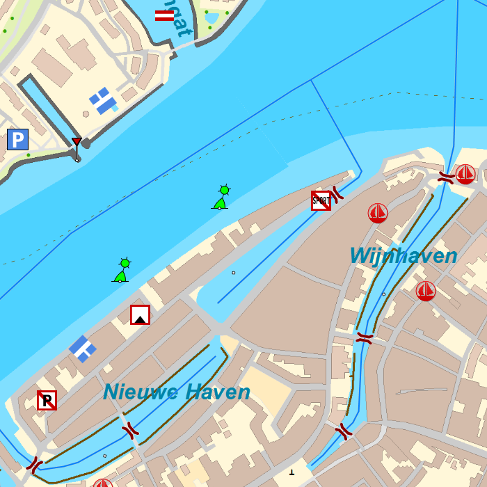
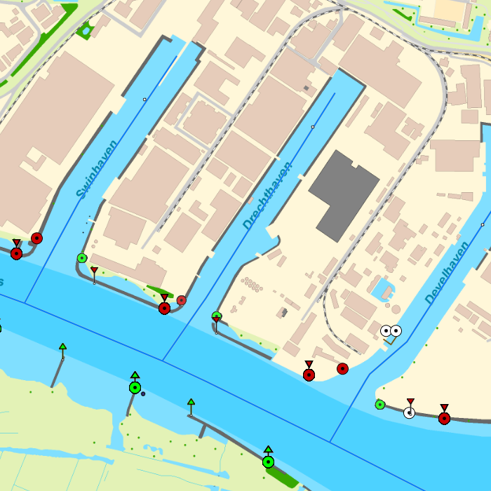
DKW Biesbosch
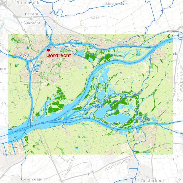
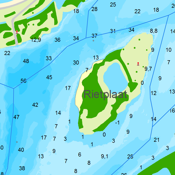
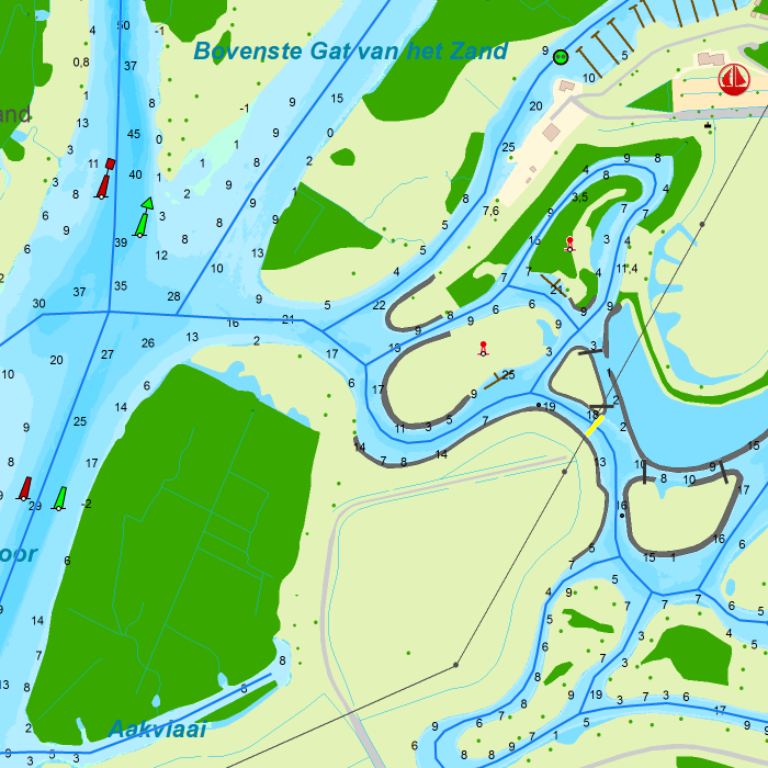
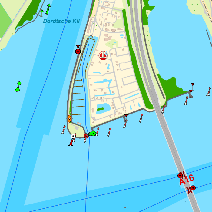
The DKW Amsterdam is developed for sailors, motorboaters and commercial shipping. Navigating along the shallow waters of Biesbosch national park has never been this easy!
Covering area
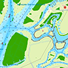
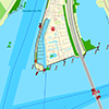
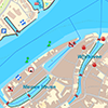
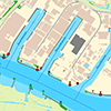
In this chart all waterways in and around Biesbosch national park are covered. With a.o.
|
|
Depth image
This chart set has a unique and clear depth image with distinctly colored depth surfaces on the lakes and depth numbers along the waterways. The chart is published annually by Stentec, based on the Top10NL data from the Kadaster, Inland ENC charts, Rijkswaterstaat and user remarks. The chart has a high level of detail with 0,8 meter per pixel, making it possible to zoom in up until the jetties at your home port.
Chart image
Stentecs inland water charts are so-called hybrid charts. The bottom surface is a raster format. This is where a.o. the quays, depths and buildings are shown. All other navigational information is projected on top of this through waypoints. These waypoints remain the same size when zooming in or out. The chart can be fully personalized by adding or removing certain waypoint groups and showing you only the information you select.
The DKW Vaarkaart Biesbosch has waypoints, with a.o. buoys, harbours, moorings, diesel tank stations, watersport campsites, VHF channels, electric chargers ‘Elektrisch Varen’ and ‘Varen Doe Je Samen’ nodes.
Specifically for commercial shipping waterway signs and VIN moorings are added.
|
System Requirements: This chart can be used in the free WinGPS Lite for Windows and can also be installed on the WinGPS Marine apps for Android and iOS. For accurate route planning with rotating chart and AIS you will need at least WinGPS Pro or the paid version of WinGPS Marine. Click here for more information about the WinGPS series. |
|
DKW Amsterdam
The DKW Amsterdam is developed for sailors, motorboaters and commercial shipping. Navigate along the beatiful canals of Amsterdam with all the many bridges, travel along the IJ and cross the IJmeer up until Pampus and Naarden.
Covering area
In this chart all waterways around Amsterdam are covered. With a.o.
|
|
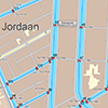
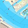
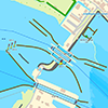
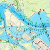
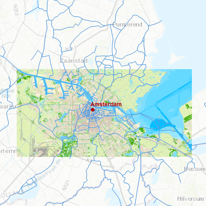
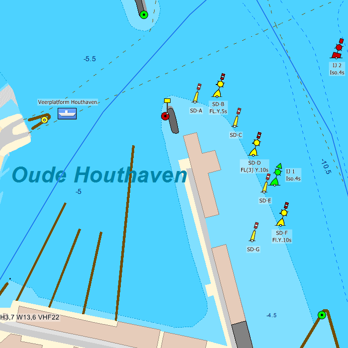
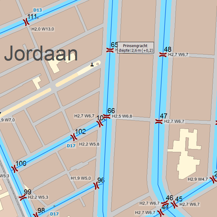
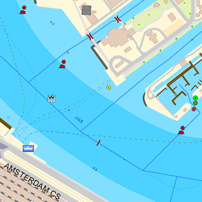
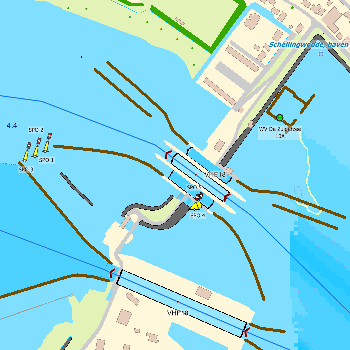
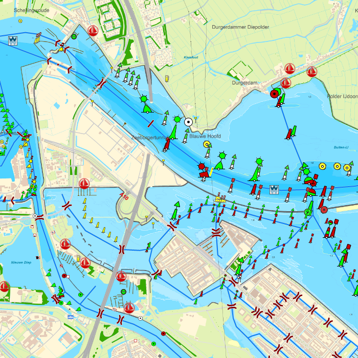
Depth image
This chart set has a unique and clear depth image with distinctly colored depth surfaces on the lakes and depth numbers along the waterways. The chart is published annually by Stentec, based on the Top10NL data from the Kadaster, Inland ENC charts, Rijkswaterstaat, PortOfAmsterdam and user remarks. The chart has a high level of detail with 0,8 meter per pixel, making it possible to zoom in up until the jetties at your home port.
Chart image
Stentecs inland water charts are so-called hybrid charts. The bottom surface is a raster format. This is where a.o. the quays, depths and buildings are shown. All other navigational information is projected on top of this through waypoints. These waypoints remain the same size when zooming in or out. The chart can be fully personalized by adding or removing certain waypoint groups and showing you only the information you select.
The DKW Amsterdam has waypoints, with a.o. buoys, harbours, moorings, diesel tank stations, watersport campsites, VHF channels, electric chargers ‘Elektrisch Varen’ and ‘Varen Doe Je Samen’ nodes.
Specifically for commercial shipping waterway signs and VIN moorings are added.
|
System Requirements: This chart can be used in the free WinGPS Lite for Windows and can also be installed on the WinGPS Marine apps for Android and iOS. For accurate route planning with rotating chart and AIS you will need at least WinGPS Pro or the paid version of WinGPS Marine. Click here for more information about the WinGPS series. |

|
DKW DK1: Kieler Bight & Fünen
Since 2014, Stentec Software has been publishing the well-known Delius Klasing charts digitally. These are based on the paper charts of Delius Klasing and have a nice, clear chart image.
Now, 10 years later in 2024, our cooperation has been strengthened and the digital versions of Delius Klasing's paper charts can be downloaded exclusively via Stentec.
Covering area
From the Northern Baltic Channel up until Juelsminde, Kalundborg, Nakskov and Lübeck. Including all (coastal) waters and islands in between.



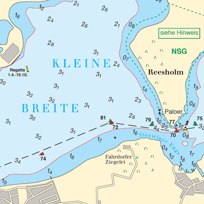


Depth image
The depths are shown in clear colors; deep waters are white and shallow waters are color coded. This is comparable to the DKW 1800 series.
Chart image
The DKW Delius Klasing series are comprised of raster charts. Because of this, the charts are an exact copy of the paper versions and you will see pixels when zoomed in to the maximum amount. The advantage of this is that all information, for example buoyage or shallows, are projected on the exact coordinates. When using vector charts a misleading image can show up when zooming in.
All products in the DKW Delius Klasing series
Click on an image for more information about the chart set.
|
DKW DK1 |
DKW DK2 |
DKW DK3 |
|
DKW DK4 |
DKW DK5 |
DKW DK6 |
|
DKW DK7 |
DKW DK8 |
DKW DK9 |
|
DKW DK10 |
DKW DK11 |
DKW DK12 |
|
DKW DK13 |
DKW DK14 |
|
|
|
System Requirements: This chart can be used in the free WinGPS Lite for Windows and can also be installed on the WinGPS Marine apps for Android and iOS. For accurate route planning with rotating chart and AIS you will need at least WinGPS Pro or the paid version of WinGPS Marine. Click here for more information about the WinGPS series. |

|
DKW DK14: Göta channel with lake Väner & lake Vätter
Since 2014, Stentec Software has been publishing the well-known Delius Klasing charts digitally. These are based on the paper charts of Delius Klasing and have a nice, clear chart image.
Now, 10 years later in 2024, our cooperation has been strengthened and the digital versions of Delius Klasing's paper charts can be downloaded exclusively via Stentec.
Covering area
Covering the Göta channel from Mem past Motala, Karlsberg, Töreboda, Sjötorp, Kristinehamn, Karlstad, Åmål, Mariestad, Lidköping, Vänersborg up until Göteborg. Including the whole of Viken, lake Väner and lake Vätter.


Depth image
The depths are shown in clear colors; deep waters are white and shallow waters are color coded. This is comparable to the DKW 1800 series.
Chart image
The DKW Delius Klasing series are comprised of raster charts. Because of this, the charts are an exact copy of the paper versions and you will see pixels when zoomed in to the maximum amount. The advantage of this is that all information, for example buoyage or shallows, are projected on the exact coordinates. When using vector charts a misleading image can show up when zooming in.
All products in the DKW Delius Klasing series
Click on an image for more information about the chart set.
|
DKW DK1 |
DKW DK2 |
DKW DK3 |
|
DKW DK4 |
DKW DK5 |
DKW DK6 |
|
DKW DK7 |
DKW DK8 |
DKW DK9 |
|
DKW DK10 |
DKW DK11 |
DKW DK12 |
|
DKW DK13 |
DKW DK14 |
|
|
|
System Requirements: This chart can be used in the free WinGPS Lite for Windows and can also be installed on the WinGPS Marine apps for Android and iOS. For accurate route planning with rotating chart and AIS you will need at least WinGPS Pro or the paid version of WinGPS Marine. Click here for more information about the WinGPS series. |

|
DKW DK13: Poland & Lithuania
Since 2014, Stentec Software has been publishing the well-known Delius Klasing charts digitally. These are based on the paper charts of Delius Klasing and have a nice, clear chart image.
Now, 10 years later in 2024, our cooperation has been strengthened and the digital versions of Delius Klasing's paper charts can be downloaded exclusively via Stentec.
Covering area
Covering the eastcoast of Poland and Lithuania from Stettin/Szczecin past lake Dąbie, the Stettiner Haff, Świnoujście, Gdańsk, Kaliningrad with a crossing chart up until the Latvian border. With an additional chart for the northern (Lithuanian) part of the Kuršių marios.


Depth image
The depths are shown in clear colors; deep waters are white and shallow waters are color coded. This is comparable to the DKW 1800 series.
Chart image
The DKW Delius Klasing series are comprised of raster charts. Because of this, the charts are an exact copy of the paper versions and you will see pixels when zoomed in to the maximum amount. The advantage of this is that all information, for example buoyage or shallows, are projected on the exact coordinates. When using vector charts a misleading image can show up when zooming in.
All products in the DKW Delius Klasing series
Click on an image for more information about the chart set.
|
DKW DK1 |
DKW DK2 |
DKW DK3 |
|
DKW DK4 |
DKW DK5 |
DKW DK6 |
|
DKW DK7 |
DKW DK8 |
DKW DK9 |
|
DKW DK10 |
DKW DK11 |
DKW DK12 |
|
DKW DK13 |
DKW DK14 |
|
|
|
System Requirements: This chart can be used in the free WinGPS Lite for Windows and can also be installed on the WinGPS Marine apps for Android and iOS. For accurate route planning with rotating chart and AIS you will need at least WinGPS Pro or the paid version of WinGPS Marine. Click here for more information about the WinGPS series. |

|
DKW DK12: Swedish Eastcoast 2
Since 2014, Stentec Software has been publishing the well-known Delius Klasing charts digitally. These are based on the paper charts of Delius Klasing and have a nice, clear chart image.
Now, 10 years later in 2024, our cooperation has been strengthened and the digital versions of Delius Klasing's paper charts can be downloaded exclusively via Stentec.
Covering area
Covering the northern part of the Swedish Eastcoast from Mem on the Göta channel past Norrköping, Stockholm up until th Kanholms Fjärden. Including all islands such as Vindö, Värmdön, Ingarö, Sandö, Ornö, Muskö, Utö and a crossing chart to Gotland island.


Depth image
The depths are shown in clear colors; deep waters are white and shallow waters are color coded. This is comparable to the DKW 1800 series.
Chart image
The DKW Delius Klasing series are comprised of raster charts. Because of this, the charts are an exact copy of the paper versions and you will see pixels when zoomed in to the maximum amount. The advantage of this is that all information, for example buoyage or shallows, are projected on the exact coordinates. When using vector charts a misleading image can show up when zooming in.
All products in the DKW Delius Klasing series
Click on an image for more information about the chart set.
|
DKW DK1 |
DKW DK2 |
DKW DK3 |
|
DKW DK4 |
DKW DK5 |
DKW DK6 |
|
DKW DK7 |
DKW DK8 |
DKW DK9 |
|
DKW DK10 |
DKW DK11 |
DKW DK12 |
|
DKW DK13 |
DKW DK14 |
|
|
|
System Requirements: This chart can be used in the free WinGPS Lite for Windows and can also be installed on the WinGPS Marine apps for Android and iOS. For accurate route planning with rotating chart and AIS you will need at least WinGPS Pro or the paid version of WinGPS Marine. Click here for more information about the WinGPS series. |
Do you have any questions?
Call us on +31 515 443515, fill in the contact form or make an appointment at our store in Heeg.
More information.
News
 Tides 2026, WinGPS updates and DKW 1600+. As the year draws to a close, we would like to share our latest news with you. In this mailing we inform you about...
 Ready for your next voyage: Upgrades, new editions and exclusive benefits for 2026. The DKW charts for 2026 are now available! Discover our brand-new DKW...
 As a loyal WinGPS user, you know better than anyone the benefits of reliable and up-to-date navigation software. That is why we invite you to inspire your...


