- News
- E-mail list
- Signup for our newsletter
- Stentec news
- News
- Developers Blog
- WinGPS
- WinGPS series
- WinGPS versions
- WinGPS specifications
- For Windows
- WinGPS Lite
- WinGPS Navigator
- WinGPS Pro
- WinGPS Voyager
- For Android
- WinGPS Marine
- WinGPS Marine Plus
- For iOS
- Apps for iOS
- WinGPS Marine
- WinGPS Marine Plus
- DKW 1800 series
- Vaarkaart Friese Meren
- Service and upgrades
- Service Subscriptions
- WinGPS Service Card
- WinGPS Yacht Navigator
- Charts
- Chart overview
- DKW Inland waters
- DKW The Netherlands
- DKW Friese meren
- DKW Amsterdam
- DKW Biesbosch
- DKW Belgium
- DKW Northern France
- DKW Southern France
- DKW Northeast Germany
- DKW Northwest Germany
- DKW Southwest Germany
- DKW Rhine and Moselle
- DKW Danube 1-West
- DKW Danube 2-Central
- DKW Danube 3-East
- DKW Coastal waters
- DKW 1800 series
- DKW 1600+
- DKW UK1 English & Scottish Eastcoast
- DKW German Bight
- DKW German Baltic coast
- DKW Imray series
- DKW Delius Klasing series
- NV-Verlag series
- Exclusive for Android
- Subscription - DKW the Netherlands
- Chart apps
- Other
- ADAC Marina Guide
- Hardware
- Simulators
- Shop
- Downloads
- Support
- Downloads
- Help pages
- Documentation
- System Requirements
- Availability GRIB files
- Frequently asked questions - FAQ
- WinGPS 5
- WinGPS Marine (Android)
- WinGPS Marine (iOS)
- Installation help
- WinGPS 5 (Windows)
- WinGPS Marine (Android)
- Tips
- Offline installation DKW charts (Windows)
- Installation ENC charts (Windows)
- Connecting SD card (Android)
- NV Verlag charts
- Offline NOAA Charts
- Download TeamViewer
- Contact
- Contactform - Helpdesk
- Callback Service
- Commercial Shipping


- Details

- Subscribe
- Past Issues
- RSS
- Translate
- English
- العربية
- Afrikaans
- беларуская мова
- български
- català
- 中文(简体)
- 中文(繁體)
- Hrvatski
- Česky
- Dansk
- eesti keel
- Nederlands
- Suomi
- Français
- Deutsch
- Ελληνική
- हिन्दी
- Magyar
- Gaeilge
- Indonesia
- íslenska
- Italiano
- 日本語
- ភាសាខ្មែរ
- 한국어
- македонски јазик
- بهاس ملايو
- Malti
- Norsk
- Polski
- Português
- Português - Portugal
- Română
- Русский
- Español
- Kiswahili
- Svenska
- עברית
- Lietuvių
- latviešu
- slovenčina
- slovenščina
- српски
- தமிழ்
- ภาษาไทย
- Türkçe
- Filipino
- украї́нська
- Tiếng Việt
|
- Details
| DKW Vaarkaart Nederland 2024 optimal for WinGPS 6 |
|
The 2024 edition of the DKW Vaarkaart Nederland is now online! In this article we would like to tell you more about the new functions, which can be optimally used, especially in the 2024 edition of WinGPS 6. Equipped with a current TOP10NL based on the most recent aerial photographs from the land registry, DKW Vaarkaart Nederland 2024 has been improved on a large number of points compared to the previous edition. Optimized for CourseUp and HeadUp sailing.
More recent depths of the Frisian Lakes
Sector and lighthouse lights as a waypoint group.
New depth image of the Wadden Sea.
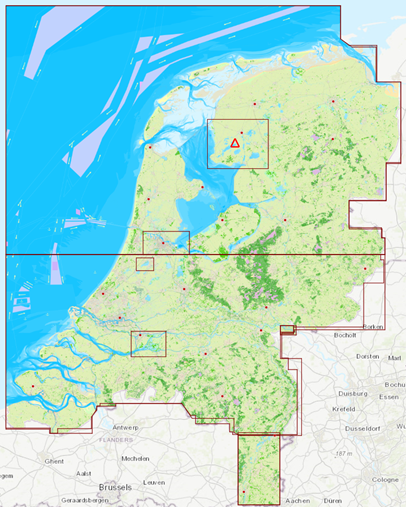
Classification of DKW Vaarkaart Nederland 2024 in images and in chart management 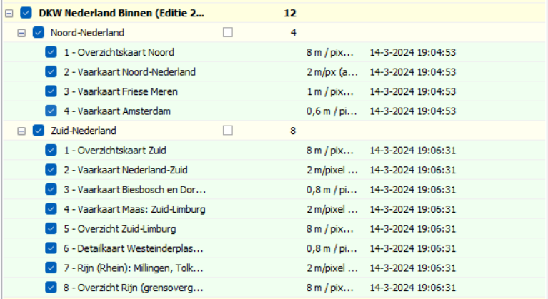
New: Detailed chart of Westeinderplassen, South Limburg and a separate border crossing at Lobith. 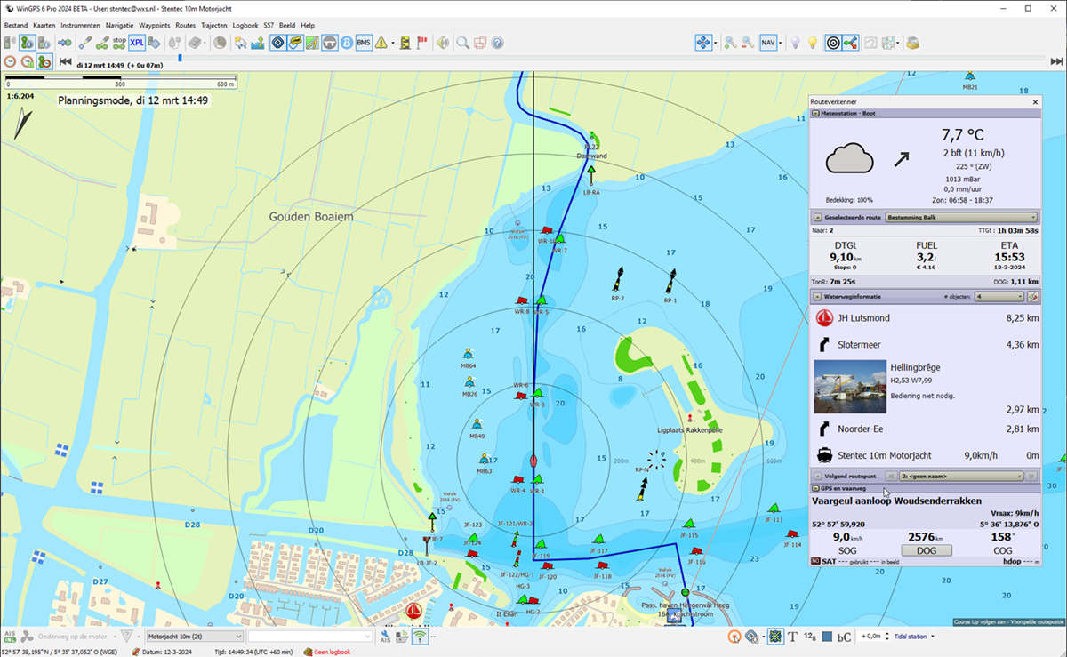
Vaarkaart Netherlands 2024 is optimized for CourseUp and HeadUP. 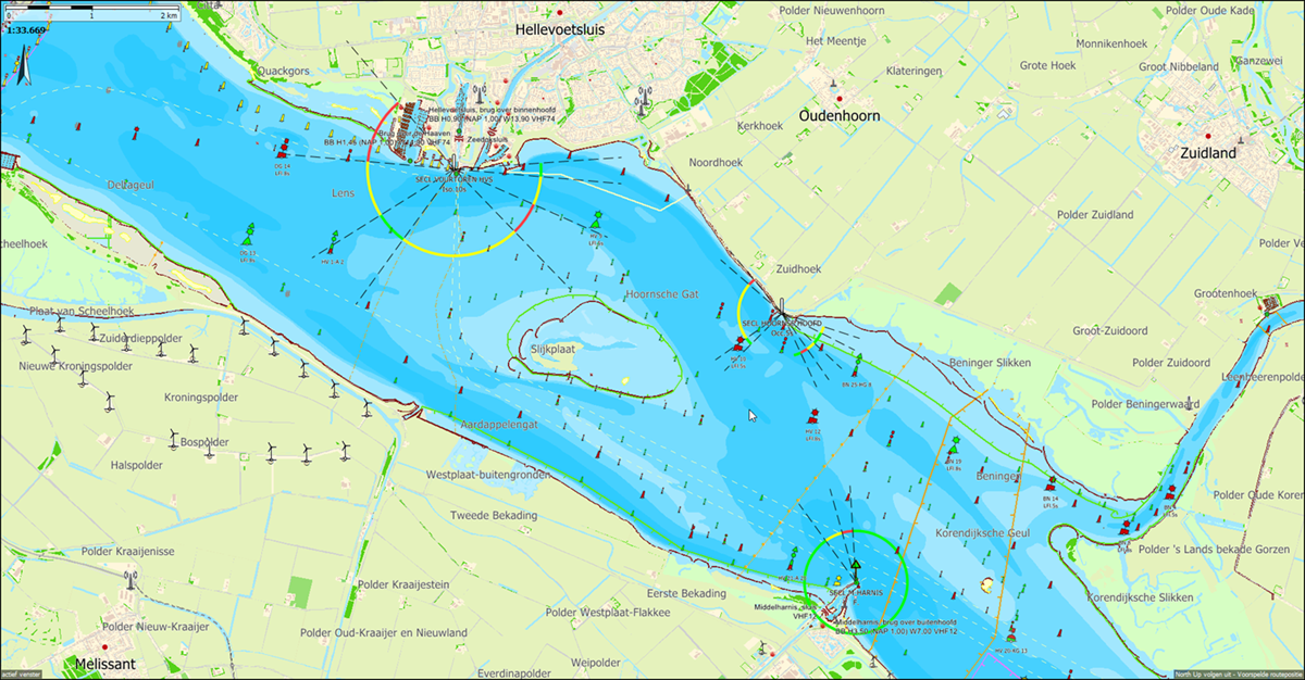
Sector lights in the Deltageul and the Hoornse gat. Only shown with WinGPS 6-2024 and subsequent versions. 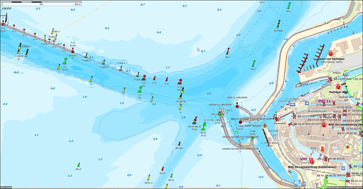
Recent depth image of the Wadden Sea near Harlingen based on IENC Wadden Sea (RWS Jan 2024). 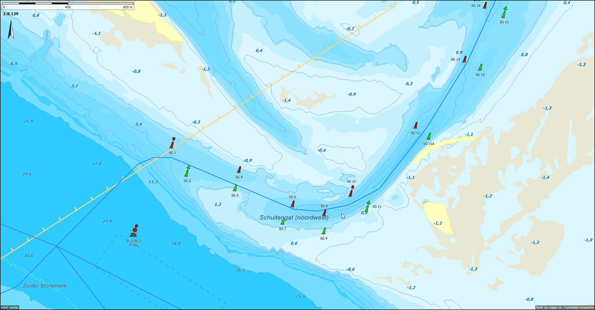
Detail of the changing Schuitengat in DKW Vaarkaart NL 2024. Note that the current buoyage has already shifted again. The route network here has not yet been updated and still runs above the red SG8 instead of below it. The buoyage of Vaarkaart Nederland is updated weekly, but that of the chart is not. The Schuitengat of the Stentec IENC Updateservice for WinGPS 6 2024 does correspond with the current buoyage. The IENC depth image of the Wadden Sea and Zeeland is updated weekly. However, the concrete on site may differ and is of course always decisive. Do you have any comments or feedback about this new chart? Then you can email this to helpdesk@stentec.com. |
News
- New DKW charts for 2026!
- Refer a fellow skipper to WinGPS 6 and receive €50 off!
- Save €30 on your 2026 Premium Subscription today!
- Free WinGPS flag for you: meet other WinGPS users
- Summer mornings open in Heeg: feel free to drop in
- Stentec tip: connect everything on board effortlessly
- Summer discount on WinGPS 6 Navigator, Pro and Voyager
- Summer discount at Stentec = extra affordable holidays
- In the spotlight: DKW 1800 & Netherlands Inland Chart
- New AIS model – now €200 less!


