


- News
- E-mail list
- Signup for our newsletter
- Stentec news
- News
- Developers Blog
- WinGPS
- WinGPS series
- WinGPS versions
- WinGPS specifications
- For Windows
- WinGPS Lite
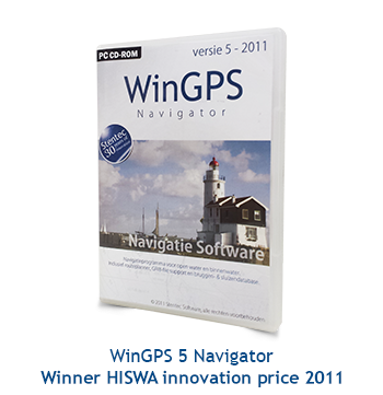
- WinGPS Navigator
- WinGPS Pro
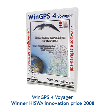
- WinGPS Voyager
- For Android
- WinGPS Marine
- WinGPS Marine Plus
- WinGPS Smartwear
- For iOS
- Apps for iOS
- WinGPS Marine
- WinGPS Marine Plus
- DKW 1800 series
- Vaarkaart Friese Meren
- Service and upgrades
- Service Subscriptions
- WinGPS Yacht Navigator
- WinGPS trackpilot
- Charts
- Chart overview
- DKW Inland waters
- DKW The Netherlands
- DKW Friese meren
- DKW Amsterdam
- DKW Biesbosch
- DKW Belgium
- DKW Northern France
- DKW Southern France
- DKW Northeast Germany
- DKW Northwest Germany
- DKW Southwest Germany
- DKW Rhine and Moselle
- DKW Danube 1-West
- DKW Danube 2-Central
- DKW Danube 3-East
- DKW Coastal waters
- DKW 1800 series
- DKW 1600+
- DKW UK1 English & Scottish Eastcoast
- DKW German Bight
- DKW German Baltic coast
- DKW Imray series
- DKW Delius Klasing series
- NV-Verlag series
- Exclusive for Android
- Subscription - DKW the Netherlands
- Chart apps
- Other
- Hardware
- Simulators
- Shop
- Downloads
- Support
- Downloads
- Help pages
- Documentation
- System Requirements
- Availability GRIB files
- Frequently asked questions - FAQ
- WinGPS 5
- WinGPS Marine (Android)
- WinGPS Marine (iOS)
- Installation help
- WinGPS 5 (Windows)
- WinGPS Marine (Android)
- Tips
- Offline installation DKW charts (Windows)
- Installation ENC charts (Windows)
- Connecting SD card (Android)
- NV Verlag charts
- Offline NOAA Charts
- Download TeamViewer
- Contact
- Contactform - Helpdesk
- Callback Service
- Commercial Shipping
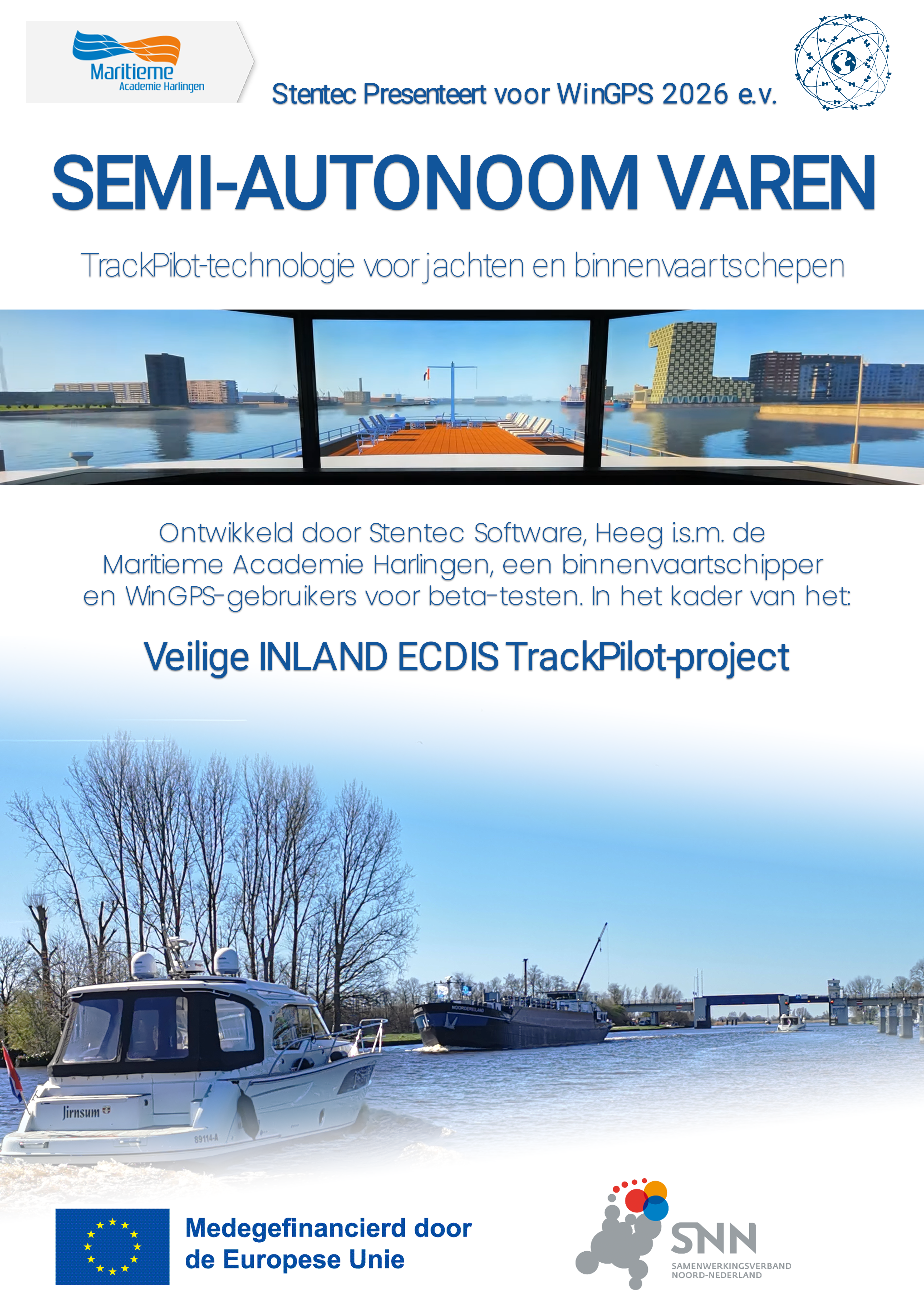
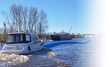
TrackPilot for WinGPS 6
Stentec presents SEMI-AUTONOMOUS NAVIGATION for WinGPS 2026 and later:
TrackPilot technology for yachts and inland waterway vessels
you can turn your existing autopilot (mounted on your tiller or steering wheel) into a smart trackpilot.
With a single push of a button, you automatically follow:
Ideal with DKW charts and IENC (via the Stentec IENC update server).
The TrackPilot has proven itself in commercial shipping for years. Now it’s available for sailing and motor yachts, as well as for small commercial vessels.
Fewer rudder movements mean smoother sailing, a quieter ride, and fuel savings.
Want to take control yourself? With the push of a button, the TrackPilot takes over again.
The result? Greater comfort and lower fuel consumption.
in collaboration with the Maritime Academy Harlingen, an inland waterway skipper, and WinGPS users for beta testing. As part of the:
Veilige INLAND ECDIS TrackPilot-project (Safe INLAND ECDIS TrackPilot project).
This 3-year EFRO-0148 project is co-financed by the European Union and the Dutch government. The project duration is from Q2 2025 through Q1 2028.
The aim of the project is to develop, test, and demonstrate an innovative, safe track pilot for inland waterway shipping, as well as a derivative version for recreational boating.
The intended results are a working and tested prototype of the TrackPilot, and a report with recommendations that can serve as a basis for new safety regulations. In addition, the project lays the groundwork for future research into autonomous navigation, and the knowledge gained will be incorporated into skipper training.
For the TrackPilot project, Stentec, in collaboration with the Maritime Academy Harlingen (MAH), is developing a smart autopilot for inland waterway shipping and recreational boating. The system automatically follows the route while taking the environment into account, such as bridges and other obstacles.
A key component is a self-learning ship model, also known as a Digital Twin. This is a digital copy of the ship that mimics its behavior and continuously learns. As a result, the system continues to operate reliably even if the GPS or compass fails.
The TrackPilot system is being tested step by step: first in WinGPS using a simulator, then on the MAH’s inland waterway simulator, and finally aboard real ships, including a commercial inland waterway vessel.
Stentec presents SEMI-AUTONOMOUS NAVIGATION for WinGPS 2026 and later:
TrackPilot technology for yachts and inland waterway vessels
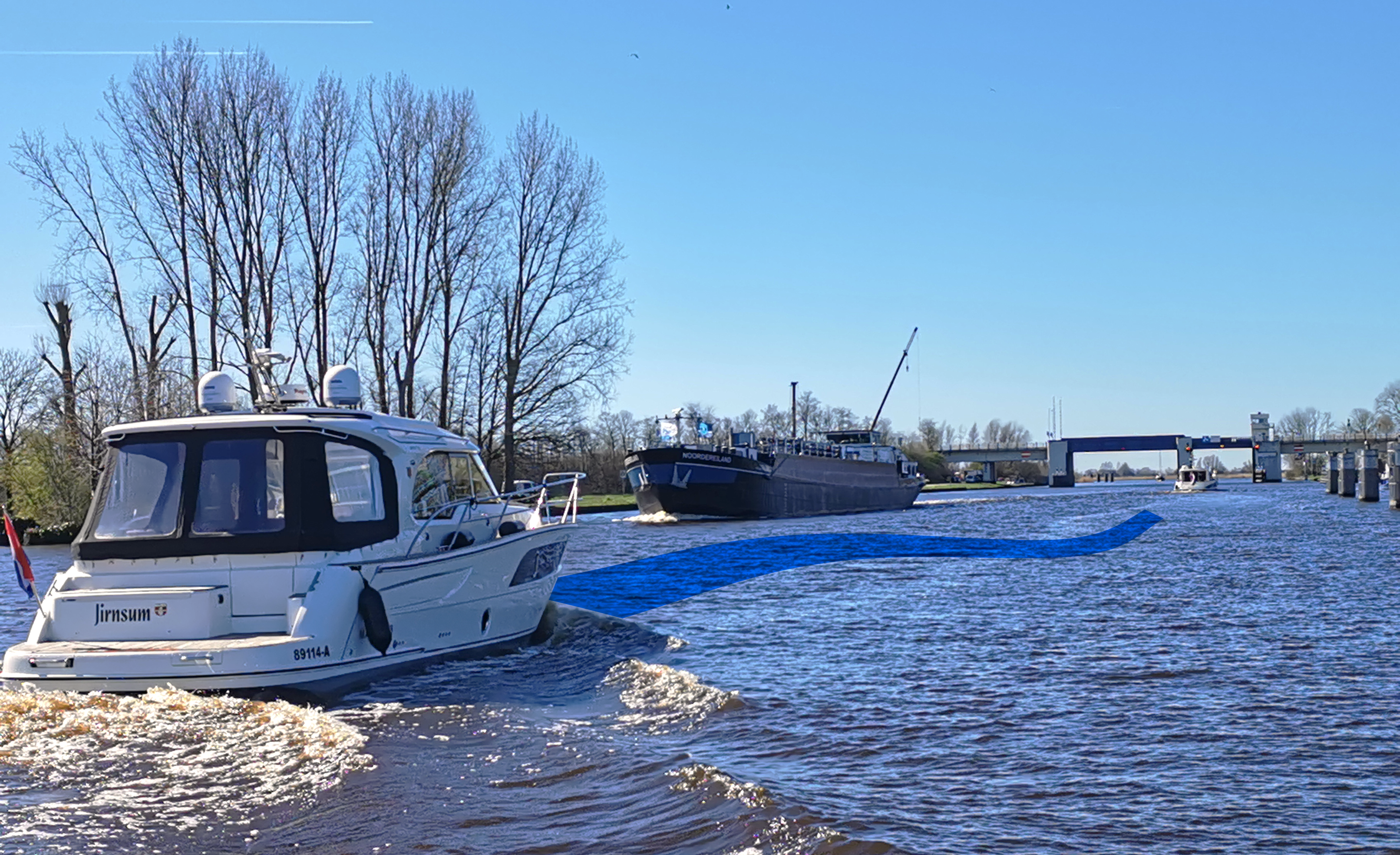
you can turn your existing autopilot (mounted on your tiller or steering wheel) into a smart trackpilot.
With a single push of a button, you automatically follow:
- the extensive European route network or
the center of the waterway - a previously sailed route
- the route of another AIS vessel,
for example, a friend’s
Ideal with DKW charts and IENC (via the Stentec IENC update server).
The TrackPilot has proven itself in commercial shipping for years. Now it’s available for sailing and motor yachts, as well as for small commercial vessels.
Fewer rudder movements mean smoother sailing, a quieter ride, and fuel savings.
Want to take control yourself? With the push of a button, the TrackPilot takes over again.
The result? Greater comfort and lower fuel consumption.


in collaboration with the Maritime Academy Harlingen, an inland waterway skipper, and WinGPS users for beta testing. As part of the:
Veilige INLAND ECDIS TrackPilot-project (Safe INLAND ECDIS TrackPilot project).
This 3-year EFRO-0148 project is co-financed by the European Union and the Dutch government. The project duration is from Q2 2025 through Q1 2028.
The aim of the project is to develop, test, and demonstrate an innovative, safe track pilot for inland waterway shipping, as well as a derivative version for recreational boating.
The intended results are a working and tested prototype of the TrackPilot, and a report with recommendations that can serve as a basis for new safety regulations. In addition, the project lays the groundwork for future research into autonomous navigation, and the knowledge gained will be incorporated into skipper training.
For the TrackPilot project, Stentec, in collaboration with the Maritime Academy Harlingen (MAH), is developing a smart autopilot for inland waterway shipping and recreational boating. The system automatically follows the route while taking the environment into account, such as bridges and other obstacles.
A key component is a self-learning ship model, also known as a Digital Twin. This is a digital copy of the ship that mimics its behavior and continuously learns. As a result, the system continues to operate reliably even if the GPS or compass fails.
The TrackPilot system is being tested step by step: first in WinGPS using a simulator, then on the MAH’s inland waterway simulator, and finally aboard real ships, including a commercial inland waterway vessel.


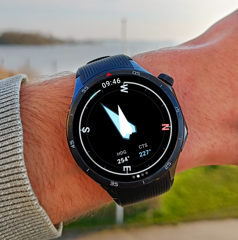
Navigate on your Wear OS smartwatch
with WinGPS Marine Plus for Android
Navigation data always at your fingertips, without picking up your phone. The new WinGPS Marine app for Wear OS displays live data from your navigation system directly on your wrist: course, speed, depth, wind data, route info, and more.
Customize the instrument panel yourself: choose which fields you see and in what order. The compass screen guides you with vibrations and an audible signal when you approach your desired course. Alarms from your navigation system appear directly on the watch, even when the app is running in the background.
The app works on Samsung Galaxy Watch, Google Pixel Watch, and other Wear OS watches, and connects via Bluetooth to WinGPS Marine Plus on your Android phone.
You can find a complete overview of the functionalities of WinGPS on your smartwatch, and installation tips, further down this page.
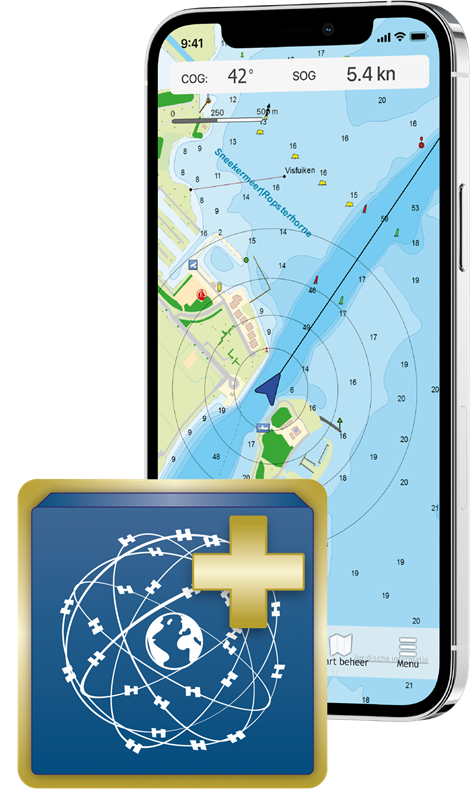
To use WinGPS on your smartwatch, you need our navigation app 'WinGPS Marine Plus' for Android.
With this navigation app you can see your position, create routes over open water and over the extensive route network (including bridges and locks information), download GRIB files for weather forecasts, view current and tide data on the Dutch coast, connect on-board instruments such as AIS, and more.
Ideal for all types of skippers: use WinGPS Marine Plus as a handy backup on your yacht, or as main navigation for day trips on a sloop, canoe or rental boat.
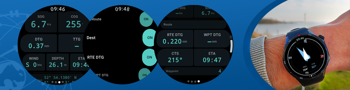
WinGPS Feature Overview on Smartwear
The WinGPS Marine Companion app for Wear OS displays live data from your navigation system directly on your smartwatch.
LIVE NAVIGATION TOOLS
The heart of the app: a fully configurable instrument panel on your wrist. You choose which data you see and in what order – drag them to your preference.
Available fields:
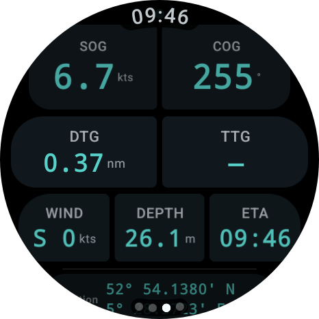
- COG - Course over Ground
- SOG - Speed over Ground
- STW - Speed through Water
- HDG - Compass Direction
- VMG - Speed Towards Waypoint
- TTG - Estimated Travel Time to Waypoint
- ETA - Estimated Arrival Time
- CTS - Course to Steer
- Depth - Water Depth Under the Keel
- Wind - Wind Speed and Direction (Real and Estimated)
- Position - Latitude and Longitude
COMPASS DISPLAY WITH HAPTIMIC GUIDANCE
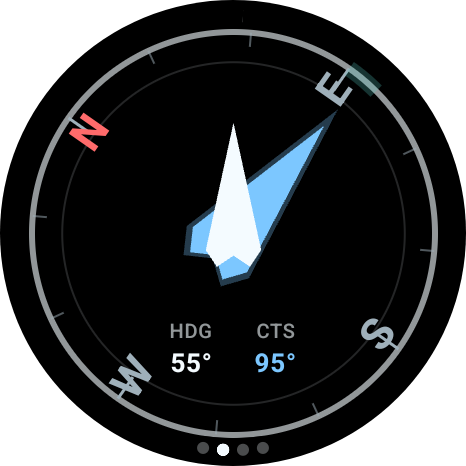
- Blue arrow points to the next waypoint
- White arrow shows the direction of your wristband
- Green arc marks the 10-degree "on course" zone
- Approach vibration: when you get close to the desired course,
the watch will vibrate to indicate that the course is correct - Audio signal at less than 3 degrees deviation
- Chart letters (N/E/S/W) rotate with the course - North always
points to geographic north
ROUTE INFORMATION
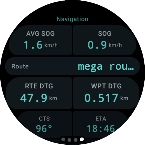
on one screen:
- Route name and destination
- Name of the next waypoint
- Distance to waypoint and total remaining route distance
- Average speed and VMG
- Course to sail and estimated arrival time
- XTE bar - when connected to Windows, a visual indicator that
shows whether you are deviating left or right from your route - Stop or change route directly from the watch
- List of recently used routes, instantly activated
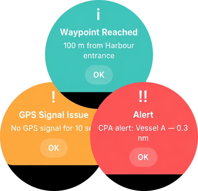
ALARM NOTIFICATIONS
When an alarm sounds on your navigation system, it appears immediately as a full-screen notification on your watch - even if the app is running in the background:
- Color coding by severity: red (critical),
orange (warning), blue (info) - Clear title and message description
- Notifications are tracked in the notification list, so
you don't miss anything
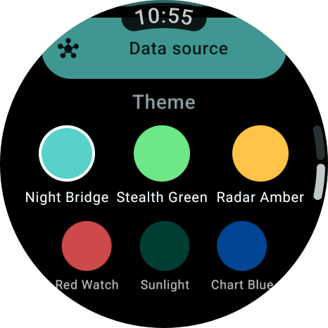
Choose the theme that suits the conditions:
- Night Bridge (standard, dark) - Night navigation, aqua accent
- Stealth Green (dark) - Night, minimal glare
- Radar Amber (dark) - Radar style, gold accent
- Red Watch (dark) - Night navigation, red accent
- Daylight (light) - Daytime, warm light
- Nautical Blue (light) - Daytime, nautical blue
ALWAYS-ON DISPLAY (AMBIENT MODE)
When you lower your wrist, the watch switches to a low-power display that protects your OLED screen:
- Compass screen shows only the course ring and CTS value
- Instrument screen shows only COG and SOG
- Navigation screen shows route name and current speed
- No animations, no unnecessary elements
CROWN CONTROL
All scrollable screens respond to the crown wheel or the rotating bezel of your watch, with haptic feedback at every step.
TWO DATA SOURCES
The app works with both the Android phone and directly with WinGPS on your Windows PC:
- Bluetooth - pair with the WinGPS Marine app on your phone
- Wi-Fi - connect directly to WinGPS on your onboard PC via UDP (in early development)
ALWAYS VISIBLE WHILE SAILING
As long as WinGPS Marine is active, a shortcut appears at the bottom of your watch face. One tap and you are back in the app, without having to search.
WinGPS Installation Tips on Smartwear
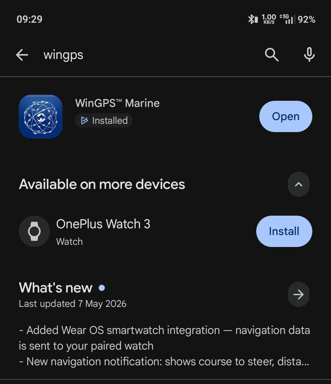
This is the fastest way to get started:
1. Open the Play Store on your phone
2. Search for "WinGPS Marine"
3. Open the app page
You will now see one of the following situations:
Situation A - Everything is in order:
Below or next to the installation button, you will see a second option such as "Install on [name of your watch]". Go directly to step 2.
Situation B - Only phone installation button visible:
Your watch is not recognized. Go to the "Having trouble?" section at the bottom of this manual.
Situation C - "Not available for your devices":
Your watch is not supported. Check the list under "Does NOT work on" at the top of this manual.
STEP 2 - INSTALL THE APP ON YOUR WATCH
1. Open the Play Store on your phone
2. Search for "WinGPS Marine" and open the app page
3. Tap "Install on [name of your watch]"
4. The installation starts automatically on your watch - you do not need to do anything else on the watch itself
5. Wait 1 to 2 minutes. Make sure your watch stays near your phone and that Bluetooth is turned on.
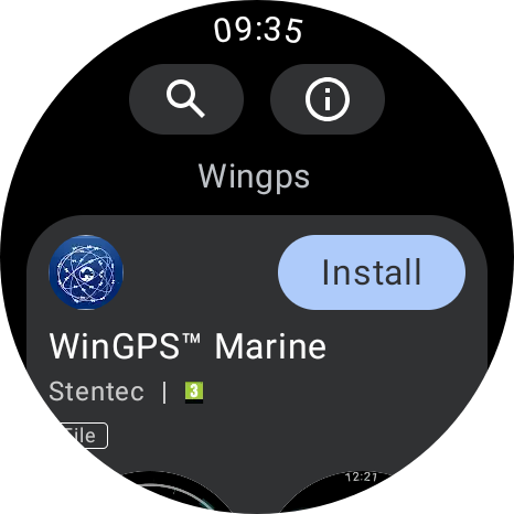
You can also start the installation via the Play Store on the watch itself:
1. Press the button on the side of your watch to open the menu
2. Scroll down to Play Store
3. Search for "WinGPS Marine"
4. Tap Install
STEP 3 - OPEN THE APP ON YOUR WATCH
1. Press the button on the side of your watch to open the app overview
2. Scroll through the list and look for WinGPS Marine
3. Tap on it to open the app
4. Start WinGPS Marine on your phone (or tablet)
5. As soon as the phone app is active and receiving navigation data, it will automatically appear on your watch
------
DID THIS STEPS NOT WORK?
The app is not in the list on my watch
Please wait a moment - apps can sometimes take 5 minutes to install. Ensure your watch:
- Is charged (at least 20% battery)
- Is connected to your phone (Bluetooth on)
- Is connected to Wi-Fi or stays near the phone
1. Turn Bluetooth off and on again on your phone
2. Restart your watch (press and hold the side button > "Restart")
3. Try the installation again via step 2
My watch is not recognized in the Play Store
The most common causes:
1. Watch is not paired with your phone
Your watch must be connected to your phone via a companion app. Which app you need depends on your watch brand:
Samsung Galaxy Watch -> Galaxy Wearable
Google Pixel Watch -> Pixel Watch
OnePlus Watch -> OHealth
Oppo Watch -> OHealth
Xiaomi Watch -> Xiaomi Wearable
Mobvoi TicWatch -> Mobvoi Health
Fossil Gen 6 -> Fossil Smartwatches
TAG Heuer Connected E4 -> E3/E4 TAG Heuer Connected
Montblanc Summit 3 -> Montblanc Summit
Hublot Big Bang e Gen 3 -> Hublot Big Bang e Gen3
Search for the corresponding app in the Play Store, install it if you haven't already, and follow the on-screen pairing guide.
2. Phone and watch use different Google accounts
Phone and watch must be logged in with the exact same Google account (Gmail address).
Check the account on your phone:
1. Open the Play Store on your phone
2. Tap your profile picture or initials in the top right corner
3. At the top, you will see the email address you are logged in with - remember this
Check the account on your watch:
1. Open the Play Store on your watch
2. Scroll all the way down
3. Tap Accounts
4. Check if the same email address is listed here
Are there different email addresses listed? Then you need to link a new account on the watch. You do this via your watch's settings: go to Settings > Other > Google > Accounts. The exact naming may vary slightly depending on the watch brand, but the Google button is almost always located under "Other".
3. Watch is not visible in the Play Store
1. Open the Play Store on your phone
2. Tap your profile picture or initials in the top right
3. Tap "Manage apps and devices"
4. Tap the "Manage" tab at the top
5. Tap "Devices" in the top right
6. Is your watch in the list and does it say "Active"? Then everything is fine - try step 1 again.
7. Is your watch not listed or does it say "Inactive"? Then make sure your watch is turned on, is near your phone, and that Bluetooth is turned on on your phone. Then try again.
QUESTIONS OR PROBLEMS?
Send an email to helpdesk@stentec.com containing:
- The brand and model of your watch
- The Android version of your phone (found via Settings > About phone)
- A description of what is going wrong

Discover the benefits of our Premium and Service Subscriptions 2026!
With a Premium Subscription, you are guaranteed to have the latest WinGPS navigation software for Windows, extensive support, and exclusive benefits such as discounts on charts and convenient updates.See below for the difference between a single WinGPS upgrade and the Premium Subscription.
Don’t have WinGPS for Windows, but still want to benefit from the extra service and discounts? Then choose the Service Subscription.


* This discount only applies to the 100% Stentec DKW chart sets.
Look at the bottom of this page for more information.
WinGPS 6 - 2026 edition
In the new edition of WinGPS 6, the route planner has been further improved. In addition, work is underway on the first test versions with TrackPilot, and a new bridge collision alarm is being introduced.
More information about the new features we developed for WinGPS 6 – 2025 can be found here:

Curious about the innovations in WinGPS 6 in recent years? Click here..


Automatic renewal
Many of our users have indicated that they would like to use the option to automatically renew their subscription annually. We are pleased to announce that this is now possible!
Choose Premium Subscription - continuous in our online shop.
You can find more information about automatic renewal in our online shop under Premium Subscription.
If you do not select 'automatic renewal', your subscription will be valid from the moment of purchase until 31 December 2026. After this date, you will no longer be entitled to the benefits mentioned above.
In the autumn of 2026, you will receive a message from us on how the subscription can be renewed and the benefits will continue in 2026.
WinGPS Lite or WinGPS Marine
If you do not have WinGPS 5 or 6 Navigator, Pro or Voyager, but you navigate with WinGPS 5 or 6 Lite or WinGPS Marine (Android or iOS), then the new Service Subscription is interesting for you. This includes not only the installation service, but also support if you have questions about the use of WinGPS.


Our service in 2026
With a Premium or Service Subscription, you can rely on our support with complete peace of mind and get the most out of your WinGPS navigation.
The service rate in 2026 remains €20 per quarter hour. If you have a Premium or Service Subscription, these costs are waived, allowing you to enjoy unlimited helpdesk support throughout the year for the price of just one hour of service.
Subscribers also benefit from a callback service, so you don’t have to wait on hold during busy periods. Simply leave your details, and we’ll call you back as soon as possible.
You can also contact us via WhatsApp, send a photo of your question or issue, and often get assistance even faster, so you can continue navigating with confidence. 
Discount on DKW chart sets
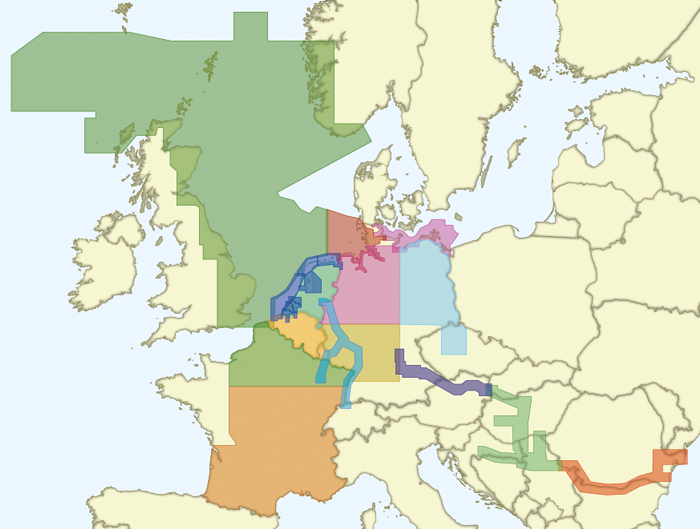
By subscribing to the Service or Premium Subscription, you will receive a €20 discount on new 100% Stentec DKW chart sets and a €10 discount on upgrades to the 100% Stentec DKW chart sets.
View the overview below on which charts this discount can be applied to.
Frequently Asked Questions - FAQ
What happens if I don’t upgrade my WinGPS (for Windows) to the latest edition?
Your license will remain active, but you will no longer receive updates. You can continue using WinGPS, but for your safety we recommend keeping the program up to date. This ensures that you continue to receive updates to the waterway network, bridges and locks, and, for Pro, Voyager, and Inland, also the latest Dutch tide data. In addition, you will benefit from program improvements and any new features.
How can I update my WinGPS Marine app for Android or iOS?
You don't need a Premium Subscription to update our WinGPS Marine apps.
For WinGPS Marine Plus for iOS, the following applies: you purchase the app once, after which you automatically receive all available updates, both for the app itself and for the waterway network.
WinGPS Marine Plus for Android is available as an annual subscription, which renews automatically. As long as this subscription is active, you will receive all available updates for the app, the waterway network, and NL-tidal data. Once you cancel your subscription, your app will revert to the free Lite version.
You can, however, opt for the Service Subscription. This subscription still provides you with exclusive discounts and premium helpdesk service.
How can I download the IENC charts for the Netherlands in WinGPS?
With a Premium Subscription, you receive free access to the IENC Update Service Netherlands.
In WinGPS, go to:File → Properties → IENC Area and check “Netherlands.” These charts will now be downloaded and updated automatically whenever new data becomes available from the relevant authorities (an internet connection is required).
Via Charts → Chart Manager, you can select which charts you wish to display in WinGPS.
The IENC Update Service NL can also be purchased separately or expanded to include additional countries. Click here to view the different IENC Update Services.
How do I get a discount on the DKW charts?
If you have a Premium or Service Subscription, you will receive a discount on 100% Stentec DKW charts*.
Once you have purchased such a subscription, it will be linked to your account and the discount will automatically be applied to your chart orders. We recommend purchasing your Premium or Service Subscription first, and only placing your chart order once the subscription has been processed.
How can I purchase a subscription?
You can order a Premium or Service Subscription directly through our online shop.
Need help? Feel free to contact us. We’ll be happy to assist you and can also complete your order by phone or email if you prefer.
How can I cancel a subscription?
You can cancel an ongoing subscription by calling +31 (0)515 443515 or by sending an email to stentec@stentec.com.
Get to know our on-board navigation programs!










| Complete your navigation package with charts and a GPS Choose the WinGPS version that suits your situation on board, or use several WinGPS versions side by side. To complete the navigation package you also need a GPS receiver and the maps of your sailing area. This can be, for example, our own DKW charts. You can use this on all 3 systems at the same time! Example situation: Plan the routes at home on a PC with a large screen, take these routes with you on a laptop on board and also use the charts on your iPhone and an Android tablet so that you always have a backup system at hand. The charts can be installed on 3 systems of Windows and Android. You also have 1 installation left for your iPhone or iPad. |
Hardware For positioning on your laptop or PC it is ideal to use a USB GPS receiver. Most smartphones, tablets and iPhones already have an internal GPS receiver that you can use to determine your position in WinGPS. Note that not all iPads have an internal GPS receiver. A wireless Bluetooth GPS receiver is then ideal for determining your position. |
WinGPS Series
Route planner for open- and inland water.
Turn your laptop, onboard PC, tablet and/or smartphone into a complete navigational center with WinGPS. Based on the experience of thousands of WinGPS users and our extensive experience in the nautic world, we can provide a wide array of different navigationsoftware. Plot a route within seconds and download the latest chart updates. WinGPS will lead you past all obstructions along your route.
What do you need?
- WinGPS navigationsoftware.
- Digital water charts. For example, Stentecs DKW water charts.
- Windows laptop or onboard PC, or an Android smartphone or tablet.
- GPS receiver
Why choose WinGPS?
- Determine your position, plot a course and see previously sailed tracks.
- Current predictions for wind, rainfall, temperature, stream and tides.
- Connect your onboard instruments with WinGPS 5 or WinGPS Marine.
- Stentecs DKW water charts are updated regularly and can be installed on both systems with just 1 license.
- English speaking helpdesk.
View the different WinGPS versions in the menu (left), or go directly to the overview of all WinGPS versions via the button below.
|
|
|
|
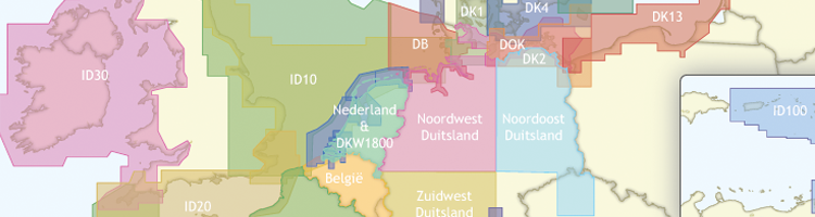
DKW water charts
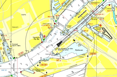
Safely navigating the waters requires up-to-date water charts. Stentec develops their own digital chats which are based on information from the Dutch hydrographic services, Rijkswaterstaat, Imray and Delius Klasing, which makes it possible to update regularly. Download the latest updates just before you start your voyage to assure yourself of the most up-to-date charts!
The most popular charts are the DKW 1800 series. These charts are updated weekly with the latest BaZ (notices to mariners) information. The DKW German bight is treated to the same weekly update, and the DKW the Netherlands is updated bi-weekly.
In addition to the DKW charts, it is possible to read charts of the S57 and BSB format in WinGPS. These include the IENC for European inland waters and the well-known charts of NV-Verlag and (free) charts of the NOAA for American waters.
Supplied with WinGPS are the online ESRI charts. These charts can only be used when you have a working internet connection and are not suitable for navigation. If you want to make your own charts you can use DKW Builder. With this program you can add scanned paper charts to WinGPS.
WinGPS Marine Lite WinGPS Marine is the navigation app that lets you navigate on your Android device. Start with this free Lite version, ideal for getting started.
|


Connect your onboard GPS
Use a Bluetooth or WIFI connection to connect your tablet or smartphone to the GPS receiver of your ship. This makes tracking your location easier, more accurate, and uses less of your battery. If you don't have a wireless GPS on board you can also use the internal GPS of your tablet or smartphone.
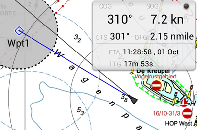
Waypoint navigation
With CTS (course to steer) and DTG (distance to go) you can use this app to navigate to a waypoint. You can create, delete and edit your own waypoints, or use the waypoints that are on the chart database.
Digital charts
All DKW water charts from edtion 2014 and newer can be used within WinGPS Marine. These charts can be installed on multiple systems with just 1 license, using your stentec account. For example on a laptop, tablet and smartphone. A check for updates of your charts will happen automatically as soon as the app is started, providing you have a working internet connection.
WinGPS Marine uses ESRI charts when you don't have any DKW water charts installed on your system. This is a free of charge chart overlay which can only be used when a working internet connection is available. ESRI charts are not suited for navigation, but can be used for global positioning and initial route plotting.
It is also possible to use the free, digital NOAA charts in WinGPS Marine Lite. These charts are provided by the US government for free on the NOAA website.
System requirements
Check whether your device is suitable for WinGPS via the link below.
|
|

WinGPS Marine Plus
WinGPS Marine Plus is the navigation app that lets you create a full-fledged navigation system on your Android device. Plan routes, download GRIB files, save sailed tracks, and wirelessly connect your GPS, AIS, and onboard instruments. Use the timeline to see weather, water levels, and currents directly on the chart.
WinGPS Marine offers handy digital navigation on board for you and your crew and is the ideal reliable backup.
WinGPS Marine is an excellent complement to WinGPS 6, the more comprehensive navigation program for Windows, and ideal for those who want flexible navigation. The app is perfect for skippers, crew members, and others who want to monitor or plan a route on their own tablet or smartphone.
In addition, WinGPS Marine is a valuable onboard backup should the main navigation system fail. This way, you always have an overview and peace of mind at your fingertips.
With WinGPS Marine for Android, you decide how comprehensively you want to navigate. Start for free with the Lite version, ideal for getting started.
Want more? Then choose WinGPS Marine Plus with a budget-friendly subscription of €39.90 per year..
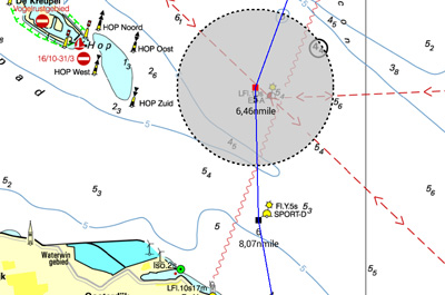
Route Navigation
With this app you can create routes and edit them while on the move. Longpress the screen to create a single waypoint or multiple to create a route. You can create multiple routes, and give each route and routepoint a unique name.
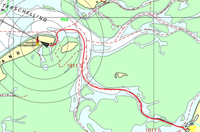
Track management
You can automatically record the sailed tracks. The tracks will be saved to review or share later. You can give each sailed track a unique name.
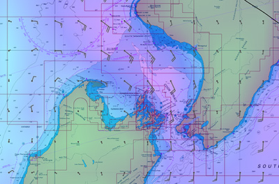
Meteo data
You can download Meteo predictions for a selected area. The wind, air pressure and rainfall can be plotted on the chart view using downloadable GRIB information.
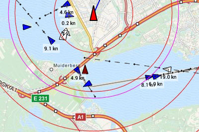
AIS (Automatic Identification System)
Your AIS receiver can communicate with the app using a wireless connection using WIFI or Bluetooth. With AIS you see all surrounding ships plotted on the chart view. You can also bring up the targets in a list, and if you tap a ship's name you can see all the AIS target data. The built-in AIS collision alarm helps you in making important decisions.
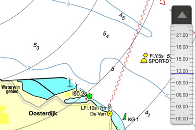
Time Bar
By using the time bar you can see the prediction on your track. By sliding it forward you will see the upcoming weather, and tidal information if available.
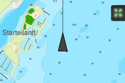
Follow GPS position
When this function is activated, your GPS position will be centered on your screen and the underlying chart will move under it. Multiple following options are available: 'North up', 'Course up' & 'Compass mode'.
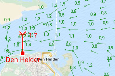
Tidal data
In addition to meteo data you can also download tidal data to use for planning and adjusting your route in this app. You can see the currents, and the depth difference.
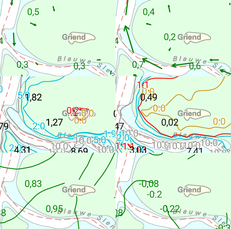
Stentec Tidal service
The Stentec Tidal service gives you the most accurate information regarding stream, tidal heights and depths for the Northsea and the Waddensea. This detailed information is based on data from the Dutch Rijkswaterstaat.
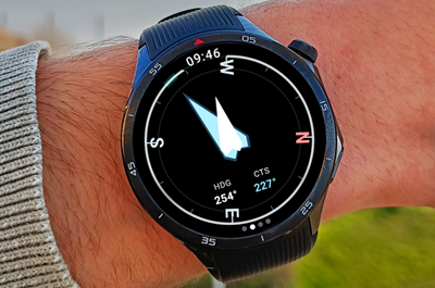
Connect your Android Smartwear Navigation data always at your fingertips, without picking up your phone. The new WinGPS Marine app for Wear OS displays live data from your navigation system directly on your wrist: course, speed, depth, wind data, route info, and more. |
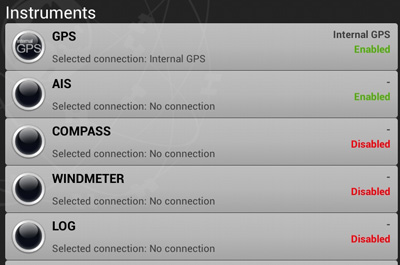
Connect your onboard instruments
Using a wireless connection you can connect your board system and read out your wind meter, compass, log and echosounder. Review all entered and incoming data in the data plotter and instrument monitor to optimize your route for a safe voyage.
System requirements
Check whether your device is suitable for WinGPS via the link below.
WinGPS Chart apps
In addition to Stentecs digital charts for Windows we also provide chart apps for Android and iOS devices. In these chart apps it is only possible to install and use the individual charts.

WinGPS Marine
These chart apps are based on the technology behind WinGPS Marine. If you want more information on your chart view (such as tidal information or AIS) or if you want multiple charts in the same view you can use WinGPS Marine.
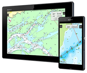
Replacement for paper charts
Stentecs chart apps are designed as a replacement for the paper chart sets. A large tablet or iPad is preferable as it has the largest possible chart view. With a built in GPS receiver the chart will move along with your position on your screen and you will always see your current position, speed and course. Place a navigational waypoint on the chart view and receive a 'course to steer' onscreen.
The app can also be used in Android smartphones or iPhones (for quick position checks) and makes it ideal for use on dinghies, charterers and for passengers.
Water chart license
You can download the chart apps from the Google Play store or Apple App store (see links below). After the chart set has been purchased and connected to your Stentec account they can also be used in our main navigation app, WinGPS Marine for iOS or Android. Or on your Windows system with WinGPS (Lite, Navigator, Pro of Voyager).
DKW Friese Meren
With this chart set you can navigate the popular Friese Meren for Fryslân. This chart set is free of charge and can be downloaded from the Google Play store.

 Free
Free
DKW 1800 Series
With this chart set you can replace the paper versions of the 1800 series created by the Dutch Hydrographical Service. This app is available per chart set or in combination packages.
From € 24,90
DKW New Zealand
Navigational app with detailed and actual digital watercharts for New Zealand from the British Admiralty. For motor boaters, sailors and commercial shipping.
Free

DKW Imray
These digital Imray charts are based on the well-known paper charts and have the same color coding. The advantage of these charts is the large covering area per chart set.
This is an overview of some of our chart apps. These are not all chart apps we have available for your Android device. When you buy a (DKW) water chart in our online shop, you can use this in combination with WinGPS Marine for Android or iOS, or in WinGPS for Windows. Click here for a chart overview.
|
|
WinGPS Lite
WinGPS Lite is the free version of the WinGPS series for your Windows PC or laptop.
You can use WinGPS Lite to introduce yourself to digital onboard navigation. Combine WinGPS Lite with the DKW 1800 series or the DKW the Netherlands chartset and experience the reliability of WinGPS and the extra safety it brings aboard.
Connect a GPS receiver to your laptop and:
- Determine your position
- See your heading
- See your speed
- Monitor your sailed tracks
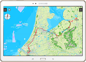
For Windows and Android WinGPS Lite, the free version of Stentec's navigation software WinGPS, is developed for your Windows PC or Laptop. If you have an Android tablet or smartphone, you can download and install the free version of our Android application WinGPS Marine Lite via Google Play. |
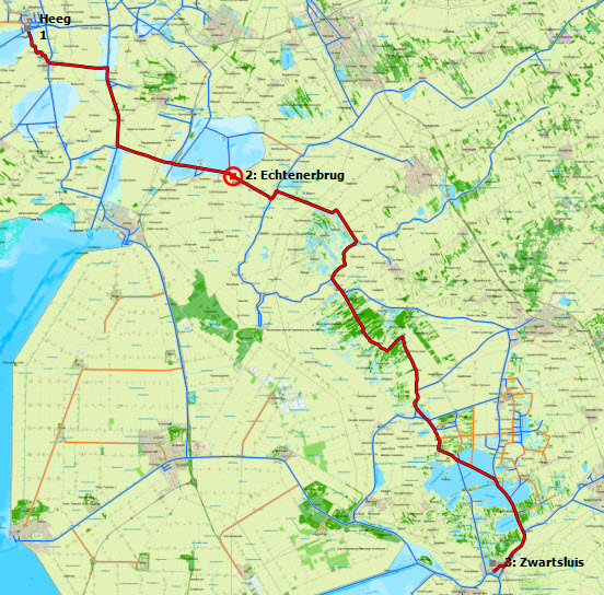
More functionality If you want extra functions that aren't available in WinGPS Lite, you can purchase a full version of WinGPS. With one of these programs you can plot routes, download GRIB files for weather forecast, connect board instruments (such as AIS) and much more! |
Digital water charts
All of Stentec's DKW water charts are available for WinGPS Lite and are easily installed.
|
|
|
System Requirements: |

This list will give you a good overview of our different versions.
For a complete overview of the features please click here.
| Features of WinGPS 5 | Lite | Navigator | Pro | Voyager | |
| GPS Tracking |  |
|
|
|
|
| Map Windows | 1 | 2 | 3 | 3 | |
| Route planner | |
|
|
||
| Time Control | |
|
|
||
| Weather (Grib) | |
|
|
||
| Current & Tide (NL Tides, Rijkswaterstaat) | |
|
|||
| NMEA Instruments like : AIS, Depth meter,Autopilot, etc. | |
|
|||
| Interactive planning of routes with Polar | |
||||
| WinGPS | |||||
| Functions specialized for power boats | |
||||
| Functions specialized for sailing boats | |
||||
| Prices | |||||
| Price Download | Free | € 129,- | € 279,- | € 379,- | |
| Price CD version | Free | € 149,- | € 299,- | € 399,- | |
Do you have any questions?
Call us on +31 515 443515, fill in the contact form or make an appointment at our servicepoint in Heeg.
Click here for our opening hours.


News
 The warm weather made for a wonderful season to be out on the water. At the same time, this poses major challenges on Dutch and European waterways.
Water...
The warm weather made for a wonderful season to be out on the water. At the same time, this poses major challenges on Dutch and European waterways.
Water...
 Good news: there’s a major update for our WinGPS navigation app for iOS WinGPS Marine Plus!
With this paid version of WinGPS for your iPad and/or iPhone, you...
Good news: there’s a major update for our WinGPS navigation app for iOS WinGPS Marine Plus!
With this paid version of WinGPS for your iPad and/or iPhone, you...
 It’s that time of year again: Sneekweek is just around the corner! The sailing spectacle of the year not only offers plenty of fun and sportsmanship, but for...
| WinGPS Navigator |
|
• Easy to use route planner |
| WinGPS Marine |
|
A navigation app for use aboard your ship. An upgradable navigation solution for all sailors, from beginner to professional. |


Stentec Navigation is specialised in digital navigation for water sporters and commercial shipping.
Trackpilot-project : 2025-2028
|
Sail Simulator 5
|
|
|
TrackPilot for WinGPS 6Stentec presents for WinGPS 2026 and later |
|
Harinxmastrjitte 29
8621 BJ HEEG
The Netherlands
T +31 (0) 515 443515

Copyright © Stentec Software. All rights reserved.
By using this website you acknowledge that you agree with our user agreement.