Inland Update Service Stentec has released a subscription specially for inland skippers. With this service you keep both the navigation software and the charts up-to-date and you can always navigate safely on the European inland waterways. The Inland Update Service includes:
|
|
Read more about the above-mentioned points below:
|
Updates WinGPS Inland Our team is continuously developing the professional navigation program WinGPS Inland. For instance, new features are regularly added, and existing functions are optimized or expanded. Examples include the ability to connect a consumption meter, or features that enable more sustainable route planning. We are also always looking for organizations that can supply new, up-to-date data, which we can offer to WinGPS users via WinGPS Inland. To this end, we are partnering with organizations such as CoVadem and BLIS. This ensures you have all data in one system, allowing you to easily update and use it for efficient route planning and navigation. By subscribing to the Inland Update Service, you gain access to all updates for WinGPS Inland. |
 |
|
Acces to IENC server Using our IENC server, you can easily indicate which European countries you will be sailing in. The IENC charts for these countries are automatically downloaded and updated (as soon as you start WinGPS and have a stable internet connection). This means you no longer have to visit the websites of the respective countries and download the IENC manually, but always have the latest updated chart on board. By subscribing to the Inland Update Service, you gain access to this IENC server. |
 |
|
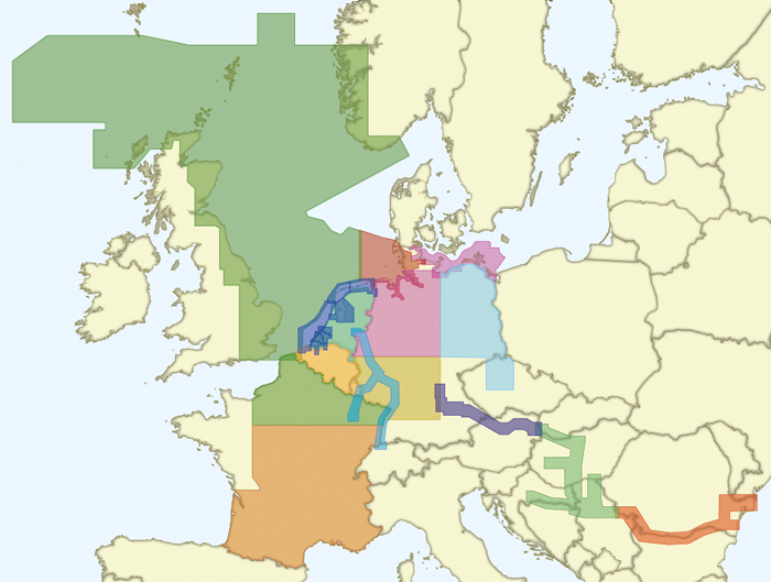
European Waterway Network IWinGPS Inland provides an extensive waterway network for the Netherlands, Belgium, France, Germany, Denmark, the Danube, and the American inland waterways. The network on European inland waterways comprises 32,377 km of waterways. This includes maximum permitted depths, widths, heights, and lengths, and clearly indicates whether the waterway is accessible to commercial or recreational vessels. By subscribing to the Inland Update Service, you receive regular updates for this waterway network and the associated structures, ensuring you always have the most up-to-date data on board. 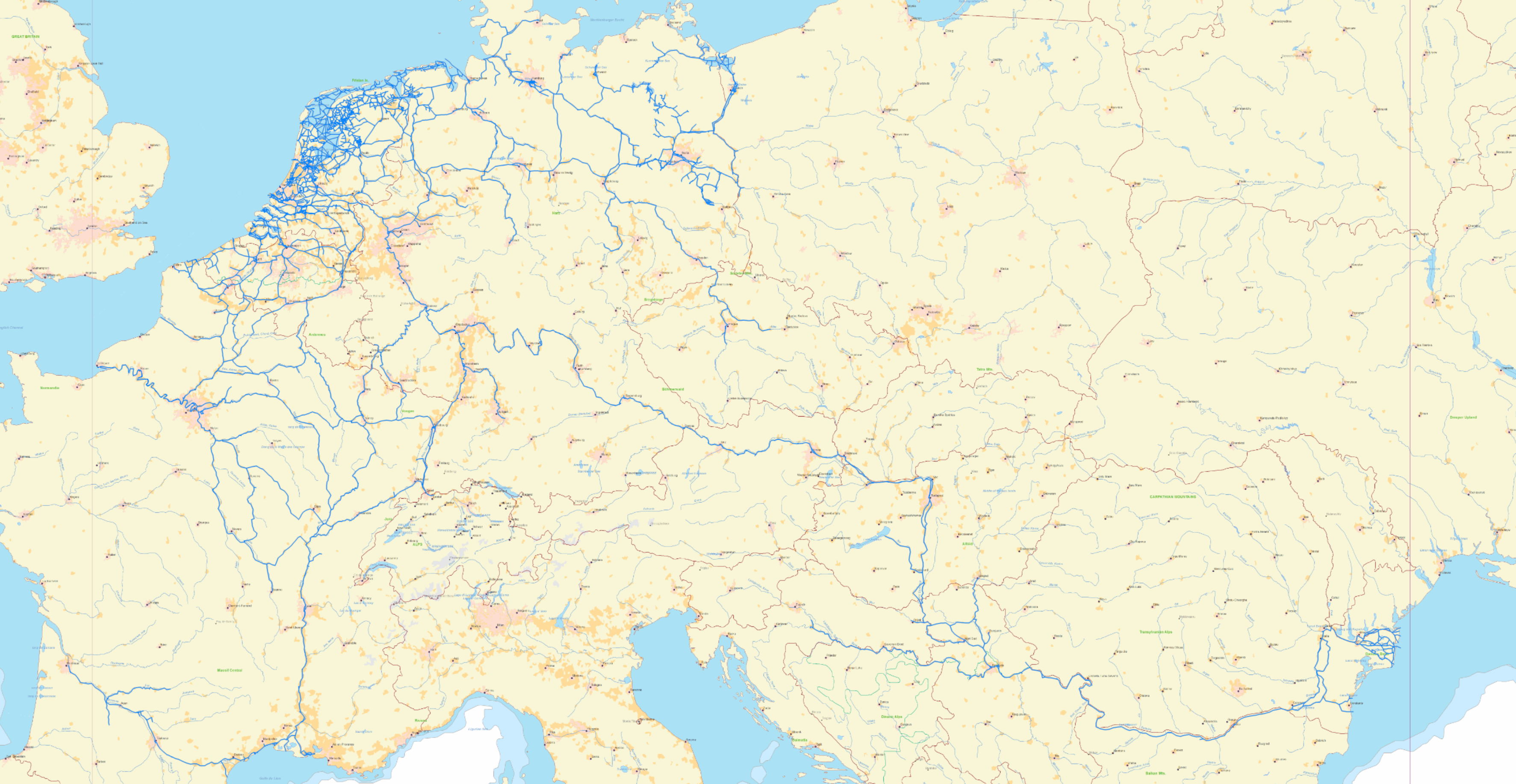 Click on the image to enlarge. |
|
NL Tidal data Every year, the Hydrographic Service publishes a new HP33, also known as the NL-tides. This provides you with the astronomical current and tidal data for the Dutch coastal waters, calculated in advance for the entire calendar year. By subscribing to the Inland Update Service, the NL-tides are automatically added to your WinGPS Inland. 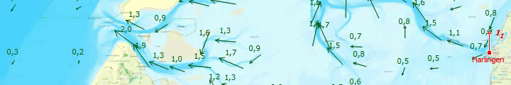 |
|
Discount on DKW chart sets By subscribing to the Inland Update Service, you will receive a €20 discount on new 100% Stentec DKW chart sets and a €10 discount on upgrades to the 100% Stentec DKW chart sets. View the overview below on which charts this discount can be applied to.
|